
IT
rek Overview
Quick Facts
Maximum Altitude
12,516 ft.
Trek Duration
5 Night / 6 Days
Trek Distance
30 Km
Difficulty Level
Moderate to Difficult
Start/End Point
Natraj Chowk, Rishikesh
Nearest Airport
Jolly grant Airport, Dehradun
Best Season
October to March
Accommodation
At Joshimath guesthouse on the first day and during the trek at the dome style tent.
Meals
Breakfast, lunch, evening snacks and dinner
Permits
Forest Department & Trekking permit
Temperature
2°C to 10°C (daytime) -7°C to -15°C (night time)
Snow
December to February
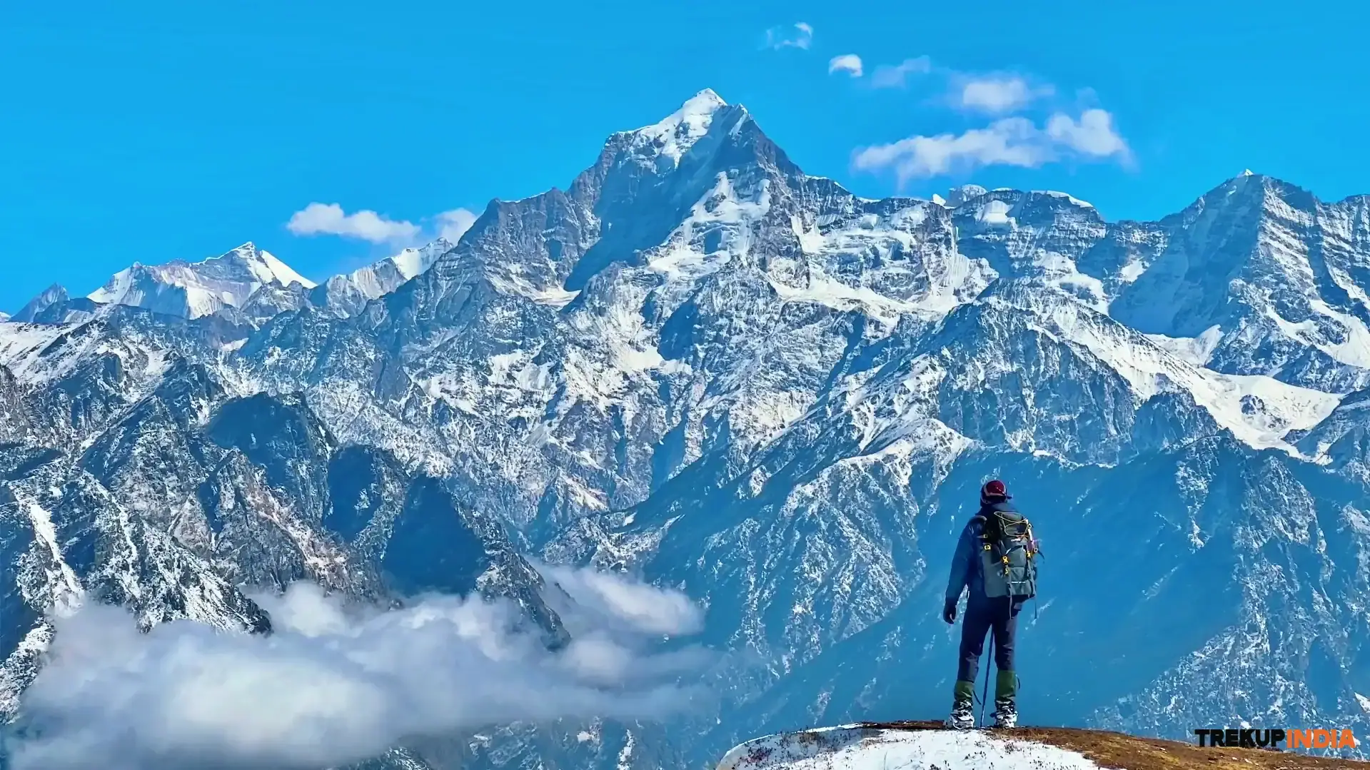
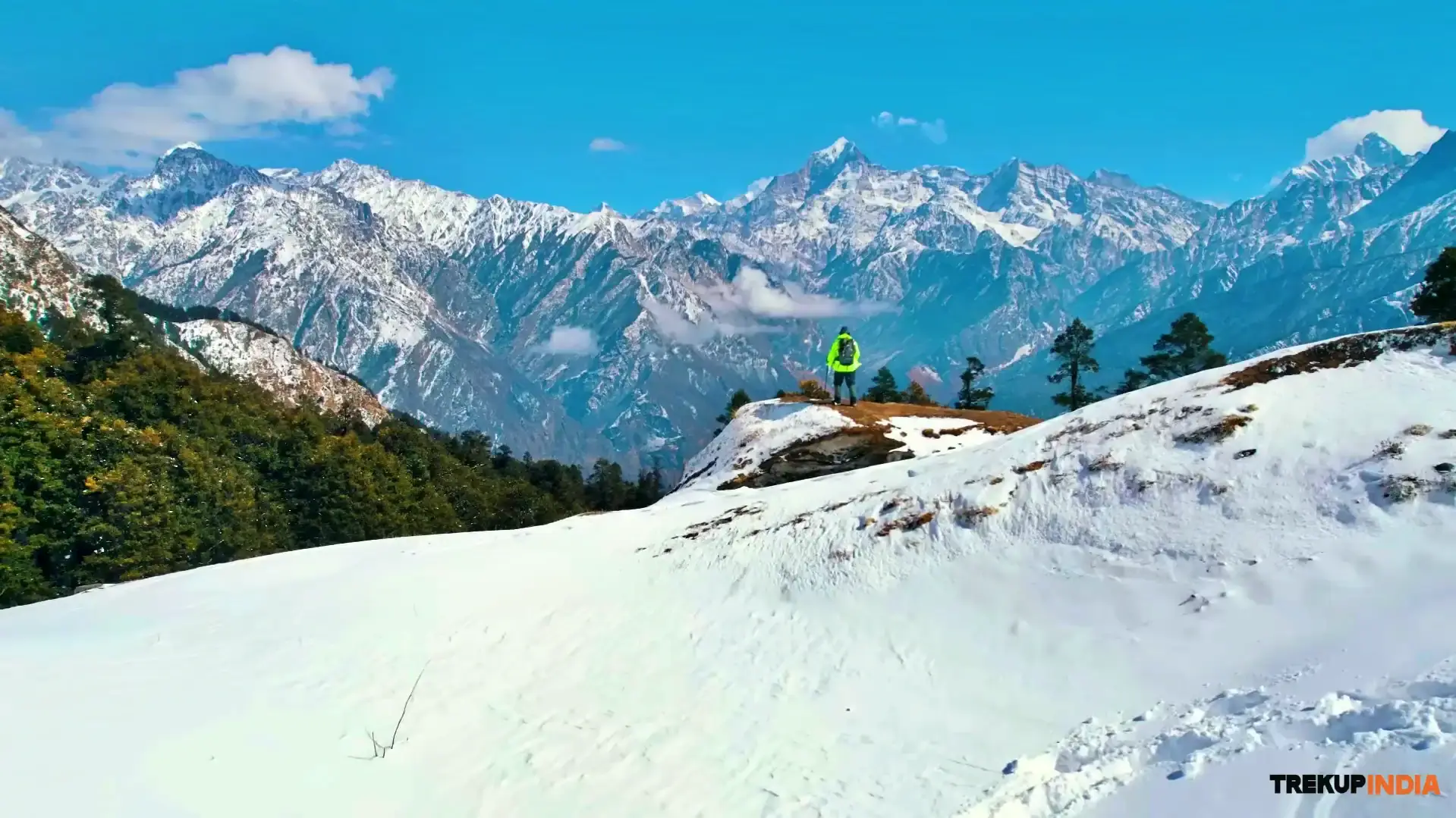
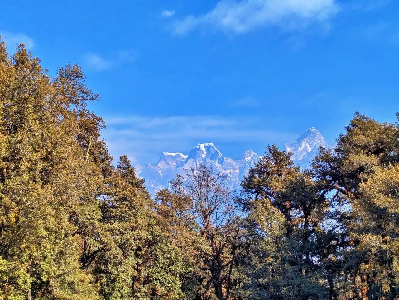
The Kuari Pass trek is also known as the Lord Curzon trail, at an elevation of 3,817meter/12,516 ft. It is considered a beautiful, multiple day trek in the region of Uttarkashi, the ideal trek for beginner trekkers due to the moderate difficulty level and richness of the views. With a distance of approximately 30 km, the Kuari Pass trek highlights some of the most prominent mountains in India: the majestic Nanda Devi Mountain, Dronagiri Mountain, and Chaukhamba Mountain. The Kuari Pass Trek has unique geological qualities, which transition from dense, ancient forests of oak and rhododendron to wide-open, rolling alpine meadows located at Gurson Bugyal in a beautiful winter wonderland with ample snow throughout even the peak of winter. The experience of trekking during the snowy winter months is a striking contrast to trekking during the cooler autumn months when the views of the mountains are unobstructed and clear. Both experiences capture the essence of the Kuari Pass, with both rich historical significance and cultural significance found within the Nanda Devi Biosphere and terminating at the renowned ski slopes of Auli.
Why is the Kuari Pass Trek so special?
The Kuari Pass trek is a famous route that provides a great combination of being easy to trek on and having spectacular views from a high altitude. It has a unique route designed to give new trekkers the views that most of the experienced trekkers get when they reach the top of very high mountains. Here we will review some of the most well-known features of Kuari Pass Trek with detail view of speciality:
1. The Nanda Devi Balcony
A trek typically finds you at the base of deep valleys, staring up into the distance towards mountain summits. However, the high-altitude ridge on which the Kuari Pass Trek occurs is a viewing gallery of the Himalayas from above, which lets you see the views of the area around you.
- Proximity: You have a close-up view of Mt. Nanda Devi 7,816m. When you're standing on a ridge 4,000 m high, it does not appear to be a distant object. Instead, it towers over you and gives you a very detailed view of the two enormous peaks and the famous inner wall of the Nanda Devi Sanctuary.
- A complete view: Not only is the view of Mt. Nanda Devi is spectacular; the ridge itself offers a complete view of all the giant mountains in Garhwal. There is a vast variety of mountains. The Pyramid-like shape of Mt. Neelkanth and the very large mass of the Chaukhamba massif offers two examples of the different types of mountains. There are many other significant peaks such as Mt. Dronagiri and Hathi-Ghoda (Elephant and Horse peaks) which offer equally unique shapes.
2. The Historical Curzon Trail
It is attributed to Associate Fox, follows the ancient Kuari Pass, marking a period in the history of trek and travel known as the Golden Age of Trekking throughout the Himalayas and beyond. The honour of being the first European to explore and report the route has led to its continued growth, but it ranks ahead of all other trails in prestige.
- The Heritage: In 1905, Lord Curzon, the Viceroy of British India, took up the challenge and created a name that has remained in popular use ever since; this is the reason the route has been given its modern name of The Lord Curzon Trail.
- Historic Access: Before the establishment of the Kuari Pass, trade was taking place at the site. Kuari Pass was the route regularly used by local animal herders and merchants travelling between Joshimath in the North and Ghat in the South of Garhwal. The trade was primarily of wool, salt and medicinal plants.
- Visiting the Kuari Pass will connect you with centuries of Garhwali and Indian History, so the scenery, location, altitude and geographical location will reveal the early history of the Garhwalis, as well as the exchange of cultures that occurred through these passes.
3. Gurson Bugyal Meadows
One of the largest and most beautiful alpine meadows located in India at approximately 10,000 feet in elevation is the Gurson Bugyal.
- Seasonal Dual-Sense: This meadow is famous for its radical seasonal change. In the spring months of April through June, it transforms into an expansive green carpet covered with wildflowers — specifically blue poppies and primulas — that are scattered throughout. In the winter months of December through March it becomes an immense white desert covered by rolling snow dunes.
- The Sense of Freedom: Unlike the narrow, rocky trails found on other trekking routes, the Gurson Bugyal's open range offers trekkers a massive open space. Walking through high-altitude pastures surrounded on all sides by the colossal Himalayas provides trekkers with an extraordinary scale and tranquillity they do not experience elsewhere.
4. The Narnia Forests
The trail traverses through some of the most awe-inspiring temperate forests in the Himalayas, which are primarily of ancient oak, rhododendron and deodar trees.
- Narnia Effect: This section of the trail is referred to by the trekking community as either the "Narnia Forest" or "Narnia" In the winter months, the twisted, mossy branches of the oak trees are so weighed down by snow that they form frozen tunnels through which individuals can trek.
- Atmospheric Effects: Sunlight filtering through the white frozen canopy creates an entirely separate, muffled world of light and shadow. Likewise, the forest wildlife is safe and the lucky trekkers might spot the Himalayan Monel or elusive Himalayan Musk Deer darting through the trees.
Trek Highlights
Scenic Beauty and Landscapes
- The Ridge Traverses: are greatly different from trekking through valleys. While trekking through this area you'll spend the majority of your time on high terrain . By being on high ground, you have the advantage of being in close proximity to the 7,816 m Nanda Devi, which is the second highest mountain in India, and is revered as the second most sacred mountain in India.
- The Sanctuary Wall: It gives you a rare and very personal view of the inner Sanctuary wall, which is a hard wall of jagged ice and rock, which has intrigued El Diablo and many others for the last century.
- Geological Evolution: Beginning at the confluence of the Alaknanda and Dhauliganga Rivers, which are bright bluish in color, you'll follow a course through dense mossy and humid forests, eventually arriving at the second largest Alpine Pasture in Asia, Gurson Bugyal, to find an ocean of deep emerald grass, which gives the appearance of being a golf course in heaven because of the gentle rise and fall of the grass.

Summit Experience
Standing at the top of the Kuari Pass, at an elevation of 12,516 feet (3,815 m) above sea level, creates an emotional and physical experience while allowing you to see all around you in all directions, achieving an amazing 360-degree view of your surroundings.
- The Panoramic View: The most astonishing view by far is that your vision reaches as far as Mt Kamet and its pyramidal peak, the massive trident of Trishul, the colossal mountains of Chaukhamba, and the iconic mountain of Dronagiri, which is believed to be the place where Hanuman brought the life-giving Sanjeevani herb.
- The Hathi-Ghoda Peaks: are the most unique view from the summit. The large formation of rocks on both sides of the valley look remarkably similar to the shapes of a horse and elephant, standing over the valley below.
- Technical Ease & High Reward: Finally, the thing that makes this experience so wonderful is that it does not require any trekking skills or equipment. It is possible to trek on this mountain, and experience the sensation of standing on top of the world without having to use ropes, ice-axes or any other specialized skills.

Best Season & Seasonal Beauty
The October to March period is the prime time for trekking the Kuari Pass and experiencing the incredible views of the Himalayas and the unique winter trekking experience.
- October to November (The Clarity Period): This is the best time to take high-resolution photographs and to see for long distances. The air is clear of most dust after the rains, making this the best time for taking pictures of Mt. Nanda Devi, sitting above brightly lit brown meadows and bright blue skies.
- December to February (The Winter Wonderland): During the winter months, the trail is covered with 3 to 4 feet of snow, creating a lovely meso/macrostal community called Narnia. Trekkers will trek silently through the forest, under white tunnels made by the oak trees, and discover frozen alpine lakes, thus experiencing the true meaning of high altitude trekking.
- March (The Spring Transition): March is the best time to see and experience a dramatic contrast in color because the upper elevations are almost entirely covered in heavy amounts of freshly fallen snow, while lower elevations have just initially started to bloom with rich red colours. Therefore, this is the sweet spot for experiencing both deep snow and mild temperatures.
- April to June (The Summer Green): This is the best time for beginner trekkers on the Kuari Pass because the meadows will be bright green, covered in velvet green grass and wildflowers, with no snow. The weather during this time is warm and mild, providing an incredibly enjoyable and stress-free experience for families and children, as well as first-time trekkers.
- September (The Green Oasis): After the monsoon rain has replenished the land, the mountains are carpeted with thick vegetation, with numerous waterfalls cascading down. The scenery is bright due to all the rain and provides a good place to relax before the start of fall’s busy tourist season.
- July to August (The Monsoon Season): While visiting during this time is typically discouraged due to the extreme risk posed by the heavy rains, cloud cover obscures the view of the Himalayan peak, trails after the rain are often slick and treacherous to navigate, and there are many leeches in the forest.

Cultural & Village Life
- The Curzon Trail: The Curzon Trail has its roots as one of the oldest routes providing inter-valley trade routes between the Joshimath and Ghat Valleys. Centuries before mountain trekking legends such as Shipton and Tilman traversed these trails they provided vital links for local traders and shepherds negotiating high-altitude ridgelines.
- The Essence of Pahari Culture: Travelling through villages such as Dhak, Tugasi and Karchi shows you the grit of the Garhwali people. You will see typical houses built from slate with roofs to withstand heavy snow with women tending to terraced Mandua (millet) and Rajma farms. This ancient and sustainable way of cultivating has created a rhythm of agriculture that remains the heart of the region.
- Joshimath, the Winter Seat: As the "spiritual centre" created by Adi Shankaracharya, Joshimath has been the winter seat of Lord Badri-Nath. When the temple on the upper reaches of the Himalayas is closed, the Deity moves to the Narsingh temple in town, permeating the town with perpetual energy from the flowing chants from the pilgrims and the Vedas.
- Pahari hospitality: The culture of the Paharis in connection with Atithi Devo Bhava (the guest is God) is reflected in the hospitality of the Paharis. The warm Chulha in the local homes provides a stark contrast to the bitter cold winds of winter, along with the sharing of a cup of tea and the breadth of open wilderness.

Flora & Fauna
- The Primordial Canopy: is a type of climax ecosystem. Within the canopy, the Deodar (Himalayan Cedar), referred to as "Wood of the Gods" because of its ability to resist rot, and Moru and Kharsu oaks (whose roots prevent slope erosion) create a sacred hierarchy. The significant understory is composed of Maple and Chestnut trees, which provide an excellent nutrient base for wildlife.
- The Narnia Metamorphosis: During the winter months, the thick layer of lichen absorbs moisture from the clouds and freezes into crystalline ice. The result is a completely silent world of ice and snow, filled only with sounds like the crunch of snow and snapping of frozen branches.
- The Rainbow Bird (Monal): is the crowning glory of the avian world in the Himalayas. When flying around Khullar's edge and camouflaged against the white snow, the metallic brilliance from nine different colours of feathers create a breathtaking flash.
- High altitude Species: Many rare high-altitude species are protected within the sanctuary, including the elusive and vulnerable "ghost of the forest", the endangered Himalaya Musk Deer, and the Himalayan Tahr which can trek vertical cliff-face habitats (70 degree slopes) using both feet, thanks to its specialized rubbery hoof.
- Hidden Predator: There are two hidden predators that are very rarely seen, the Snow Leopard and the Black Bear. These animals leave behind signs such as scratch marks on the trunks of Deodars (territory) and fresh markings made with claws.
Adventure and Difficulty Level
- The Beginner's Benchmark: is a 30 km trek with an easy to moderate rating and serves as the ideal entry point for all fit beginners. There are gradual inclines, which are designed to build confidence in the beginner instead of crushing their will, and as a result, it is accessible to anybody that can jog consistently at a pace of 5 km/h.
- Acclimatization Hub: At an elevation of 12,516 ft, the pass serves as an acclimation zone for alpine conditions. On Summit Day, which takes 6 to 8 hours, you will learn how to adapt to the thin air conditions by practicing rhythmic breathing and acquiring important physiological adaptations for longer 5,000 m ascents in the Himalaya.
Unique Experiences
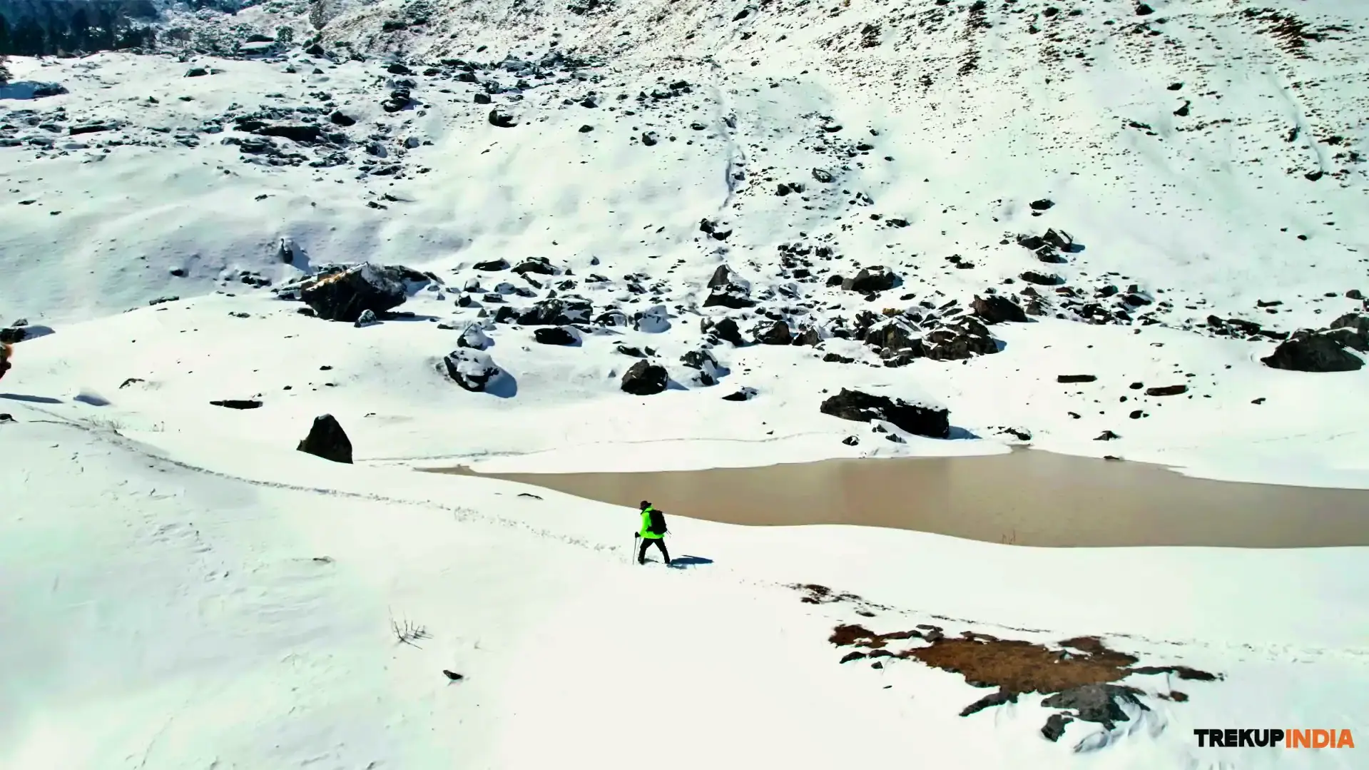
- The Mirror of Tali Lake: The Mirror of Tali Lake is a hidden jewel that is a small pond located at a very high altitude and on a clear day gives a mirror-like reflection of Mt. Nanda Devi. The lake is secluded and tranquil in its beauty and feels like a secret only a few select wanderers have uncovered after leaving the designated routes of travel.
- Stargazing At Khullara: Campsites such as Khullara have no artificial light. When one exits their tent at midnight, the stars appear to be a mass of brightness and seem to be within reach. The Milky Way will generally be seen as a smoky, bright ribbon of light flowing through the high peaks of the Himalayas.
Short and Detailed Itinerary, Trek Map and Altitude Chart of Kuari Pass Trek
This section provides a comprehensive, simple explanation of the Kuari Pass Trek, including general day-to-day routing, elevation gain, etc. The basic itinerary is designed to give an overview of the trek; all-inclusive itinerary allows for a more in-depth understanding of the various distances between campsites, the nature/type of terrain that trekkers will be traversing, and the locations of the campsite relative to one another.
In addition to the above, the trek map indicates the specific route of the trekking path, village locations, forest locations, and campsite locations within the trek area enabling trekkers to imagine their trek through snow-covered coniferous forests and alpine meadows. The elevation chart clearly indicates the total elevation gained and lost each day of the trek ensuring that trekkers can prepare adequately before arriving at the basecamp, acclimatize safely to altitude, and have a positive experience on their overall trek.
IS
hort Itinerary
Day 1:Drive from Rishikesh (1,200 ft.) to Joshimath (6,150 ft.)
Drive Distance
247 Km (9-10 hrs)Altitude Gain
4,950 ft.Meals
Evening snacks and dinnerStay
At Joshimath guesthouseExpert Advise: If you have motion sickness problem make sure to take medication prior to the drive starts.
Day 2:Drive from Joshimath (6,150 ft.) to Dhak Village (7,000 ft.) & trek to the Gulling top (9,600 ft.)
Drive Distance
12 Km (1 hr)Trek Distance
6 Km (4-5 hr)Altitude Gain
2,600 ft.Meal
Breakfast, lunch, evening snacks and dinnerStay
At gulling top campsiteWater Sources: Fill your thermoflask at gulling top campsite
Day 3:Trek from Gulling top (9,600 ft.) to Tali forest camp (11,000 ft.)
Trek Distance
5.5 - 6 Km (4 - 5 hr)Altitude Gain
1,400 ft.Meals
Breakfast, lunch, evening snacks and dinnerStay
At Tali forest campsiteWater Sources: Limited so refill your thermoflasks at the campsite before trekking.
Day 4:Trek via Khullara top from Tali forest camp (11,000 ft.) to Kuari Pass (12,500 ft.)& back to the Tali forest campsite
Trek Distance
7-10 Km (5 - 6 hr)Altitude Gain
1,500 ft.Meals
Early breakfast, packed lunch, evening snacks and dinnerStay
At Tali forest campsiteWater Sources: Available at the Tali forest campsite.
Day 5:Trek from Tali forest camp (11,000 ft.) via Gurson bugyal & Auli to Joshimath (6,150 ft.)
Trek Distance
8-10 Km (7- 8 hr)Altitude Loss
- 4,850 ft.Meals
Breakfast, lunch, evening snacks and dinnerStay
At Joshimath guesthouseWater Sources: At Joshimath guesthouse
Day 6:Drive from Joshimath (6,150 ft.) to Rishikesh (1,200 ft.)
Drive Distance
247 Km (9 - 10 hr)Meal
Only morning tea/coffeeWater Sources: Tea stops and restaurants on the route to Rishikesh.
Kuari Pass Trek Route Map and Altitude Chart
Trek Map
To assist you with your upcoming Kuari Pass trek, we have created an encompassing Trek Route Map. This map will provide you with a comprehensive overview of the entire trek; from your departure to the summit and back again. On this map, you will find all of the most critical information regarding all of the significant way points (trails, elevations, points of interest) as well as terrain and distance between campsites and approximate durations of trek, making your trek planning more efficient. Our team at Trekup India, put a high priority on giving you the full range of important information required to aid you in your trekking experience without issues. For the best experience, we strongly encourage you to study the Route Map before your trek. Should you have any questions or require clarification regarding this map, please do not hesitate to reach out to the Trekup India customer support team. We are always here to help you prepare for your journey with confidence.

Altitude Chart
The Kuari Pass Trek Altitude Chart provides useful information to help trekkers keep track of their altitude change as they make their way through the trek. The chart shows how much elevation gain is made at each segment of the trek, which enables trekkers to effectively develop a plan for their pace during the trek, as well as monitor how their body reacts when they are at higher elevation. Therefore, this chart is beneficial for both beginner trekkers and experienced trekkers, mainly because they will have better preparation in terms of acclimatization and how to get the best experience from the Himalayas. Furthermore, the Altitude Chart enables trekkers to visually see how the trail will gradually go up and down, making it easier and safer to have a well-paced trek.

ID
etailed Day Wise Kuari Pass Trek Itinerary
Day 1: Drive from Rishikesh (1,200 ft.) to Joshimath (6,150 ft.)

Basic details for the day: The day will feature a strenuous 247 Km drive across the mountains, leading to the actual entrance to the High Himalayas. You will travel in a vehicle for approximately nine to ten hours, with a total elevation gain of 4,900 ft, beginning in the humid plains of Rishikesh at an elevation of 1,100 ft. and culminating at the bustling mountain settlement of Joshimath at an elevation of 6,149 ft. This represents a significant transition from the humid lowlands of the Ganges Valley to the more isolated highlands of the Garhwal region.
Route Description and Terrain Insights: Today's trail will be the turn-by-turn path of the Badrinath Highway. This road is an example of the spectacular complexity of Himalayan geology, as you move from the sedimentary Shivalik foothills through the main metamorphic zone of the "Main Central Thrust." The road runs high along the edge of nearly vertical cliffs with the Alaknanda River roaring below you in a deep valley.
Natural and Scenic Highlights: One of the high points along your route will be the five sacred river confluences, known collectively as the Panch Prayag. You will see the emerald green Bhagirathi merging with the muddy Alaknanda at Devprayag to form the Ganga. You all will have experienced the well known peaks and mountain ranges- Mana, Kamet Peak, Hathi Parvat and Gauri Parvat. It is an awe-inspiring sight that will be forever imprinted upon your memory.
Cultural and Local Touchpoints: You will be travelling along an ancient artery of faith and spirituality. You will see many orange-clad pilgrims and roadside shrines entrenched into the rock faces of the mountains, as well as small hamlets where life is dictated by the seasons of the river and the temple calendars.
Safety and Acclimatization Guidelines: This is the beginning of a phase of "passive acclimatization" as your body adjusts to decreased air pressure. You should be diligent about staying hydrated because of this decrease; however, instead of drinking caffeine, you should be drinking water and electrolytes to help your blood oxygenate more efficiently in the lighter atmosphere.
Experience Notes by our trekkers who completed this trek: The drivers on this route are known for being incredibly skilled and calm. When you converse with them, you will discover they exhibit a 'mountain philosophy' attitude. This philosophy is a combination of patience and precision, which is critical when surviving in a mountainous area.
Camp Information & Logistics: You will find that lodging for the night is available in a stone and mortar building in the town of Joshimath. The town also has the winter residence of the Rawal (Chief Priest), who oversees the temple of Badrinath. This town serves as the final stop for civilized living before you begin your journey into the wilderness.
Practical tips for trekkers: It’s a good idea to keep a small pack with you, while travelling in your vehicle, that contains a light sweater, lip balm, and motion sickness medication because by the time you reach Joshimath, the temperature will be nearly 10° Celsius lower than it is now.
Kuari Pass Trek Photos and Videos
The Kuari Pass Trek features great sights along the trail such as snow-covered forests, beautiful summit views, campsite life, and experiences while trekking. By using real photos and videos along with these images, you will have the ability to find out what your trek and terrain will look like, and give yourself an idea of what sorts of trekking await you before leaving for your Kuari Pass Trek.
IP
hotos


IV
ideos

Kuari Pass Trek Reviews and Experiences
IVideo Reviews
The Kuari Pass Trek has real trekkers who tell their stories about how the trek feels on the trail. In this section, you will learn what other trekkers say about the snow, the campgrounds, the quality of food, the safety, the trek leaders, and their experience with Trekup India.
These stories help you see what it is actually like to be on trekking, what the summit will be like, and how beautiful it is to watch the sunrise from the top of the mountain. By reading real experiences, you will be able to trust, answer any common questions you may have, and properly plan your Kuari Pass Trek with Trekup India.


Best time for Kuari Pass Trek: Season by season guide
The Kuari Pass Trek is one of the highest trekking routes in the Himalayas, with the best time to visit being Autumn (October - March) when there is maximum atmospheric clarity, or during Winter (November - February) for an authentic snow experience. There are many different things to do along this trail due to all of the seasons. One of the main reasons to trek on Kuari Pass is because it provides an incredible 360 degree view of the Garhwal Mountains (including Nanda Devi-7,816m). During the dry months of Autumn, you can see Nanda Devi beaming brightly across the range away as the sun rises and sets. Spring offers a lush floral experience as well, but Winter has the most to offer in terms of unique snow capped views. In Winter, it is not unusual to trek through fields of snow covered trees and meadows, while enjoying beautiful light illuminating the peaks all around you. If you are a photographer or if you love trekking in snowy conditions, Kuari Pass will definitely have something for you.
Kuari Pass Trek: Month by month breakdown
Here is the month by month breakdown for the Kuari Pass Trek categorized season transition and trail condition you can expect.

Advice by our Expert Team-
Our Expert trek leaders and trek guides are well known about the trekking trails with the adverse weather conditions at higher altitudes and they know how to deal if any uncertainty arises. They have years of experience in trekking adventure and suggest you with some advice for the trek.
1. Prioritize Acclimatization: Stable weather in the spring and autumn makes it easier but never rush to the trek. There is a chance of AMS problems occurring due to dry cold so be prepared, take precautionary measures with yourself.
2. Proper Layering: Temperature fluctuates instantly, especially on the higher altitude, so layering should be proper (base, mid and outer) is critical for managing sweat and preventing the cold.
3. Premium Boots: Make sure your boots are long lasting and well broken or used before your trek starts. The risk of foot injury and blister from the new boot can end your trek journey
4. Hydration: It's advisable to drink 3 to 4litre/day. Because of high elevation and exertion, you need constant intake of fluids to overcome the effects from AMS.
5. Pace Yourself: Walk at a comfortable pace using what is called the mountaineers shuffle. This will conserve your energy and help you manage your breathing.
6. Protect Against UV Rays: Use High-Quality UV Sunglasses (Cat 3 or Cat 4) to protect your eyes from snow blindness, and use high SPF Sunscreen on your skin to protect it from sun damage.
7. Healthy Consumption: Food should consist of small amounts consumed frequently and contain a lot of nutritious ingredients and minerals. This will provide you with the sustained energy needed for trekking at high altitudes.
8. Safety: Pay attention to what your body is telling you when you are feeling AMS Symptoms. Should you believe you might be suffering from AMS, report it immediately and prepare to descend. Descending is the quickest treatment you can receive.
How to Plan Your Travel for Kuari Pass Trek
Are you excited to start your adventure for Kuari Pass Trek? The travel journey starts from Rishikesh where all the trekkers reach & move towards Joshimath. In this section we will guide you how to plan & proceed your travel journey for Kuari Pass trek. From your home town to pickup point Rishikesh, we guide you with all the necessary means of transport for a smooth and adventurous journey. You can opt various means of transport like flight, train & bus to reach your pickup point at Rishikesh.
Modes of transport to reach Rishikesh (The base pickup city)
There are various means of transport to reach at your pickup point via flight, train & bus with variation in timings. All the flights, trains & buses have different arrival & departure times, so plan your travel journey accordingly. We have mentioned all the information regarding the travel perspective for your convenience.
1. By Flight (Fastest Means)
The Jollygrant Airport is located 30 km away from the pickup point. There are scheduled, nonstop flights from all major metro cities such as Delhi (DEL), Mumbai (BOM), and Bangalore (BLR) etc.These airlines offer direct flights from multiple cities.The timings are subject to change and will vary day by day. You can book your flight one day prior to your travel journey.
Suggestions: Please make sure to arrive early, if you have enough time for your journey you can rent a room at an affordable price in nearby Natraj Chowk, Rishikesh.
2. By Train (Dependable Means)
The railway station of Rishikesh is very close approximately 500-600 Meters from the pickup point. You can cover the distance by walking to the pickup point. The best train services for overnight travel from Delhi (New Delhi Railway Station) to Rishikesh:
Suggestions: Ensure to book AC's or Sleeper seats in advance of your travel during peak winter season.
3. By Bus (Affordable Option)
The ISBT of Rishikesh is 1.5km away from the Natraj Chowk, Rishikesh. Buses are well air-conditioned like Volvo, Sleeper, and Non-AC buses with departures mainly from Delhi, Jaipur, Mumbai, Bangalore and other cities. The timings are subject to change and will vary day by day and the format of timing is 24 hour format.
Suggestions: Consider using an overnight air-conditioned Volvo/ac sleeper bus service to reach early morning (5.00 am to 6:00 am).
How to reach trek base Joshimath from pickup point Rishikesh
From Rishikesh, it is approximately 247 Km and takes 9 -10 hours by road. While travelling from Rishikesh to Joshimath you will cross Devprayag sangam, Dhari Devi and near Teen Dhara at 9:30 am we will halt here for breakfast around 30 minutes with the scenic view of pindar valley after covering couple of distance we will reach Naal Gaon where we will take a stop for Lunch approx. 2:30 pm. After having lunch we will head towards our final destination Joshimath.
Means of transport from Base city Rishikesh to Joshimath Guesthouse
1. Trekup India Vehicle: If you book with the Trekup India, transportation depends on the number of trekkers according to their size, vehicles will differ like tempo traveler, bolero, innova or mini bus. Our cab picks you from Natraj Chowk, Rishikesh & drops you at Basecamp Joshimath safely. Our vehicles are well maintained & hygienic for your travel journey.
Here are the pickup details from the base city Rishikesh (If you opt our transport facility):
- Pickup Point: Natraj Chowk, Rishikesh
- Pickup Time: 6:30 AM
- Drop Location on Last Day: Natraj Chowk, Rishikesh
- Drop Time for Last Day: 05:00 PM - 06:00 PM (expected)
2. Public Transport Bus: You can opt for a public transport bus early in the morning to reach base camp Joshimath on time for the next day's trek. But make sure you are particular with the bus time in the morning as there are very limited buses between 5:30 AM to 7:30 AM. There is no bus after this so try to pick a bus early from Rishikesh.
3. Private Taxi/Cab: If you miss your bus from Rishikesh, another way to reach Joshimath is by taxi/cab. You can book a taxi/cab on a sharing basis with a shared price. But make sure that your timing is matched with the taxi timing as the number of taxis are very limited in the morning and generally operated early in the early morning from 5:00 AM onwards.
Tips for Mountain Drive
Whenever you are planning to trek on the mountains, health plays a crucial role. Your main motive on any trek is to be physically and mentally healthy. Here are all the important travel suggestions that you are going to face on your travel journey.
- Motion Sickness: Take medication Dimenhydrinate (prescribed by doctor) - 30 minutes before your journey starts and make sure to sit in the front seat of the taxi.
- Punctuality: Being a wise person, always be on the time whether you are on the camp site or on the trek.
- In hand Case: Have an adequate amount of cash because you never find any ATM at a nearby location.
- Proper Hydration: Always take the water and fruits throughout your travel to avoid dehydration & other health related issues.
- Charge: Make sure that all electronics / power banks are fully charged before being stuck in a long taxi ride, as there are not many charging stations available on the route.
- Check luggage: always make sure to check your luggage when you are on the trek or during the trek.
Day 2 - Day 5 (The Trek Days)
After reaching the basecamp Joshimath its time to start the trek from day 2, base camp Joshimath to Dhak village by drive of 12 Km & trek from Dhak village to Gulling top of 5 Km covering in 3 to 4 hrs after reaching to the campsite there will be some activities & hot meal for all the trekkers. On day 3 from Gulling top to Tali forest camp distance of 5.5 km in 4 - 5 hrs, then on day 4 from Tali forest camp to the Kuari Pass top via Khullara top and then after on the same day come back to Tali forest camp, the total distance covered is 7 - 10 km in 5 - 6 hrs. Day 5, starts with the beautiful morning view at the Tali forest camp with hot water and delicious breakfast then after will start our trek to the Joshimath via Gurson Bugyal and Auli distance of 8 - 10 Km finally after the trek will reach to the basecamp Joshimath in evening you will enjoy your evening tea and snacks with the everlasting scenic beauty of Joshimath. By the end of the day certificate distribution for all the trekkers and wind up your day with hot dinner at the campsite. On day 6, after having morning tea / coffee proceed to Rishikesh by covering a distance of 247 km in 9 to10 hrs approx. 5 - 6 Pm in the evening.
Planning Your Return Journey from Joshimath to Rishikesh
Once you have completed the Kuari Pass trek, returning should be overwhelming with good memories, pictures and new friends on the trek. Our Trekup India vehicle will pick you from the base camp Joshimath and leave you at the dropping point Natraj Chowk, Rishikesh.
Suggestions: Book your return transport after 6.00 P.M & for security you should also keep a buffer of 1 - 2 hours for your return journey in case there might be delayed due to traffic, land slides or vehicle breakdown.
Return From Rishikesh to your Hometown
We have mentioned details of various means of transport like flight, train and bus with the estimated timings, so book accordingly with your preferred time. Below mentioned data helps you to choose and book for your return journey.
Note: The timings are subject to change and will vary day by day. Also the mentioned timing is written in 24 hours format.
By Flight / By Train
There are a number of flights and trains departing from Delhi to various designated cities on time. On the whole, you can book your flight or train from Delhi as there are many availability of flights and trains directly to your hometown.
Suggestion: Try to travel by bus to Delhi and in Delhi you can further book your train/ flight to your hometown.
By Bus
Here is the list of buses departing from Rishikesh to Delhi with their departure and estimated arrival timings. Make sure you book your further travel after reaching Delhi according to the below mentioned time. The timings are subject to change and will vary day by day. Also the mentioned timing is written in 24 hours format.
Safety Aspects and Emergency Exit for Kuari Pass Trek
1. Understanding Trek Safety
Your trek leaders and trek guide have years of experience in getting you to the summit but most importantly back to safety. Trekking at high-altitude requires a huge amount of respect for the mountains and therefore is a correct, safe way of doing things throughout, especially on a moderately challenging trek like Kuari Pass. This responsibility starts with full understanding of Acute Mountain Sickness (AMS) prevention, a strict adherence to the gradual ascent plan, and absolute understanding of emergency procedures. Your ability to follow safety procedures will determine the success and enjoyment of the trek.
2. Acute Mountain Sickness (AMS)
Altitude sickness (Acute Mountain Sickness or AMS) is the result of the body being unable to adapt lower levels of oxygen pressure (*hypoxia*) at high altitudes (usually over 8,000 feet). The risk is that untreated AMS will progress to High Altitude Encephalopathy (HACE) or High Altitude Pulmonary Edema (HAPE) if the person keeps trekking higher in a state of unequipped acclimatization.
Important Symptoms of the Acute Mountain Sickness (AMS):
Mild AMS:
- Headaches are the most significant and common sign.
- Nauseous feeling, lack of desire to eat, and general tiredness.
- Poor sleep (insomnia).
Severe AMS (HACE warnings):
- Difficulty balancing and walking straight (unable to walk a straight line - "heel-to-toe" test).
- On-going severe headache that can't be helped with medication.
- Confusion or some alteration in understanding.
Severe AMS (HAPE warnings):
- Unable to breathe without feeling short of breath.
- Persistent cough with wet/sputum or sometimes pinkish-tinted frothy mucus.
- Excessive tiredness and feeling of heavy pressure in the chest area.
Precautionary Measures of AMS
1. Ascent Gradual
- The 6-day itinerary from Joshimath to Kuari Pass top point has been set up to allow for acclimatisation. You are advised not to skip camps and rush up the mountain.
- The principle of "Trekking High and Staying Low" at the Base Camp helps you get acclimatised.
2. Hydration and Nutrition
- You need to drink 3-4 litres of water every day. If you become dehydrated, it will only make any AMS (Acute Mountain Sickness) symptoms worse.
- You should continue to drink a lot of water, even when you don't feel thirsty. At the campsite, you will also be provided with a high-carbohydrate diet which will give you the energy to acclimatise.
- Do not drink alcohol or caffeine.
3. Pacing and Movement
- Use the Trekker's Shuffle to keep a slow and consistent pace. Do not waste energy on speed and frequent stops.
- Use trekking poles to maintain your balance and to absorb some of the pressure on your joints when doing the long descent on day four.
- Always try to remain in sight of your friends and the guide when out walking.
4. Medication
- Talk to your Doctor regarding the use of Diamox (Acetazolamide) to help alleviate AMS.
- Discuss starting this medication one or two days before reaching altitude if it is prescribed over a prescription.
- Remember to carry any personal prescription medications and basic pain relief (for example Ibuprofen) in your day pack.
3. Emergency Response and Evacuation
The Kuari Pass Trek uses a decend first approach to aid in the prevention of issues related to high altitude. Due to the fact that cars cannot reach the Pindar Valley. The process includes a chain of survival which entails using mules or stretchers to carry the injured person to the Joshimath Road Head, driving them by 4x4 to the hospitals in Joshimath and finally flying via helicopter from Dehradun for critical situations. All of this must take place rapidly and requires a well developed system of coordination between camping guides, local messengers and the State Disaster Response Force.
Action Plans: High Altitude Emergency
1. Immediate Action: If any member shows signs of moderate altitude sickness (e.g., a very bad headache, vomiting, and loss of coordination), stop immediately and let the Trek Leader inform. First, supply the member with oxygen (if available) and start going downhill. The guide's decision on whether or how far down to go, is final.
2. Evacuation Plan: Evacuate downwards to Joshimath. A casualty will be assisted/carried on a stretcher by the trekking group's support team to the village, and then to the vehicle from there.
3. Medical Support: The nearest major medical service provider is the Primary Health Centre or hospital at Joshimath which may take an hour to access from the base point.
4. Communication: The trail beyond Joshimath has no mobile network access. All communications must be done over the Trek Leader’s satellite phone/radio, so do not count on your personal telephone for emergency communications.
4. Trekkers Responsibility for the Trek
1. Personal Health and Honesty:
- Report Symptoms: You must report any illness symptoms to your trek leader or guide as soon as they occur. Symptoms include headache, nausea or any other uncharacteristically extreme fatigue. Do not attempt to conceal these symptoms so that the group will not be held up due to your illness symptoms.
- Fitness: You are responsible for preparing yourself physically for the trek and ensuring that you have consulted with your physician regarding the effects of altitude, vaccinations you may require, and the proper medications you may require as a result of altitude trek.
- Hydration: You are responsible for consuming your daily requirements of water (3-4 litres). Expect and do not wait for your guide to remind you to hydrate, as you are responsible for doing so.
2. Gear & Equipment:
- Mandate kit: Ensure you have the appropriate gear and equipment for the trek; this includes wearing clothes that are appropriate for the weather; layers for cold; and using well broken-in boots.
- Headlamp Readiness: You should carry an operational head lamp, and charge it before the trek. You should also carry extra batteries and keep sensitive electronic equipment and batteries warm to prevent them from draining due to cold conditions.
- Personal First Aid Kit: It's a good idea for you to carry a small personal first aid kit with you. Basic supplies should include band-aids, blister treatment, antiseptic, and any prescription medications.
3. Conduct on the Trek:
- Follow Instructions: Follow the trek leaders instructions regarding pace, route, camp protocols and the use of safety equipment such as microspikes or trekking poles.
- Maintain group integrity: To maintain group integrity, do not travel solo on any trail or trek; always stay in sight of the group and be with the designated guide.
- Leave no trace: To reduce environmental impact, you must properly dispose of any non-biodegradable items (plastic packaging, drink bottles, etc.) and not pollute local water sources. Remember to respect the natural environment by respecting the plants and animals found in the area.
4. Teamwork & Respect
- Respect Local Cultures: Be conscious of the customs, way of life, and religious sites of the people who live near the trails and do not interfere with their lives.
- Support Other Trek Participants: Encourage other trekkers by giving them advice when necessary. Notify a guide if you think a teammate is in distress or danger. A team that cares for each other is a safer team.
5. Emergency Exit of the Kuari Pass Trek
When trekking to the Kuari Pass, your safety plan should include an established emergency exit route; this is the most important part of your safety plan. The unpredictability of the weather in the Himalayas and the elevation of the trek (3,600 meters) means that in any type of crisis—either from altitude sickness or injury—the fastest method of getting out of trouble is to descend as soon as possible. The fastest way to descend is to walk down toward Joshimath. This trail allows you to descend from the Khullara meadows to the Dhauliganga river valley and immediately access transportation via road and medical facilities. In addition, if an emergency occurs on the lower sections of the trek, retreating through the oak forests to either Dhak or Tugasi provides you with a fast route back to a village. Due to the lack of network availability at the Kuari Pass, the emergency exit routes described above will serve as your only reliable lifelines to get to civilization. Therefore, you should note the nearest point you can enter the emergency exit route at each campsite along the trek.
1. Primary Evacuation Point:
The Kuari Pass Trail offers three different escape routes (latitudes) based on your location along the trail:
- Sector A (Gulling Top - Lower Forest): Should an emergency arise early on the trek (Day 2), the exit will be straight back down from either Dhak Village. This is the safest, most secure route because it is broad enough for mules and stretchers.
- Sector B (Tali/Khullara - High Forest): If you are camping near the Tali or Khullara campsites, the quickest escape route will be towards Auli. This allows you to avoid the steep, treacherous switchbacks of the Dhak Trail and instead navigate the broad open fields of the Gurson Bugyal, which are easier for transport of an injured trekker.
- Sector C (Ridge Level - The Pass): Should a medical emergency (sudden illness or injury) occur at the top of Kuari Pass, the patient must be transported to the Khullara meadows immediately via one of the alternate escape routes. The alternate escape route leads directly down toward Tugasi Village and the escape route avoids the longer Tali forest road thus making it the fastest, safest escape route to reach road access.
2. Specialized Medical Care:
The care that a wounded individual receives in the valley from specialized medical personnel will be based on the nature of their wounds and the severity of the wounds.
- Stabilization Center (CHC Joshimath): A Community Health Centre (CHC) is the first point of clinical care for patients at Joshimath. A CHC provides high-flow oxygen therapy and initial treatment for basic physical traumatic injuries.
- Specialized High-Altitude Care: The Military Hospital at Joshimath is a military installation, and therefore they maintain a specialized medicine department. The Army and ITBP (Indo-Tibetan Border Police) are among the world leaders in the treatment of HAPE (High Altitude Pulmonary Edema) and HACE (High Altitude Cerebral Edema).
- Tertiary Trauma Care: For the most serious multisystem internal injuries and advanced neurological cases, patients are sent to either AIIMS Rishikesh or Jolly Grant Hospital (Dehradun), as both locations have a developed and trained staff available for ICU services and surgery.
3. Aerial Evacuation (Helicopter Rescue):
Only when ground transportation takes too long or the patient's state is critical can a helicopter evacuation be executed.
- Auli Helipad: This helipad location is closest to the trekking trail. It is located near the GMVN guesthouse.
- Joshimath (Army Helipad): It is a secured operational helipad for the airlifting of patients with a level of the greatest need.
- Response Time: 45 minutes - 1.5 hours to get to AIIMS Rishikesh (weather permitting).
Critical Rescue Points
- SDRF Uttarakhand: 9411112984
- Police Station Joshimath: 01389-222103
- District Emergency Centre: 01372-251437
The Essential Kuari Pass Trek Packing List: Pack for Adventure & Safety
Are you excited for your Kuari Pass Trek? Our expert trek leader will provide a packing list that is easy to carry and remember. From their experiences and years of expertise working in high altitude, they have created a packing list from head to toe to provide you with a simple and safer option to protect you from the high altitude sickness. Packing for your trek is all about safety and your performance. As a trek leader and mountaineer with years of experience leading the high altitude trek several times, we have seen the gear plays an important and life saving role to the trekkers. So we created a packing list for your convenience while you are planning for the trek. Below we have mentioned packing philosophy, strategic gear list and important tips to remember while you are planning for the higher altitude trek.
Packing Philosophy: Prepare for extreme
We believe essential over extras. Always avoid excessive packing weight, but should have at least three non-negotiable gear categories:
- Extremity Protection: Must have UV blocked sunglasses (the only way to protect against snow blindness), waterproof gloves, and a warm balaclava/cap to protect your most exposed areas.
- Layering System: Utilize multiple layers of synthetic or wool insulation clothing (acceptable, no cotton) to manage body temperature and moisture to prevent chilling.
- Waterproof Footwear: Durable waterproof trekking boots at least mid-calf are required so your feet and ankles remain protected on snow and ice.
Strategic & Non-Negotiable Gear list for the Trek
1.Major gears: The frontline of protection
| Item | Characteristic Feature | Pro-tip |
|---|---|---|
Waterproof, Ankle-Height Trekking Boots | These are high quality boots with stiff rubber soles that prevent water entry. | Must be fully broken in. Good with a deep aggressive grip to avoid injury in toe or fingers. |
Trekking Poles (Pair) | Provide 2 additional points of contact for stability on snow / ice and reduce impact on knees while descending. | Use them together to distribute the weight of your pack, this can reduce stress on your knees and ankles. |
Waterproof Gloves (2 pair) | Protects against cold injury. Having two pairs that allows warmth while protecting your hands. | Keep the shell of gloves dry for a waterproof layer for handling snow and keep the inner liner for warmth. |
Gaiters (required) | Create a seal between your boots and trousers to prevent snow from entering your boots / sock. | Put your gaiters on as soon as you reach the snowline; avoiding snow wetting your socks / boots minimizes risk for cold injury. |
High-Grade SPF Sunscreen and Lip Balm | Protects against severe sun / wind burn. It is important for exposed skin at high altitude due to reflection from snow. | Reapply sunscreen to face, neck, and ears every 2 hours spent on the snow. |
Sunglasses (Category 4) | Highest level of protection required to protect against temporary blindness (photokeratitis) | Do not remove sunglasses when you are on the snow because snow can reflect 80% of UV light back into your eyes. |
2.Clothing: The layering system
| Category | Item | Specification & Reason |
|---|---|---|
Headwear | Warm Beanie / Balaclava | Must be thick wool or fleece; cover the ears completely. Important in retaining body heat, as a large percentage of body heat is lost from the head. |
Wide-Brim Sun Hat or Buff | Light material (hat) or synthetic tube (buff). Protects face, neck, and scalp from high-altitude UV radiation from the sun. | |
Upper Body | Moisture-Wicking T-Shirts (2) | Choose Synthetic (polyester) or thin Merino wool; short or long sleeve because cotton actively makes you cold and uncomfortable when you sweat. |
Thermal Base Layer (1) | Mid-weight Merino wool or synthetic long-sleeve top. Provides immediate insulation; it will lock in body heat as the starting point of your heat-trapping system. | |
Fleece Jacket (1) | Mid-to-heavy weight (200-300 GSM) fleece or softshell jacket full of insulation. This layer provides the best warmth-to-weight ratio It can be worn alone or under your shell. | |
Insulated Puffed Jacket (1) | Down or synthetic insulation; rated for 0∘C and below. Your main source of heat protection for cold night camping, evening, and the summit push when below freezing conditions are anticipated. | |
Waterproof & Windproof Jacket (1) | Shell material (e.g. Gore-Tex equivalent) with taped seams. Your outer barrier (shell layer) keeps the rain, snow and penetrating wind out from the mountains. | |
Lower Body | Quick-Dry Trekking Pants (2) | Synthetic, lightweight, and preferably stretchable or convertible. Durable for comfortable walking, fast drying after getting wet from rain or snow. |
Thermal Base Layer (1) | Mid-weight thermal bottoms (wool or synthetic). Vital layer of insulation under your trekking pants in cold walking conditions at camp. | |
Waterproof Rain Pants (1) | Lightweight, packable shell pants. These will protect your trekking pants and base layers from getting wet when it's snowing or raining heavily. | |
For Feets | Create a seal between your boots and trousers to prevent snow from entering your boots / sock. | Put your gaiters on as soon as you reach the snowline; avoiding snow wetting your socks / boots minimizes risk for cold injury. |
Trekking Socks (4-5 pairs) | Wool or some kind of synthetic blend (not cotton). 1-2 pairs should be extraordinarily thick for nights. These will manage moisture in your foot to reduce blisters and provide warmth at night sleeping in a bag or in boots! | |
Camp Shoes | Lightweight sneakers, sandals, or slippers. You'll want these to dry out your trekking boots and let your feet rest when at the campsite. |
3.Equipment & Essentials
| Category | Item | Important Notes |
|---|---|---|
Backpacks | Main Rucksack (50-60 L) | For Porter. Good frame of posture and hip belt required. |
Daypack (20-30 L) | Daily carry. Must have water, layers, snacks, camera, and gloves in your daily essentials. | |
Sleeping bag & liner | Sleeping Bag (Rated to −10∘C / 14∘F) | Confirm if Trekup India provides a sleeping bag; if you're renting your bag, make sure it is a reputable outfit. |
Sleeping Bag Liner | A liner adds additional warmth and keeps your bag clean. | |
Hydration | Insulated Water Bottles (2x 1L) | CRUCIAL: No hydration bladders (the tube will freeze). Insulated bottles will keep your water from freezing. |
Hydration Tablets/ORS | Make sure you have enough hydration tablets and/or Oral Rehydration Solution (ORS) which are important for replacing electrolytes lost at high altitude. | |
Safety & Navigation | Headlamp with extra batteries | Essential for crossing the pass started early in the morning. |
Basic First-aid kit | With plasters (Compeed!), Band-Aids, antiseptic, pain medication, and then any of your personal medications you might need. | |
Personal | Personal toiletries | Toothbrush, tooth paste, biodegradable soap, toilet paper (pack out!), and hand sanitizer. |
Quick Dry Towel | Material should be water absorbent with light in weight and small in size. | |
Power bank | There will be no place to charge devices on the trek. |
4.Essential Documents
- Government-issued Photo ID
- Indians: Aadhar Card, Voter ID, or Driving License.
- Foreigners: Passport and Indian Visa.
- Must Have: Necessary for verification at the Basecamp and Forest Department checkpoints.
- ID Copies (2 copies): Also submitted for the forest authorities for required trekking permits, etc.
- Medical Certificate & Undertaking Form: a form (usually provided by your operator- Trekup India) signed by an MBBS registered doctor confirming that you are fit for high altitude trekking.
Note: Please keep your photo identities on waterproof or ziplock bags to avoid it from rain or snow.You all need to verify your identity when your trek starts.
Cash: To avoid any inconvenience during the trek, make sure to carry some cash for your personal expenses. (No ATMs available)
5.Important tips by the trek leader (from their experience)
1. Pack Light Guidelines:
- Three Second Rule: If you can’t immediately think of a reason to pack an item, simply don’t pack it.
- Layer Duplication Rule: You cannot pack more than two of the same, heavy layer (e.g., two heavy fleece jackets). A proper layering system will give one item a temperature range.
- Multi-Use Only: Every item should have a minimum of two functions (e.g., balaclava can be a sweat rag, shade your face from the sun, or act as a neck gaiter).
2.Test Everything Rule
- Boot Break-In Rule: Don’t take new boots on a hike unless they have over 50 miles already walked in them. Boots need proper break-in time before using them outside.
- Base System Check: Set up your sleeping system (sleeping bag, liner, pad) in your house, on the day before the trek.
- Pack System Test: Wear your complete layering and set it up in similar cold/wet conditions to find any cold spots and distributed moisture.
3. Luxury Item Rule (The Worth It Extras)
- Comfort Item: Allow yourself one small item which is not a necessity. (ex. good book, tiny bottle of whiskey, small pillow).
- Ear Plugs: These are essential to block noise from the other trekker/ trek activities at the camp site ensuring you get your sleep without interruption.
- Camp Footwear: Lightweight flip-flops, Crocs, or just down booties that you can wear inside the tea house tent. Getting your feet out of your boots is total bliss.
4. Leave No Trace (LNT)
- Carry Everything Out: This is the most important. Nothing goes under the ground or in a fire pit—especially plastic, tin foil, or batteries.
- Human Waste: If there are no bathroom facilities, you need to bury human waste to a minimum of inches deep at least away from any water source or trail. Be sure to pack out toilet paper.
Stay on The Trail: Follow the straight path on the established trail. Widening the trail causes soil erosion and environmental damage.
6.Final Verdict:
Take advice from your doctor regarding the potential risks of high altitude and then verify that your travel insurance will cover high-altitude trekking and emergency evacuation. Before departing, give the contact information of your guides and operators, along with a complete travel itinerary, to a trustworthy friend or family member. You will need to have sufficient local cash separately from your main wallet because there will be no options for electronic payment on the trail. Your safety is your own responsibility. This is preparation advice to help you but by signing the form, you agree to follow all your professional guide's instructions on the trail regarding safety and emergency procedures.
Kuari Pass Trek Cost Inclusions and Exclusions
The concept of pricing is the key part of your trekking journey. It defines the value and experience you receive for the price you pay for your trek. For a structured high altitude trek, like Kuari Pass trek operated by Trekup India provides transparency with the cost & amenities provided to our trekker. Inclusions provide clarity in respect to operator's responsibility; essentially every necessary service, logistical support, group equipment, and permit to have a safe and fully supported trek from start to finish while exclusions provide clarity in respect to individual's responsibility, for all expenses related to personal choice (like a porter), necessary contingency items (like insurance), or mandated fees examined outside the package price (like GST).
Total Trek Cost: 8,950 / person + 5% GST (Mandatory)
Included in the trek cost
All the items that are included in the trek cost customised by Trekup India are mentioned below with pre, during and post trek support.
1 - Pre-Trek Support by Experienced Trek Coordinators
This is a special component of Trekup India, where a personalized trek coordinator is assigned to each trekker and who makes your preparation easy before coming on a trek, all your doubts, queries, myths are clarified, and you are mentally and physically guided to ensure that you come fully fit for your adventure. Every aspect from what to carry, what exercises need to be done, and how to prepare yourself for the trek, all will be guided by Trekup India’s Experienced Trek Coordinators.
2 - What is included during the trek
The offered cost covers all major essentials that are mandatory for a successful adventure, such as accomodation, meal, permit, team of experts, trek equipment, safety gears and mules / potters support. We provide you all the services that are involved in the trek. Below find specifics.
Accommodation:
1 Nights accommodation in Joshimath guesthouse will be provided on Quad / multi sharing basis. 4 Nights accommodation in Dome style customised tents of Trekup India on Triple sharing basis.
Meal:
Your meals with Trekup India starts with evening tea & snacks on day 01 in Joshimath and ends with tea/ coffee on Day 06 in Joshimath. All meals provided by Trekup India are pure vegetarian meals and FOUR meals a day when on trek (Breakfast, Lunch, Tea Snacks and Dinners). The meals are freshly cooked and non repeated with delicious sweet dishes each night.
Permit: All camping and Trekking Permits from Forest Department, full assistance in documentation and formalities will be given by the team Trekup India.
Team of Experts & Professionals:
- Trek Leaders: Qualified and Experienced Trek Leaders to lead your group when on Trek. Trekup India Trek Leaders are AMC, BMC certified and trained for immediate First Aid with search & rescue Course.
- Assistant Trek Leaders: They are super wise under the Trek Leader guidance focussing on the safety, logistics and trekkers engagement.
- Local Guides: Experienced local guide familiar with region & routes. They understand the way of conduct better, especially being locals.
- Support Staff: A team of high altitude including mountain chefs and Helpers to prepare and provide you healthy and freshly cooked meals on your trek.
Trek Equipment: Trekup India provided high quality of trekking equipments for your adventure, all equipments provided on the trek is 100% customised by Trekup India, any equipments provided is tested on high altitude by our mountain experts and thereafter qualified for use of our trekkers, each fabric and designed are carefully chosen.
- Dome Stye Trekking Tents: The sleeping tent we provide is 6/6 ft. in size giving extra comfort for your sleep in the high altitude.
- Sleeping Bags: To provide you warmth, comfort and cosy sleeping.
- Sleeping Mattresses: Warm Form mattresses are provided inside your dome tents.
- Kitchen tent: A designated area at the campsite where all the cooking staff prepare all the meals.
- Dining tents: A large common area where all the meals are ready to be served. It is the social space for enjoying meals together.
- Toilet tents: These are the private space away from the main campsite area to avoid smell and maintain hygiene. We have two separate toilets for male and female.
- Camp Chair/ Table: Portable stools and tables are provided at your campsite.
- Cooking & Service Utensils: All the necessary cooking and serving utensils.
Safety Gears: Trekup India stands proud itself that all our Treks and adventures operated since 1993 are without any single casualty as we take safety of our trekkers and staff on high priority, following are some of the gears that are included in your trek cost.
- Oxygen Cylinders
- First Aid and Medicine
- Stretchers
- BP Machine to regulate your blood pressure
- Oximeters to regulate your oxygen flow
- Health cards to measure your daily BP and Oxygen reading
- Walkies Talkies for Immediate communication - Micro Spikes - Gaiters
- Other Safety Equipment such as Helmets, Rops, Ice Axe, Carabiners much more as per technicality of a Trek.
- Porters / Mules Support: Porters / Mules are provided to carry your common trekking gear, rations, trekking equipment and other supplies.
3 - Post-trek Assistance
This section implies with the following -
- Trek Feedback and improvement advice call from your Trek Coordinators.
- How to overcome Trek injuries and settle to normal life.
- Advice and suggestions for Next Adventure Trek.
Completion Certificate:
It is the best way to recognize someone’s adventure journey with a certificate. A well recognized certificate (IMF, ATOAI & Uttarakhand tourism development board) approved is provided to the trekker by two ways:
- Reached at Summit: we are giving certificates of summiteer to those trekkers who have completed their trek at the Summit.
- Incomplete Summit: we also provide our certificate for those who have not reached the final summit due to medical reasons but they are part of the trek.
Kuari Pass Trek Difficulty: An Honest & Detailed Guide
The Kuari Pass Trek is often called The Lord Curzon Trail, which is one of the best high-altitude treks in India located in the Garhwal Himalayas (Uttarakhand). It reaches a maximum elevation of 12,516 ft and has 360-degree views of some of the highest peaks in India including Mt. Nanda Devi (7,816 m), Dronagiri, and Kamet. Kuari Pass Trek is also considered an easy-moderate level trek and has a wide variety of topographical features as it passes through ancient oak and walnut trees, Gurson Bugyal’s vast rolling alpine pastures, and Tali Lake mirrored view. Kuari Pass Trek combines natural and cultural beauty through trekking past the remote villages of Dhak and Tugasi and historically by means of The British Viceroy’s expedition in 1905. Whether your trek is on a snowy winter experience similar to Narnia or in spring an experience through fields of rhododendrons, it offers an accessible yet rewarding experience on the mountains with an awe-inspiring ridge walk with most of the iconic silhouette of the area (The Garhwali Giants).
Kuari Pass Trek Difficulty: A Factor-by-Factor Analysis
1. Terrain: Footsteps Could Be Underfoot
- The Trail: Well-defined forest paths, steep switchbacks, and dramatic ridge walk trails offer you a variety of terrain as you pass through ancient oak forests and very-open meadows of Gurson Bugyal.
- The Challenges: Ridge walk - sections of it are steep drops on one side causing mental drain to persons who suffer from height phobia and the steepness of the final descent between Tali to Auli places a large lateral pressure upon the knees.
- Honest Take: This is probably one of the friendlier terrains experienced in the Himalayas (it is not technical - i.e. rock climbing, no ropes, etc.) It does, however, require a slow and deliberate foot placement especially when descending.
2. Altitude: Manageable but not negligible
- The Stats: Starts at Dhak/Joshimath to summit (6,150' ft) with a final elevation gain of 12,516' ft completing over 6,000' ft. vertical elevation gain over a span of approximately 3 - 4 days.
- The Challenges: Once reaching this elevation loss of 40% oxygen causes the body to be; and subject to quicker exhaustion and shortness of breath. Risk of AMS - Again, because of the elevation increase these symptoms of headache or nausea can be avoided by staying hydrated.
- Honest Take: mostly healthy trekkers should gradually acclimatise to significant altitude gains due to the amount of time they spend at high altitudes and their ability to maintain an adequate level of hydration while trekking slowly.
3. Weather: The defining challenge
- The Conditions: The level of difficulty during winter is typically categorized as moderate; equipment required includes: heavy snow, frozen trails (i.e., black ice), and night time low temperatures as low as -15°C on winter nights.
- Shoulder Season: Conditions typical of shoulder seasons (i.e., early to mid/mid to late March/April) are quite variable; expect to see sudden rains or unprecedented snow events.
- Honest Take: Weather is likely to be the most unpredictable element throughout the year, and your gear will determine whether or not you will have a good experience or a bad experience (i.e., cold temperatures are extremely uncomfortable and can ruin otherwise enjoyable experiences).
4. Duration and Remoteness: The isolation factor
- The Stats: Total length is about 33 km over 4 days of trekking.
- The Challenge: Cell phone service is lost shortly after leaving Dhak. For about 4 days you are out of touch with everyone/everything. Emergency evacuation will require hours of being transported by mule or a few hours of carrying the person to the nearest road.
- Honest Take: Kuari Pass is not as remote as many remote expeditions into the mountains, yet it's still considered a remote wilderness area. You may actually be just a day's trekking distance from a village but are far enough from help that you should have a basic medical kit and stay within your trek leader's guidelines for safety.
So, is the Kuari Pass Trek Difficult? The Honest Verdict
In all honesty, the Kuari Pass trek is physically demanding, requiring an individual to possess a good level of cardiovascular fitness and also requires no special skills in technical mountaineering; however, while the Kuari Pass trek is ideal for newbies it should be taken seriously. At a height of 12,516 feet above sea level, this trek features high altitude/thinning air, a long, exposed ridgeline for walking on, and also steep descending hills (knee-jarring) heading into Auli which will challenge an individual's endurance capabilities. Furthermore, due to seasonal variations, the winter months provide an increased level of difficulty due to deep snow requiring much more physical effort than dry trail conditions. Overall, the Kuari Pass trek is predominantly based on stamina (80% of successful completion of this trek) with only 20% relying on an individual's mental fortitude; thus a consistent training programme for several weeks prior to embarking on this trek will provide the foundation for a successful and rewarding experience.
The Beginner Trek
- The Good News: The trek has pathways through which you can trekk without having to traverse treacherous boulders or icy surfaces.
- The Real World: This trek is more difficult than the famous Kedarkantha trek, as the open mountain ridgelines make it easier for novice trekkers to be worn out by wind and variations in terrain (forest, grassy, rocky).
The Most Difficult Things About This Trek
- The Ascent: On Day 5, as you approach the summit of 12,516 ft., there is less oxygen in the atmosphere. Consequently, on that day, you'll likely feel your heart racing and be out of breath as you trek to the summit due to the decrease in oxygen.
- The Descent: The trek back down to Auli is arguably the hardest part. The descent involves steep drop-offs where your knees will literally feel like jelly as you scramble down. If the trek is truly difficult, we would advise bringing trekking poles with you to take care of your knees while you are trekking downhill.
The Winter Element of This Trek
- Deep Snow: When trekking in late January or February, the trek will be significantly more difficult due to the deep snow you will encounter, which will be like doing a workout in a gym and requiring 40% more effort to trek in snow as opposed to regular trekking.
- Icy Path: When trekking in the winter months, you will need to wear microspikes on your boots in order to prevent slipping on ice that is hidden beneath the snow and/or ice and to avoid freezing to death.
Verdict:
Kuari Pass is primarily determined by your physical capabilities and to a lesser degree by stress and anxiety. Although it is classified as an entry-level trek since it does not require any special trekking equipment (e.g., ice picks), you still must be cautious of the mountain.
Who is this Trek Really for?
For ambitious novices who are transitioning from easy trekking to serious high-altitude trekking, the Kuari Pass Trek is the ideal bridge. As it is located at 12,516 feet, it offers a controlled challenge in a safe environment with well-maintained trails that will help you develop the mountain muscles and the mental resilience necessary for participating in more challenging expeditions such as Roopkund or Goechala. While it is technically easy, it is also physically demanding because there is a steep trek and knee-jarring descent to Auli. Therefore, the Kuari Pass Trek is an excellent option for anyone with basic cardiovascular fitness.
The Himalayan trekkers
- Why it matters: The Kuari Pass Trek is the ideal bridge to go from casual to serious trekking at high elevations. With an elevation of 12,516 ft., it is a controlled challenge on safely maintained trails and helps build the muscle memory required for future treks (such as Roopkund or Goechala) that require more of a commitment than just fitness. Kuari Pass Trek is easy from a technical standpoint but still requires a great deal of physical effort as you will be trekking steeply from the top and descending sharply to Auli, leaving you with a fantastic 6-day professional mountain trek.
- The logic: There is also a logic that it is a true litmus test of how your body copes with acclimatization.
Landscapes and Astro photographers
If you want your trek to be about visual reward rather than a painful experience, the scientific reasoning is if you aim to experience a reward through sightlines, visually, you will not find better opportunities for great sights than on the Kuari Pass Trek.
- Sights: Many treks involve days trekking through valleys, and when you arrive at a mountain you get to see it from the endpoints of depths of those valleys. The majority of your trek on Kuari Pass will involve trekking along a Ridge Walk.
- Views: Constant and completely unobstructed, in every direction, of your Trek's view of Nanda Devi Sanctuary. The campsites are located in open meadows (Gurson Bugyal), so the full dimension of your 360-degree view of the Milky Way or the sun rising over the Himalayan peaks provides the perfect opportunity for capturing photographs of both.
The Winter Adventure Seeker
The majority of the Himalayan treks close during the winter due to heavy snowfall. The Kuari Pass trek is still available to trek during the winter months but is quite challenging.
- The Challenge: Kuari Pass is the perfect trek for those who want to trek in extreme cold temperatures down to -15°C as well as the experience of snow slugging without the risks associated with glacier trekking.
- The Rewards: Because of the heavy snowfall, the forests are transformed into winter wonderlands that resemble the forests in The Chronicles of Narnia.
Verdict:
For those looking for an incredible trekking experience, but don't want to have to rely on trekking gear, the Kuari Pass Trek offers the highest reward and the lowest technical skills needed. The trek has no technical difficulty (ie., it does not require the use of ropes or axes) but it is moderate in terms of physical difficulty due to being at 12,516 feet (3816 metres) above sea level and because the steep descent to Auli will put a lot of strain on your knees.
Honest Comparison with other treks
Here is an honest view of how the Kuari Pass Trek compares to the three most popular beginner-level winter treks: All the mentioned treks are categorized as beginner-to-moderate difficulty. However, the level of exertion for each of these treks is considerably different.
Kuari Pass vs Kedarkantha:
Although Kedarkantha is the most well-known winter trek, it is usually crowded with people making it feel like a mountain carnival. Kuari Pass is longer (33 km versus 20 km) and more physically challenging but offers superior, up-close and personal views of Nanda Devi, as well as a more diverse range of forest trails.
Kuari Pass vs Sandakphu:
Sandakphu is a teahouse trek located near the Nepal border, where people usually stay in lodges and walk on a stone pathway, this trek is considered more of a long endurance test due to the great distance that it covers. Kuari Pass, in contrast, is more of a rugged camping experience and has a more wild feeling and a steeper ascent, as it puts trekkers much closer to the peaks rather than further away from them.
Kuari Pass vs Brahmatal:
While both Kuari Pass and Brahmatal offer the ultimate winter trekking experience, Brahmatal is particularly well-known for its frozen alpine lake and outstanding view of Mt. Trishul, while Kuari Pass is recognized for its beautiful ridge walk that takes you through the enormous high-altitude meadows known as Gurson Bugyal that provide great expansiveness when compared to the relatively small meadow that is located near Brahmatal.
Verdict:
If you want a quiet, professional camping experience with great views for your effort, then go for Kuari Pass. If you would like a bed, go for Sandakphu; however, if you only have 4 days and want to reach a summit quickly, then go for Kedarkantha.
Final Advice: Prepare to succeed
For your successful trek to an altitude of 12,516 feet and to reduce the risk of potential problems along the way, it is important to perform the physical conditioning needed to prepare for the physical training as well as the strategic decision of what to wear. Cardiovascular fatigue while descending is one of the two most prevalent trek-stoppers. The second most important cause of injuries on a long trek is knee pain. Therefore, these two major reasons for failure on the trail can be prevented with careful preparation over a period of three weeks.
Physical Preparation: Building Your Mountain Engine
As the trek involves a steep, strenuous push to the summit and thin air, you should place emphasis on developing cardiovascular endurance and leg strength.
- Cardio: Aim to run 5 km in less than 30 - 35 minutes for a minimum of four days each week. If you do not enjoy running, you can trek stairs (15-20 stories) while wearing a backpack weighing at least 5 kg to simulate the vertical gain that you will experience on the trail.
- Leg Strength: Include squats, lunges, and planks in your strength training routine. It is important to build up the strength of your quads and glutes, as they will be put through extreme stress when you descend 3,000 ft from the pass to Auli. The descent is very hard on your knees and puts a tremendous amount of pressure on your joints.
Gear Preparation
- Double Pole Strategy: Using two trekking poles reduces the impact on your knees by approximately 25% when descending steeply to Joshimath.
- Complete Layering: Temperatures at the Khullara campsite can drop as low as -10 C. Use a layering process with 3 layers: moisture-wicking material as your base layer, a heavy down jacket for warmth, and finally a windproof outer shell.
- Footwear: Be sure to break in your trekking boots for at least two weeks prior to the trek to avoid blistering. Make sure they offer high ankle support and deep lugging for traversing slippery areas of Gurson Bugyal.
Verdict:
For a successful trek to Kuari Pass, physical endurance accounts for roughly 80% and mental fortitude for roughly 20%. If you can control your breathing and manage your knee pain while trekking, you will experience the greatest sunrise on Earth over the Nanda Devi massif.
Fitness Required & Preparation Guide For The Kuari Pass Trek
The Kuari Pass Trek is classified as an easy to moderate level trek and requires good fitness levels and conditioning in preparation for the trek. As a trekker, you will need to achieve a good level of physical and mental strength in order to perform well on the trek. If you are getting ready to do the Kuari Pass Trek, one of the most important aspects in preparation is to build your own fitness level, for your future safety and being healthy. Trekking is a physically challenging adventure for your body, as it takes a good degree of cardiovascular endurance, muscular strength, and overall fitness. Trekup India suggests that you should engage yourself with the basic exercise, running and walking as part of your fitness. It is important to follow a specialized fitness routine that develops strength, stability, and endurance. By our experienced trek guides and trek leader, every recommendation and advice is practically field tested and aligned with the real demands of mountain trekking. We have divided each guideline into the following sections.
- Training Plan (8- 12 Weeks)
- Cardiovascular Training
- Strength Training
- Breathing Exercises
- Meditation
- Weekly based workout activity
- Gear Preparation for the trek
- Physiological adjustments on the trek
1. Training Plan: 8 - 12 Weeks
A structured 8–12 week training plan designed to build stamina, strength, and endurance for a safe and successful trek.
A structured 8–12 week training plan designed to build stamina, strength, and endurance for a safe and successful trek.
To make your trekking experience memorable and a good one, be ready to prepare with proper planning of cardiovascular, strength, breathing based training and meditation. Your 8-12 week training program includes developing your stamina and strength through 4-5 workout sessions per week. This plan is designed for the following -
- To build your cardiovascular stamina
- To strengthen your muscle group
- To prevent from the injury
- To cope up with the breathing problems
- To keep you focus with calm during the trek
2. Cardiovascular Training
Exercises focused on improving stamina, heart health, and endurance to prepare your body for long trekking days.
Exercises focused on improving stamina, heart health, and endurance to prepare your body for long trekking days.
It is the most vital physical component for trekking that enhances your body's capacity to tolerate different environmental conditions at high altitude.These workout exercises build stamina, endurance, and agility, relative to the intensity of trekking. Here are some cardio exercises that help you to fit for your trekking journey.
1. Walking
- Goal: Walk regularly at least 2-3 km per day, gradually increase your distance day by day.
- Specification: There are many things that you can do to prepare for trekking, and walking with a backpack on the trail represents the most direct stimulation of the different types of actions (movement) that will occur on a trek.
- Focus Shift: While the primary focus of the walking must be the distance (km), the focus should actually shift to Time on Feet (walking). Once you reach a point of comfortably walking continuously for 2-3 km you must move into a mode of challenge and attempt to walk continuously for 60-90 minutes.
- Benefits: Consistent walking allows your ligaments, tendons and joints to withstand the cumulative stresses of walking for 5-8 hours at a time, thereby reducing your chances of developing overuse injuries when trekking.
2. Jogging / Running
- Goal: Jogging and running are another form of endurance exercise, so start slowly building up your tolerance by gradually increasing the number of steps you take each time you jog/run, as well as building up a morning routine.
- Trek Elaboration: Running/jogging is an effective way to quickly increase your body's ability to take in oxygen; the Higher Rate of Oxygen Consumption (VO2 Max).
- Specificity: Include increments of grades on your routes, as running/hiking up a hill assists in developing your climbing muscles and running down a hill develops the eccentric strength of the knee and quad muscles to minimise the impact when descending.
3. Cycling
- Goal: Cycling is an excellent low-impact method that develops strength and builds leg endurance, while producing minimal impact on the joints.
- Specification: Cycling is a great way to develop strength as you can pedal in high-resistance (high tension) for short segments of time that will replicate the power you will require in your legs when trekking up steep hills.
- Trek Focus: Cycling can also serve as a form of active recovery (increased circulation through light pedalling to reduce lactic acid build-up) after heavy strength training and / or hiking days.
4. Weighted Bag Walking
- Goal: Walking with a weighted backpack (made of heavy material such as sand, rocks or concrete blocks) is critical to simulate a proper load and endurance preparation.
- Trek Specification: You should begin this method of training with a light bag (5-10% of your bodyweight) for 1-2 months before adding additional weight until you reach a maximum of 15% of your bodyweight by the end of your training period.
- Integration: Integrate these walking workouts into hilly or uneven terrain with your hiking boots and hiking poles. Training your core and stabilizer muscles (agility) about the changes in your centre of gravity allows your heart to adapt to the increased demands placed on it from an elevated level of circulatory demand. It allows your body to maintain balance.
5. Burpee: Full Body Power & Cardio
The Burpee is a multi-joint, total-body exercise that utilizes power and aerobic conditioning through a sequence of exercises done at high speed. The exercise consists of moving the body from a standing position to the squat position, then to a plank position, usually including a push-up, and finally jumping back to the standing position.
- Main Benefit: The Burpee significantly increases your heart rate in a short period of time, which is an important component of building anaerobic capacity, as well as developing explosive power in the lower legs for steep, difficult hills during long-distance trekking.
- Muscles Used: The Burpee exercises nearly all of the major muscle groups, including: quads, hamstrings, glutes, chest, shoulders, triceps, and core.
- Key Tip: To avoid hip sagging and to help with protecting your lower back, maintain a flat back and engage your core when kicking back into the plank position.
3. Strength Training
Exercises aimed at building leg, core, and upper-body strength to handle steep climbs, descents, and carrying a backpack during the trek.
Exercises aimed at building leg, core, and upper-body strength to handle steep climbs, descents, and carrying a backpack during the trek.
The downhill portions of this trek are very taxing on your knees, and injuries occur frequently on the descent. You will need to build strong legs, in conjunction with a stable core, to prevent injuries from over-straining and over-fatiguing. Below mentioned are some strength based training that helps you when you are going to the trek.
1. Squats
Primary Muscles: Quadriceps, Hamstrings, Glutes, and Calves
Trekking Advantages: Squats promote more strength and endurance in the lower body muscles that power a trek uphill. Strong glutes and quadriceps make climbing easy, while hamstrings control stability and strength while descending.
How to do squats:
- Begin standing with feet shoulder-width apart, with toes pointed slightly outward.
- Lower down with your body by bending your knees and bending at the hips by pushing your hips back, all while keeping your back as straight as you can.
- Lower down as far as you can, ideally until your thighs are even with the ground, then to a height that is comfortable for you.
- Push through your heels, and back to the standing position.
2. Lunges
Primary Muscles: Quadriceps, Hamstrings, Glutes, and Calves
Trek advantage: Lunges promote better balance, flexibility, and stability and help to keep your balance while moving over uneven and rocky trails. Lunges specifically develop the lower body muscles needed to move uphill, as well as descend downhill.
How to do lunges:
- Begin standing upright, with feet hip-width apart, and hands at your sides or on your hips.
- Step forward with one foot, lowering your body until there is a 90-degree angle between your front thigh and your lower leg, and a 90-degree angle between your back leg and lower back thigh.
- Push through the heel of your front foot to elevate your body back to standing position while lowering your back knee closer to the forms as much as possible.
3. Planks
Areas: Abdominals, Obliques, and Low Back
Advantages for Hiking: Planks strengthen your entire core and improve balance & posture which reduces lower back fatigue over long hikes
How to do It:
- Start on your elbows and toes, making a straight line from head to heels
- Tighten your core and hold
- Continue to breathe, while not sagging/arching your back.
4. Russian Twists
Areas: Obliques, Abdominals, and Low Back
Advantages for Hiking: Russian Twists improve rotational stability and core endurance which is important to maintain balance while walking over uneven surfaces or carrying a pack.
How to do It:
- Sit on the ground with your knees bent, and feet flat.
- Lean back just a little so your core is engaged.
- With hands together, twist your torso to one arm's side, and then to the opposite side.
- Repeat to the desired rep scheme.
4. Breathing Exercises
Techniques to improve lung capacity, oxygen intake, and breath control for better performance at high altitudes.
Techniques to improve lung capacity, oxygen intake, and breath control for better performance at high altitudes.
It is a technique used to control the rate, depth and rhythm of respiration to promote physical health and emotional calmmess. The purpose is to control how much breath is taken in and how much is breathed out, therefore training the lungs and the mind to be relaxed when they are fatigued, during steep ascents/descents, etc.
Types of the Breathing Exercises
1. Diaphragmatic Breathing
Diaphragmatic Breathing allows the user to maximally utilize the diaphragm muscle, which raises the tummy area with each inhalation and does not raise the lungs. Thereby using all of the lung to its maximum capacity and bringing in maximum amounts of oxygen.
Benefit: Diaphragmatic Breathing can be thought of as the building block of good quality breathing habits.
2. Pursed Lip Breathing
The goal of Pursed Lip Breathing is to perform a longer than average exhalation time period (at least 2 times longer than you inhaled), or to provide a back pressure during the expiratory phase by creating a tight seal between the lips to prevent air from escaping.
Benefit: This technique provides you with the ability to maintain an open airway for a longer period of time.
3. Nose Breathing (Nadi Shodhana):
This exercise is performed by gently holding each nostril closed with the fingers in an alternating manner, and breathing in and out of the left or right nostrils, respectively.
Benefit: Alternate Nose Breathing is extremely calming and reduces anxiety and stress in a challenging situation; it also creates a balance in the body’s nervous system, which helps improve mental concentration.
4. Box Breathing (Four-Square Breathing):
This method provides an equal count for all four parts of the breath, using a methodical rhythm for inhalation (4), holding (4), exhalation (4), holding (4). Using counting to become mindful of where you are during the process of Box Breathing.
Benefit: Provide an immediate sense of calm and control good for dealing with the acute panic or fear on the trek.
5. Meditation
Practices to enhance mental focus, calmness, and resilience, helping you stay relaxed and positive throughout the trek.
Practices to enhance mental focus, calmness, and resilience, helping you stay relaxed and positive throughout the trek.
Meditation is a practice to mentally train the mind by redirecting your focus from thoughts and feelings to a chosen medium such as breathing or physical sensations. The purpose of meditation is not to stop all thoughts, but to build the ability to observe your thoughts without judgment, leading to mental clarity and emotional regulation while decreasing reactivity and stress response.
Methods:
- Focusing: The practice of focusing your attention on one specific object (e.g. a mantra, a candle, the breath) For example, when the mind wanders, you gently guide it back to the focus.
- Open Monitor Meditation (Mindfulness): The act of being non-judgmental toward whatever comes into your awareness, whether it is internal (thoughts, emotions, sensations) or external (images, sounds).
Benefits of Meditation
- Lower Stress Levels: Meditation helps reduce cortisol, the stress hormone, and can help alleviate anxiety symptoms.
- Stronger Focus Ability: By practicing meditation, we strengthen the neural pathways that allow us to remain focused and flexible cognitively.
- Greater Emotional Regulation: Through practicing meditation, people develop the ability to become aware of and recognize their emotions before acting on them, providing greater emotional stability.
- Better Physical Health: Practicing meditation helps decrease or increase blood pressure, heart rate, and improve quality of sleep.
6. Week Based Workout Activity
A structured, week-by-week workout routine designed to gradually improve fitness, strength, and endurance in preparation for the trek.
A structured, week-by-week workout routine designed to gradually improve fitness, strength, and endurance in preparation for the trek.
For Week 1 to Week 4
For Week 5 to Week 8
For Week 9 to Week 12
For more information and practical approach, you can see our fitness related videos -
| Day | Workout Focus | Week 1 Target | Week 2 Target | Week 3 Target | Week 4 Target |
|---|---|---|---|---|---|
| Long Endurance | Sustained hiking or walking with a good grip of boots. | 90 minutes | |||
| Moderate Cardio | Walking, light jogging and cycling by maintaining steady pace where walking is possible | 30 minutes | |||
| Intensity | Stairs, treadmill on incline or hill repeat | 20 minutes |
7. Gear Preparation for the trek
Planning and organizing all essential gear in advance to ensure comfort, safety, and readiness throughout the trek.
Planning and organizing all essential gear in advance to ensure comfort, safety, and readiness throughout the trek.
1. Footwear (Socks and Boots)
Choosing proper footwear is very important. The number of people who stop trekking early due to foot issues has increased. Wearing suitable footwear is one of the main reasons there is a higher percentage of early trek abandonments.
- Trekking Boots: Good-quality trekking boots (mid- or high-cut) not only protect the feet from the environment but also provide stability to the ankle and prevent rolling when walking on uneven terrain. Good-quality trekking boots are made with waterproof membranes (Gore-Tex, for example) to keep feet dry if they come into contact with moisture from the environment.
- Trekking Socks: Trekking socks serve a dual purpose as insulation and the intermediary between your foot and the boot. Synthetics and Merino wool are the preferred materials because they wick moisture away from the skin and keep your feet dry.
2. Backpack (Fit & Packing)
Good fit and packing of the backpack will reduce risk of injury, optimise energy expenditure and allow for rapid access to items needed.
- Fit: A frequent mistake is loading the weight on the shoulders. Correctly fitted backpacks are designed so that most (70-80%) of the weight is carried on the hips with a hip belt and this helps to distribute the load and stress to the larger, stronger muscles of the legs and hips. You will need to learn how to adjust the sternum strap (for shoulder stabilization) and load lifters (straps on top of the shoulder straps) as you train to achieve the most efficient balance while walking.
- Packing: Heavier items should be placed as close to the back as possible, centred between the two shoulder blades to maintain your natural centre of gravity while carrying the backpack. Bulky, lighter weight items that will not be used during the day should be stored in the bottom storage (sleeping bag compartment). Strategic packing increases stability when walking, reducing the chance of muscle strain and unstable gait, especially on steep terrain.
3. Layering: The 3-Layer System
A dynamic three-layering system assists with temperature stability and temperature management. Using a three-layer system limits the risk of overheating and also limits the risk of hypothermia.
- Base Layer: A base layer is used primarily to transport moisture. When you sweat, a base layer moves sweat away from your body and into the air for evaporation. If you wear cotton, your cotton base will absorb moisture, which rapidly decreases your core temperature when you stop exercising because it traps the moisture against your body and creates a "chill factor."
- Mid Layer: The mid-layer forms an insulating air gap around your core. This layer can be made of lightweight and quick-drying fleece, or synthetic or down-filled puffy jackets. When you stop for a short break, you can easily add or remove this layer to help maintain core temperature without stopping for an extended time.
- Outer Layer: The protective outer layer is essential. It should be made of a high-quality, breathable waterproof and windproof shell. The key feature of the outer layer is the ability to let internal vapour (sweat) out of the shell while preventing external moisture (rain or wind) from entering.
4. Trekking Poles (Highly Recommended)
The use of trekking poles increases the use of other muscles in your body when trekking, thus helping to reduce the amount of time you spend getting tired or injured. Trekking poles enhance the walking motion, allowing total body utilization when walking, thus diminishing fatigue and reducing the possibility of injury.
- Height Adjustment: When using trekking poles and adjusting them for height, the elbows should be up at a right angle (90 degrees) when the tip of the pole is on the ground next to the foot. When climbing uphill, the trekking poles should be slightly shorter to provide a better uphill climbing position. When going downhill, the trekking poles should be slightly longer to give you more reach and to provide additional braking ability. Mastering the skill of getting the height adjustment correct is essential for any activity.
5. Warm Accessories
Small, warm accessories are an often-neglected part of preparing for a mountain trek, however, these items are essential for surviving quickly changing mountain weather conditions.
- Head and Neck: Approximately 30% of body heat is expelled through the head; thus, the best (and quickest) way to warm the entire body is with a beanie or hat. A neck gaiter or Buff (which can be pulled over the nose and mouth, thereby warming cold air before being inhaled and provides a compact storage size) has a better fit than a traditional scarf.
- Gloves and Hand Warmers: It is often observed that your hands and feet are the first to be affected by exposure to cold temperatures; therefore, wearing waterproof gloves on the outside will help protect your hands from the cold.
6. Health and medical preparation
- Medical Check: Consult your doctor especially when you are going on a trek at high altitudes. Discuss medication like Diamox for altitude sickness prevention.
- Dental Check-up: Get any necessary dental work done, a toothache on the trail is miserable.
- Vaccination: Ensure all the standard vaccinations are up to date.
- First Aid Kit: Prepare a medical kit on your personal behalf which includes all the important medication that is required in the trek.
- Blister Treatment: Compeer, moleskin and medical tape.
- Pain Relief: Anti-inflammatory or paracetamol.
- Stomach/Bowel: Anti-diarrhoea medication and broad spectrum antibiotic (prescribed by doctor).
For more protection from the external climatic conditions such as rain, heavy snow and cold wind. You can buy the rental gear seven days prior to the trek starts because last minute renting is not confirmed due to size availability. Rental gear involves- double layer waterproof jackets, hand gloves, head torch, poncho, thermos flask water bottles, trek pants, trek pole and trekking shoes at an affordable price. You can rent these gears from our company’s website https://rent.trekupindia.com/ .
8. Physiological Adjustment on the trek
The body’s gradual adaptation to altitude, terrain, and physical exertion to maintain health and performance during the trek.
The body’s gradual adaptation to altitude, terrain, and physical exertion to maintain health and performance during the trek.
Physiological Adjustment refers to an lifesaving adjustment your body goes through as it encounters environmental stresses on your trek. This adaptation is due to the body internally adapting its systems for delivery of Oxygen to tissues, i.e., the body will increase the heart and respiration rates; as you continue at higher elevations in a gradual manner, the body will eventually stimulate the production of more red blood cells. Unlike general physical fitness, Physiological Adjustment is not something that you can develop through training; this adjustment occurs on the trail at the same time you are managing your pace, hydration, safety practices, and so forth. By understanding where the limits of your body are and being able to recognize when they are reached, you will achieve effective physiological adjustment, otherwise altitude sickness can be life-threatening.
1. Alert to your body:
This adjustment is critical, especially for the prevention of AMS (Acute Mountain Sickness). Your body will give you immediate feedback if you listen!
- Actionable Insight: Be aware of any early warning signs/symptoms that you may be experiencing, such as a constant headache, nausea, general fatigue, or appetite suppression. These are the first indicators of AMS.
- Rule for Descent: If symptoms are worsening while resting, then you must descend immediately! Do not ascend when your symptoms decline.
2. Hydration:
High-altitude environments result in rapid fluid loss because of the cold/dry air (respiratory loss) and from increased urine output. When there is less fluid in the blood, it is thicker, making it more difficult for it to carry oxygen to the tissues (muscles) and brain.
- Actionable Insight: Aim to drink 3 to 5 litres of fluids/day (i.e., water, soup, tea). Keeping well-hydrated in keeping the blood fluid, which facilitates efficient circulation for transporting of the limited amount of oxygen available for use during times of extreme exertion/motion (i.e., physical activity).
- Hydration Reminder: Check the colour of your urine. If it is very dark yellow; or orange, then you know you are dehydrated! If the colour of your urine is light yellow or clear, then you are well-hydrated.
3. Maintain your pace
A fundamental principle of climbing is to maintain a consistent speed on the mountain as opposed to trying to climb as fast as possible.
- The Reason It Works: If you start off trekking too hard your body will enter into an anaerobic state or doesn't have enough oxygen to perform aerobic work. As a result, limited amounts of energy glycogen stores quickly, and fatigue sets very quickly. Trekking at a slow and steady rhythm allows your body to conserve oxygen and continue to burn fat for fuel, therefore giving you eight hours of walking ease rather than collapsing after two hours.
4. Focus On Your Journey
Mental fatigue is a bigger contributor to failure than physical exhaustion. Try not to focus on how far you still have to go or how tired your legs feel. Instead, look around and notice all the amazing things -- the scenery, the trees, the sky, the people.
- The Reason It Works: By focusing on the external rewards of beautiful views along with the unique culture of your surroundings, you redirect your brain away from focusing on the discomfort of physical exertion. The physical challenge is just one small part of your whole experience; the real reward is the memory that you are creating and taking with you.
Local Culture & Attractions on the Kuari Pass Trek
The Kuari Pass Trek offers an opportunity to view the lifestyle of people who live in the high Himalayan region. As you trek along this route, you will pass through traditional villages such as those in Dhak and Tugasi, where you will find stunning stone homes, apple orchards, and farmers tilling their terraced green fields. The Garhwali community, who have coexisted with these enormous mountains for centuries, inhabit these areas. The most prominent attraction in the vicinity is the town of Joshimath, which is revered as a pilgrimage site due to the presence of many ancient temples and tranquil monasteries. One particular temple, the Narsingh Temple, is more than a thousand years old. There are also many small shrines located along the trekking route, where local herders can ask for divine protection on their treks. From local legends regarding deities to the friendly, welcoming nature of the community, this area's culture is just as captivating as the mountain scenery.
Nearby Villages and Communities
The path connects many remote villages at or above 10,000 feet, inhabited mainly by the Bhotiya and Garhwali peoples.
- Dhak and Tugasi Village: are the main gateway or access points along Kuari Pass. The villages are made of local stone and timber and are built in a terraced style. In addition, they have large and vibrant community gathering areas at their centers.
- Shepherd Culture: Gaddi and Bakrawal shepherds travel between the alpine meadows (known locally as 'Bugyal') during the summer and return to the valleys in the winter.
- Agriculture: is the main source of income for the people of this region, as well as livestock farming; the majority of their fields are either growing Rajma (kidney beans), Mandua (finger millet), or apples.
Temple, Monasteries & Sacred Sites
The Kuari Pass is located in Dev Bhoomi, or Land of the Gods, each ridge of the Himalayas is considered to be protected by a deity according to the beliefs of the various communities in the area.
- Joshimath (Jyotirmath): is the centre of spirituality on this trek. It is one of the four mathas (monasteries) established by Adi Shankaracharya in the 8th century. Within Joshimath is the Narsingh Temple, where the idol of Lord Badrinath is worshipped during the winter months.
- Tapovan: Located close to the trailhead, Tapovan is known for its natural hot springs which are believed to have healing properties and to be spiritually significant to pilgrims.
- Mountain Shrines: Small rock piles with brightly coloured flags along the route of the pilgrimage are small local shrines that are dedicated to the Kshetrapal (guardian spirit of the region) and where pilgrims and residents can pray for safe travel.
Festivals and Traditions
People living in the Garhwal region have developed their traditions based on the cycles of nature and the celestial calendar.
- Pandav Nritya: is an important cultural event where local people perform ritual dances to tell the story of the Mahabharata. This event is believed to have taken place when the Pandavas were travelling to heaven through these mountains.
- Holi and Diwali: are celebrated in the mountains, with the addition of local folk songs and communal feasts where community members eat dishes such as Phanu and Gahat Dal.
- Bloom Festival: takes place in spring when the blooming of the Rhododendron flower (Burans) indicates the end of a long winter and the return of life to the valley. This festival is celebrated informally.
Local Folklore and Stories
The high peaks around Kuari Pass are not just mountains; they are living stories in the minds of the local people.
- The Legend Nanda Devi: Nanda Devi represents a goddess referred to as the Daughter of the Himalayas. The locals have much respect and some fear of the mountain because of the legends of Nanda Devi's heavenly abode.
- The Sanjeevani Booti: In the Ramayana, it is said that Lord Hanuman came to the local Dronagiri Parvat to find a life-giving plant called Sanjeevani. It is said that when Hanuman could not find the herb, he picked up the entire mountain and brought it back to life.
Cultural Awareness and Travel Responsibility
When you trek in the Indian Himalayas, you have a responsibility to take care of the environment as well as the culture of the people who live there.
- Treat Sacred Places with Respect: You should treat all temples, shrines, and sacred sites with respect. If you wish to take photographs of the local people, please ask first. Also, don't take photographs in a place of worship unless you have been granted permission.
- Follow the Leave No Trace (LNT) Principles: You must adhere strictly to the LNT principles. Carry all non-bio-degradable waste (i.e., plastic, wrappers) with you when you leave. You should camp in designated areas, and you should not disturb natural (freshwater) sources of water.
- Support the Local Economy: When trekking in the Himalayas, it's important to stay in local homestays in Joshimath, hire local guides and porters, and purchase local crafts and food, to help support the local mountain communities and to encourage the continuation of their traditional lifestyle.
- Dress Appropriately: When visiting a village or place of worship, it's a good idea to dress modestly in order to show respect for their culture.
- Interaction with the Local People: You should engage with the local people respectfully, try to learn a few phrases in their language (Hindi or Garhwali), and don't impose on them any customs or ideas from urban life.
The Kuari Pass Trek should be viewed as not just a snowy adventure, but also a cultural and spiritual journey that leads to the core of Garhwal region. If one wishes to have a better trekking experience and be a part of preserving the natural and cultural heritage of the Kuari Pass Trek, one must approach their trek with open-mindedness and an awareness of the needs of the local population.
Meet the Expert Behind the Above Insights

Nanda Rawat
Operations Manager
Nanda Rawat holds a Master’s degree in Tourism & Hospitality and brings over 16 years of experience in adventure and leisure travel. He has led multiple Himalayan expeditions, contributed to ATOAI, and is trained in first aid by the Indian Mountaineering Foundation. A strong supporter of sustainable and ethical tourism, he plays a key role at Trekup India.
Write to him at: nanda@trekupindia.com
How We Created This Guide?
- First-hand knowledge: Our guides and trek leaders, many of whom have lived and worked in these regions, contribute detailed insights.
- Local expertise: Information is cross-verified with villagers, porters, and ground teams who know the trails better than anyone.
- Continuous updates: Each season, we refine our trek details based on weather conditions, trekker feedback, and safety improvements.
- Responsible practices: The content aligns with Leave No Trace principles and Trekup India's strict safety protocols.
Why This Content Exists?
At Trekup India, our mission is simple: to empower trekkers to explore the Himalayas with confidence and respect.
- We want to cut through the clutter of generic trek info online by offering authentic, ground-tested guidance.
- Our goal is to ensure that every trekker, whether a beginner or a seasoned mountaineer, feels prepared, safe, and inspired.
- Most importantly, this content exists to build trust, because we believe every successful trek starts with honest information.