
IT
rek Overview
Quick Facts
Maximum Altitude
12,250 ft
Trek Duration
5 Night / 6 Days
Trek Distance
29 Km
Difficulty Level
Easy to Moderate
Start/End Point
Natraj Chowk, Rishikesh
Nearest Airpot
Jollygrant Airpot, Dehradun
Best Season
(Oct - Apr)
Accommodation
At Lohajung guesthouse on the first day and during the trek at the dome style tent.
Meals
Breakfast, lunch, evening snacks and dinner
Permits
Forest Department & Trekking permit
Temperature
5°C to 12°C (daytime) -5°C to -15°C (night)
Snow
December to February
Brahmatal Trek is one of the most popular winter treks in the Garhwal Himalayas, offering trekkers an awesome combination of high snow-covered areas, as well as some of the most breathtaking alpine views to be found anywhere in the world! The highest point in this trek will be approximately 12,250 feet above sea level (or 1,073 meters). From oak, and rhododendron to vast open, snow-covered meadows. The transition from mid-December to March will freeze everything. The frozen lakes of Bekaltal and Brahmatal become the focal points of many trekkers, surrounded by completely white landscapes. What is truly unique about this trek, is the outstanding view over the summit ridge, with trekkers looking upon the tremendous profile of Mount Trishul, and Nanda Ghunti. This trek is also very similar to being in high-altitude trekking, but you will not need to be an experienced trekker to complete it. For new beginners, this trek is all about cultural immersion; visiting Lohajung, the oldest village on this trek's route, is an important part of the experience. A great degree of respect for the weather conditions should be shown by all trekkers; at night the temperatures drop to below freezing, and micro-spikes are essential gear for safely traversing icy hilltops.
Why is the Brahmatal Trek so special?
1. Winter Gateway for Beginners:
The Brahmatal trek is convenient and safe for people of all skill levels to reach an alpine environment in the winter. Because most treks within the Himalayas above 12,000 feet are considered dangerous, challenging or impossible to complete due to the severe cold and high amounts of snow in the winter months (January and February), this makes Brahmatal stand out because it is considered to be moderately easy in difficulty—therefore, it is a good option for beginner trekkers who want to experience the difficulty of a winter trek while being safe from the hazardous conditions of other winter treks. Additionally, the trek offers a controlled environment for winter experience, allowing trekkers to achieve the feeling of skiing across a frozen lake at a high elevation.
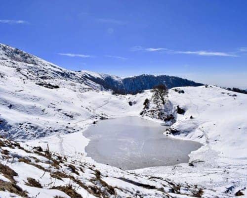
2. Frozen Beauty: Brahmatal and Bekaltal lake
The beauty of freezing lakes are what define this trek and make it a truly unique opportunity. As the temperature drops below freezing, both Bekaltal and Brahmatal Lake's develop two feet/thick layers of ice. The ice formed on the top of the lake creates a mirror-like surface that reflects the surrounding forest, which is generally dark and heavy with snow (oak and rhododendron). This landscape, because of its dynamic nature—while the appearance is similar to the winter months—is considered to be among the most beautiful landscapes created on any known trek.
3. Giant Mountain Views are Unique and Beautiful
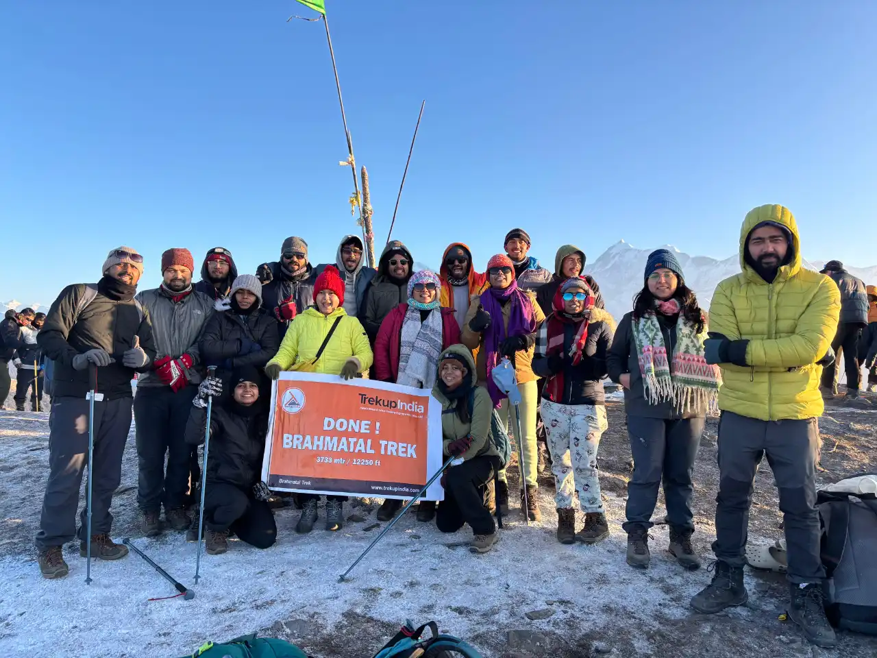
Brahmatal Top, located at 12,250 feet above sea level, provides an unrivaled 360-degree panoramic view of some of the highest and holiest mountains in the Garhwal Himalayas. From this high point, you can see some of the most impressive giants Mount Trishul, and Nanda Ghunti in the region with amazing clarity and very little distance. The breathtaking views from Brahmatal Top allow trekkers to experience an inspiring Giant Mountain View without having to travel as far or climb as high as would normally be required.
4. Clear Visibility for Winter Photography
Most people expect to have less visibility during winter months than in other seasons, but that is often not true in the Himalayas immediately after a fresh snowfall. The extremely cold temperatures and clear winter weather keep dust and haze away from the lower levels of the atmosphere, giving fabulous visibility (and also an ultra-crisp quality of light). The low angle of the winter sun highlights the detailed textures of the snow and the massive granite cliffs, making for some remarkable photography of the incredible scale of the mountains against the deep blue sky.
Trek Highlights
Scenic Beauty and Landscape
As you trek through this adventure, you'll see an incredible variety of natural beauty in the area. Much of the area we will walk through is covered in dense Oak and Rhododendron forests. In the winter, when the white snow on the trees forms what can easily be described as a magical tunnel. During your trek, you will encounter rolling meadows and High Altitude Ridges, all leading up to two beautiful alpine lakes, Bekaltal and Brahmatal. The pristine white landscapes of winter snow will be replaced with brilliant colours in Spring from the flowers of the Rhododendron trees.
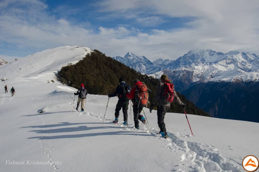
Summit Experience
The highest point on this trek will be known as, Brahmatal Top (approx. 3,734 m / 12,250 ft). From here you'll have unobstructed 360 degree views, from the beautiful Himalayas, and all this for your effort during the trek. From here you will be able to see one of the most incredible views of the entire trek, up close and personal, with two of the most famous mountains in the world: Mt. Trishul (7,120 m) and Mt. Nanda Ghunti (6,309 m) as well as many other spectacular peaks.
Best Season & Seasonal Beauty
There are two beautiful seasons. The first beautiful season is the Winter season, which runs mid December to February, where the snow will be covering the ground, and the lakes will be frozen with the purest, and coolest air to breathe. The second beautiful season is the Autumn season, which runs from October to April. It is during the Autumn season, that you will see the new life coming out after the rains, changing the lush green ground of Post- Monsoon to gold, and the best views of all the Mountains in their sharpest form.
Cultural and Village Life
The trek starts in Lohajung, which is a base village for the trek. It is a small and rural village located at the foot of the mountains. It has traditional Garhwali architecture and lifestyle. This village provides an excellent insight into the very simple rural Himalayan lifestyle. Although much of the trekking will consist of remote camp sites, the hospitality provided by the people in this community as well as traditional architecture will provide a warm welcome and farewell before and after your trek. The lake has a mythological significance in relation to Lord Brahma.
Flora and Fauna
The trail is rich in Sub-Alpine forests which consist of Oak Trees, Rhododendrons, and Pines. There are not many large mammals but the trail is well known for having a wide variety of Birds of the Himalayas and other Small Wildlife Species. The Rhododendron (Burans) plants are the highlight of the Flora with their large red and pink blossoms that bloom in the spring.
Adventure and Difficulty Level
Level of Difficulty: Easy to Moderate, There are many gradual and easy to moderate inclines on this trail and they are not Technical treks.
Level of Adventure: The main adventure aspect of this trail is experiencing the trail during the winter months when there is deep snow and camping in sub-zero weather. You will need to be in good physical shape and have the right gear to do this, however, there is ample opportunity for beginners.
Unique Experience
The Brahmatal Trek provides an unparalleled chance to experience the magnificent and untouched vastness of winter trekking through a trail that features many beautiful ice-covered alpine lakes and snowy wonderland, yet is still accessible and safe for beginners. As a result, this trek presents an extremely high level of scenic beauty, given the moderate effort required during this trek.
Short and Detailed Itinerary, Trek Map and Altitude Chart of Brahmatal Trek
This section provides a comprehensive, simple explanation of the Brahmatal Trek, including general day-to-day routing, elevation gain, etc. The basic itinerary is designed to give an overview of the trek; all-inclusive itinerary allows for a more in-depth understanding of the various distances between campsites, the nature/type of terrain that trekkers will be traversing, and the locations of the campsite relative to one another.
In addition to the above, the trek map indicates the specific route of the trekking path, village locations, forest locations, and campsite locations within the trek area enabling trekkers to imagine their trek through snow-covered coniferous forests and alpine meadows. The elevation chart clearly indicates the total elevation gained and lost each day of the trek ensuring that trekkers can prepare adequately before arriving at the basecamp, acclimatize safely to altitude, and have a positive experience on their overall trek.
IS
hort Itinerary
Day 1:Drive from Rishikesh (1,200 ft.) to Lohajung (7,600 ft.)
Drive Distance
278 Km (9-10 hrs)Altitude Gain
1,200 ft → 7,600 ftMeals
Evening snacks and dinnerStay
Guesthouse at LohajungExpert Advise: If you have motion sickness problem make sure to take medication prior to the drive starts.
Day 2:Trek from Lohajung (7,600 ft.) to Bekaltal (9,700 ft.)
Trek Distance
6 km (4–5 hrs)Altitude Gain
7,600 ft → 9,700 ftMeals
Breakfast, lunch, evening snacks and dinnerStay
At Bekaltal campsiteWater Sources: Water streams in the route (Carry 2L thermoflask filled at campsite)
Day 3:Trek from Bekaltal (9,700 ft.) to Brahmatal lake campsite (10,450 ft.)
Trek Distance
7 Km (6-7 hrs)Altitude Gain
9,700 ft → 10,450 ftMeals
Breakfast, lunch, evening snacks and dinnerStay
At Brahmatal lake campsiteWater Sources: Limited so refill your bottles at the campsite before trekking.
Day 4:Trek from Brahmatal lake campsite (10,450 ft.) to Brahmatal Top point (12,250 ft.) & return back to Brahmatal lake campsite
Trek Distance
12 Km (8-9 hrs)Altitude Gain
10,450 ft → 12,250 ft (Summit)Meals
Early Breakfast, packed lunch, snacks and dinnerStay
At Brahmatal lake campsiteWater Sources: Available at the Brahmatal lake campsite
Day 5:Return back to base camp Lohajung (7,600 ft.)
Trek Distance
4 Km (3 - 4 hrs)Altitude Loss
10,450 ft → 7,600 ftMeals
Breakfast, lunch, evening snacks and dinnerStay
At Lohajung guesthouseWater Sources: Easily available at the guesthouse
Day 6:Drive back to Rishikesh (1,200 ft.) from Lohajung
Drive Distance
278 KmMeals
Only Morning tea / coffeeWater Sources: Springs on the trail and restaurants in the Rishikesh route.
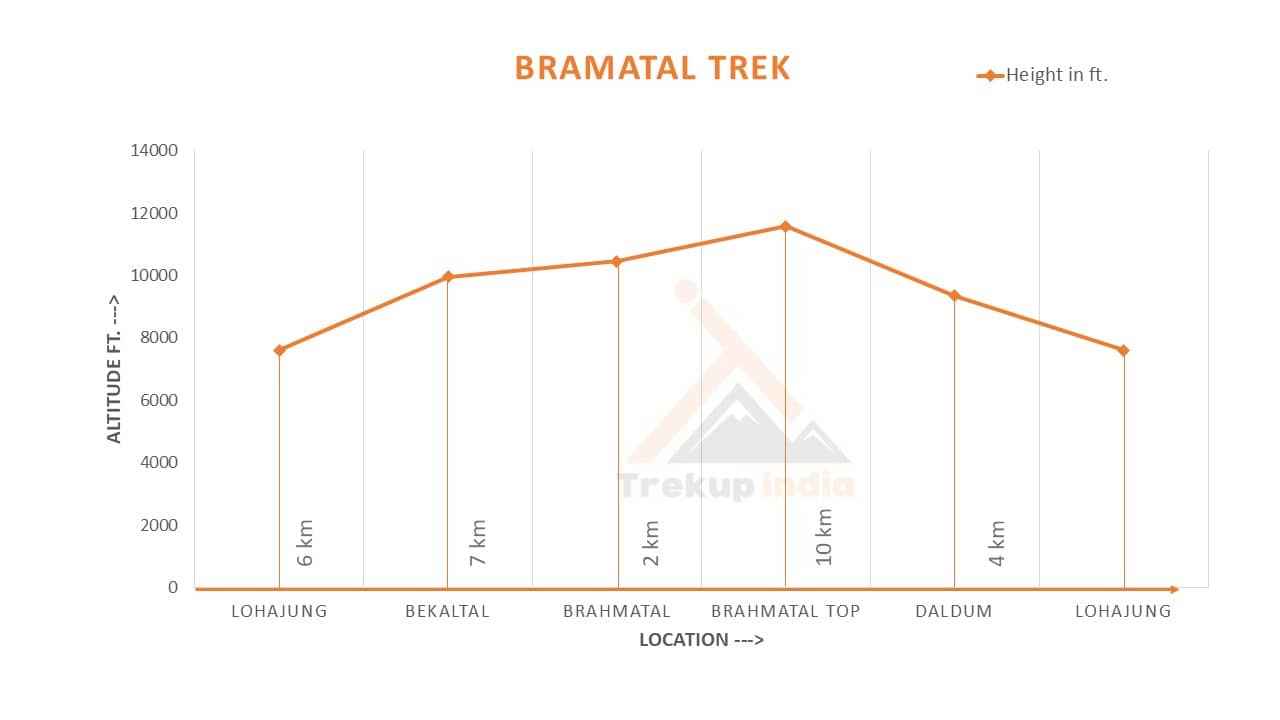
Brahmatal Trek Route Map and Altitude Chart
Trek Map
To assist you with your upcoming Brahmatal trek, we have created an encompassing Trek Route Map. This map will provide you with a comprehensive overview of the entire trek; from your departure to the summit and back again. On this map, you will find all of the most critical information regarding all of the significant way points (trails, elevations, points of interest) as well as terrain and distance between campsites and approximate durations of trek, making your trek planning more efficient. Our team at Trekup India, put a high priority on giving you the full range of important information required to aid you in your trekking experience without issues. For the best experience, we strongly encourage you to study the Route Map before your trek. Should you have any questions or require clarification regarding this map, please do not hesitate to reach out to the Trekup India customer support team. We are always here to help you prepare for your journey with confidence.

Altitude Chart
The Brahmatal Trek Altitude Chart provides useful information to help trekkers keep track of their altitude change as they make their way through the trek. The chart shows how much elevation gain is made at each segment of the trek, which enables trekkers to effectively develop a plan for their pace during the trek, as well as monitor how their body reacts when they are at higher elevation. Therefore, this chart is beneficial for both beginner trekkers and experienced trekkers, mainly because they will have better preparation in terms of acclimatization and how to get the best experience from the Himalayas. Furthermore, the Altitude Chart enables trekkers to visually see how the trail will gradually go up and down, making it easier and safer to have a well-paced trek.
ID
etailed Day Wise Brahmatal Trek Itinerary
Day 1: Drive from Rishikesh (1,200 ft.) to Lohajung (7,600 ft.)
Basic details for the day: Start your trek by driving for 278 km from Rishikesh to base camp Lohajung, which takes around 10 hours, and increases your elevation to 7,600 feet. This drive consists of many winding mountain roads throughout Garhwal and has many tea shops along the way that provide water and refreshments. When you reach the base camp at night, you will have snacks in the evening and a hot meal before sleeping at Trekup India guesthouse.
Route Description and Terrain Insights: Particularly important note about the trail: a pure vehicle drive on some of the winding mountain roads, as described above. The road will take you along these same winding mountain roads through some incredible terrain; and the terrain will change from the low-lying river valleys of the Ganges to the steep, rough mountain slopes of the Chamoli district as your vehicle descends from the top of these mountain roads.
Natural and Scenic Highlights: Some highlights for your Nature sceneries include: Devprayag, Rudraprayag, Karnaprayag = the confluences of Panch Prayag (the merger points of five rivers; Ganga, Yamuna, Saraswati, Kamala, Nanda Devi); at altitude you can see the silhouette of Mt. Nanda Ghunti comes into view.
Cultural and Local Touchpoints: Things to see in town; many small towns such as Srinagar and Tharali give you insight into the busy, thriving lives of the Himalayan mountain communities, ending at the mythical village of Lohajung — the alleged site of a battle between Goddess Parvati & demon Lohasur.
Safety and Acclimatization Guidelines: To avoid nausea or vomiting while trekking the many hundreds of hairpin turns along this route, a practical strategy is to keep your windows slightly cracked for airflow, drink plenty of water throughout the trip, and then rest in the evening in Lohajung to help your body adjust to the altitude.
Experience Notes by our trekkers who completed this trek: The journey on shared transport gives trekkers from diverse backgrounds an opportunity to develop good bonds through shared excitement during the journey, while the drivers from the area typically provide travellers with some interesting old stories about the mountain range that can be seen from the road.
Camp Information & Logistics: Accommodation for the night will be provided and will be in a local guesthouse or homestay which provides very basic services; this will be the last place where a consistent mobile network and charging services are available.
Practical tips for trekkers: Trekkers should take sufficient quantity of cash with them from Rishikesh, as the ATMs along the route are notoriously unreliable and are frequently not working, thus the evening should be spent ensuring everything is in good working order and preparing their gear and, if possible, off-loading excess gear at the base camp shop.
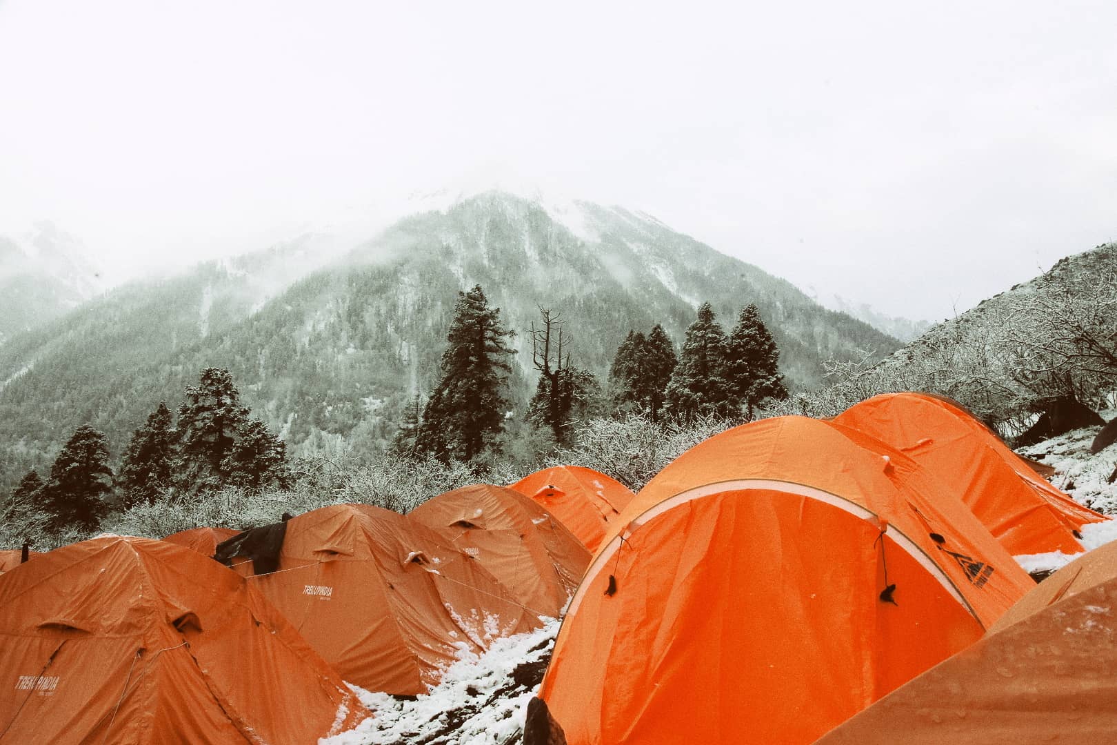
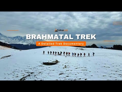
Brahmatal Trek Photos and Videos
The Brahmatal Trek features great sights along the trail such as snow-covered forests, beautiful summit views, campsite life, and experiences while trekking. By using real photos and videos along with these images, you will have the ability to find out what your trek and terrain will look like, and give yourself an idea of what sorts of trekking await you before leaving for your Brahmatal trek.
IP
hotos
IV
ideos
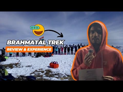
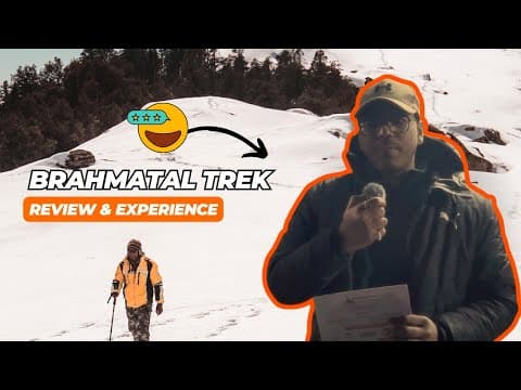
Brahmatal Trek Reviews and Experiences
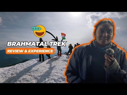
IVideo Reviews
The Brahmatal Trek has real trekkers who tell their stories about how the trek feels on the trail. In this section, you will learn what other trekkers say about the snow, the campgrounds, the quality of food, the safety, the trek leaders, and their experience with Trekup India.
These stories help you see what it is actually like to be on trekking, what the summit will be like, and how beautiful it is to watch the sunrise from the top of the mountain. By reading real experiences, you will be able to trust, answer any common questions you may have, and properly plan your Brahmatal Trek with Trekup India.

Best time for Brahmatal Trek: Season by season guide
Brahmatal is one of the rare gems of a high altitude trek in the Himalayas which can be traversed even when all high altitude vanishing passes throughout India are completely under snow providing trekkers with a prime view of the remarkable seasonal changes that occur in the Garhwal region. This extraordinary trek takes the trekker from the crystal clear, beautiful autumn colours of October to the extreme cold and ice conditions of January to the stunning springtime flowers and green grass of May; no two times on this trek will be the same. Therefore, the time frame for trekking in this area, from October to April, is known as the 'Golden Time' of Trekking in India, and can be accomplished only if one has in-depth knowledge of weather patterns because at that time last October may not be anything like January.
Brahmatal Trek: Month by month breakdown
Here is the month by month breakdown for the Brahmatal Trek categorized season transition and trail condition you can expect.
Advice by our Expert Team-
Our Expert trek leaders and trek guides are well known about the trekking trails with the adverse weather conditions at higher altitudes and they know how to deal if any uncertainty arises. They have years of experience in trekking adventure so on this, they will suggest or guide you with some advice.
1. Prioritize Acclimatization: Stable weather in the spring and autumn makes it easier but never rush to the trek. There is a chance of AMS problems occurring due to dry cold so be prepared, take precautionary measures with yourself.
2. Proper Layering: Temperature fluctuates instantly, especially on the higher altitude, so layering should be proper (base, mid and outer) is critical for managing sweat and preventing the cold.
3. Premium Boots: Make sure your boots are long lasting and well broken or used before your trek starts. The risk of foot injury and blister from the new boot can end your trek journey
4. Hydration: It's advisable to drink 3 to 4LT/day. Because of high elevation and exertion, you need constant intake of fluids to overcome the effects from AMS.
5. Pace Yourself: Walk at a comfortable pace using what is called the mountaineers shuffle. This will conserve your energy and help you manage your breathing.
6. Protect Against UV Rays: Use High-Quality UV Sunglasses (Cat 3 or Cat 4) to protect your eyes from snow blindness, and use high SPF Sunscreen on your skin to protect it from sun damage.
7. Healthy Consumption: Food should consist of small amounts consumed frequently and contain a lot of nutritious ingredients and minerals. This will provide you with the sustained energy needed for trekking at high altitudes.
8. Safety: Pay attention to what your body is telling you when you are feeling AMS Symptoms. Should you believe you might be suffering from AMS, report it immediately and prepare to descend. Descending is the quickest treatment you can receive.
How to Plan Your Travel for Brahmatal Trek
Are you excited to start your adventure for Brahmatal Trek? The travel journey starts from Rishikesh where all the trekkers reach & move towards Lohajung. In this section we will guide you how to plan & proceed your travel journey for Brahmatal trek. From your home town to pickup point Rishikesh, we guide you with all the necessary means of transport for a smooth and adventurous journey. You can opt various means of transport like flight, train & bus to reach your pickup point at Rishikesh.
Modes of transport to reach Rishikesh (The base pickup city)
There are various means of transport to reach at your pickup point via flight, train & bus with variation in timings. All the flights, trains & buses have different arrival & departure times, so plan your travel journey accordingly. We have mentioned all the information regarding the travel perspective for your convenience.
1. By Flight (Fastest Means)
The Jollygrant Airport is located 30 km away from the pickup point. There are scheduled, nonstop flights from all major metro cities such as Delhi (DEL), Mumbai (BOM), and Bangalore (BLR) etc.These airlines offer direct flights from multiple cities.The timings are subject to change and will vary day by day. You can book your flight one day prior to your travel journey.
Suggestions: Please make sure to arrive early, if you have enough time for your journey you can rent a room at an affordable price in nearby Natraj Chowk, Rishikesh.
2. By Train (Dependable Means)
The railway station of Rishikesh is very close approximately 500-600 Meters from the pickup point. You can cover the distance by walking to the pickup point. The best train services for overnight travel from Delhi (New Delhi Railway Station) to Rishikesh:
Suggessions: Ensure to book AC's or Sleeper seats in advance of your travel during peak winter season.
3. By Bus (Affordable Option)
The ISBT of Rishikesh is 1.5km away from the Natraj Chowk, Rishikesh. Buses are well air-conditioned like Volvo, Sleeper, and Non-AC buses with departures mainly from Delhi, Jaipur, Mumbai, Bangalore and other cities. The timings are subject to change and will vary day by day and the format of timing is 24 hour format.
Suggestions: Consider using an overnight air-conditioned Volvo/ac sleeper bus service to reach early morning (5.00 am to 6:00 am).
How to reach trek base Lohajung from pickup point Rishikesh
From Rishikesh, it is approximately 250 Km and takes 9 -10 hours by road. While travelling from Rishikesh to Lohajung you will cross Devprayag sangam, Dhari Devi and near Teen Dhara at 9:30 am we will halt here for breakfast around 30 minutes with the scenic view of pindar valley after covering couple of distance we will reach Naal Gaon where we will take a stop for Lunch approx. 2:30 pm. After having lunch we will head towards our final destination Lohajung.
Means of transport from Base city Rishikesh to Campsite Lohajung
1. Trekup India Vehicle: If you book with the Trekup India, transportation depends on the number of trekkers according to their size, vehicles will differ like tempo traveler, bolero, innova or mini bus. Our cab picks you from Natraj Chowk, Rishikesh & drops you at Basecamp Lohajung safely. Our vehicles are well maintained & hygienic for your travel journey.Here are the pickup details from the base city Rishikesh (If you opt our transport facility):
- Pickup Point: Natraj Chowk, Rishikesh
- Pickup Time: 6:30 AM
- Drop Location on Last Day: Natraj Chowk, Rishikesh
- Drop Time for Last Day: 05:00 PM - 06:00 PM (expected)
2. Public Transport Bus: You can opt for a public transport bus early in the morning to reach base camp Lohajung on time for the next day's trek. But make sure you are particular with the bus time in the morning as there are very limited buses between 5:30 AM to 7:30 AM. There is no bus after this so try to pick a bus early from Rishikesh.
3. Private Taxi/Cab: If you miss your bus from Rishikesh, another way to reach Lohajung is by taxi/cab. You can book a taxi/cab on a sharing basis with a shared price. But make sure that your timing is matched with the taxi timing as the number of taxis are very limited in the morning and generally operated early in the early morning from 5:00 AM onwards.
Tips for Mountain Drive
Whenever you are planning to trek on the mountains, health plays a crucial role. Your main motive on any trek is to be physically and mentally healthy. Here are all the important travel suggestions that you are going to face on your travel journey.
- Motion Sickness: Take medication Dimenhydrinate (prescribed by doctor) - 30 minutes before your journey starts and make sure to sit in the front seat of the taxi.
- Punctuality: Being a wise person, always be on the time whether you are on the camp site or on the trek.
- Inhand Case: Have an adequate amount of cash because you never find any ATM at a nearby location.
- Proper Hydration: Always take the water and fruits throughout your travel to avoid dehydration & other health related issues.
- Charge: Make sure that all electronics / power banks are fully charged before being stuck in a long taxi ride, as there are not many charging stations available on the route.
- Check luggage: always make sure to check your luggage when you are on the trek or during the trek.
Day 2 - Day 5 (The Trek Days)
After reaching the basecamp Lohajung on day 1, its time to move towards the trek which starts from day 2, trekking from base camp Lohajung to Bekaltal with a trek distance of 6 Km completed in 4 hrs - 5 hrs after that there are some activities & hot meal for all the trekkers. On day 3 from Bekaltal to Brahmatal lake distance of 7 km in 6 hrs - 7 hrs, then on day 4 Brahmatal lake campsite to the top point distance of 12 km covered in 8 hrs - 9 hrs spending some time at the top point after completing the summit moving back to the base camp Lohajung which takes around 3 hr - 4 hr. On day 5, finally moving to the Basecamp Lohajung by covering a distance of 4 km and on day 6, after having morning tea/ coffee will proceed to the dropping point Natraj Chowk, Rishikesh at 5:00 to 6:00 PM expected.
Planning Your Return Journey from Lohajung to Rishikesh
Once you have completed the Brahmatal trek, returning should be overwhelming with good memories, pictures and new friends on the trek. Our Trekup India vehicle will pick you from the base camp Lohajung and leave you at the dropping point Natraj Chowk, Rishikesh.
Suggestions: Book your return transport after 6.00 P.M & for security you should also keep a buffer of 1 - 2 hours for your return journey in case there might be delayed due to traffic, land slides or vehicle breakdown.
Return From Rishikesh to your Hometown
We have mentioned details of various means of transport like flight, train and bus with the estimated timings, so book accordingly with your preferred time. Below mentioned data helps you to choose and book for your return journey.
Note: The timings are subject to change and will vary day by day. Also the mentioned timing is written in 24 hours format.
By Flight / By Train
There are a number of flights and trains departing from Delhi to various designated cities on time. On the whole, you can book your flight or train from Delhi as there are many availability of flights and trains directly to your hometown.
Suggestion: Try to travel by bus to Delhi and in Delhi you can further book your train/ flight to your hometown.
By Bus
Here is the list of buses departing from Rishikesh to Delhi with their departure and estimated arrival timings. Make sure you book your further travel after reaching Delhi according to the below mentioned time. The timings are subject to change and will vary day by day. Also the mentioned timing is written in 24 hours format.
Safety Aspects and Emergency Exit for Brahmatal Trek
1. Understanding Trek Safety
Your trek leaders and trek guide have years of experience in getting you to the summit but most importantly back to safety. Trekking at high-altitude requires a huge amount of respect for the mountains and therefore there is a correct, safe way of doing things throughout, especially on a moderately challenging trek like Brahmatal. This responsibility starts with full understanding of Acute Mountain Sickness (AMS) prevention, a strict adherence to the gradual ascent plan, and absolute understanding of emergency procedures. Your ability to follow safety procedures will determine the success and enjoyment of the trek.
2. Acute Mountain Sickness (AMS)
Altitude sickness (Acute Mountain Sickness or AMS) is the result of the body being unable to adapt lower levels of oxygen pressure (*hypoxia*) at high altitudes (usually over 8,000 feet). The risk is that untreated AMS will progress to High Altitude Encephalopathy (HACE) or High Altitude Pulmonary Edema (HAPE) if the person keeps trekking higher in a state of unequipped acclimatization.
Important Symptoms of the Acute Mountain Sickness (AMS):
Mild AMS:
- Headaches are the most significant and common sign.
- Nauseous feeling, lack of desire to eat, and general tiredness.
- Poor sleep (insomnia).
Severe AMS (HACE warnings):
- Difficulty balancing and trekking straight (unable to walk a straight line - "heel-to-toe" test).
- On-going severe headache that can't be helped with medication.
- Confusion or some alteration in understanding.
Severe AMS (HAPE warnings):
- Unable to breathe without feeling short of breath.
- Persistent cough with wet/sputum or sometimes pinkish-tinted frothy mucus.
- Excessive tiredness and feeling of heavy pressure in the chest area.
Precautionary Measures of AMS
1. Ascent Gradual
- The 6-day itinerary from Lohajung to Brahmatal top point has been set up to allow for acclimatisation. You are advised not to skip camps and rush up the mountain.
- The principle of Trekking High and Staying Low at the Base Camp helps you get acclimatised.
2. Hydration and Nutrition
- You need to drink 3-4 litres of water every day. If you become dehydrated, it will only make any AMS (Acute Mountain Sickness) symptoms worse.
- You should continue to drink a lot of water, even when you don't feel thirsty. At the campsite, you will also be provided with a high-carbohydrate diet which will give you the energy to acclimatise.
- Do not drink alcohol or caffeine.
3. Pacing and Movement
- Use the Trekker's Shuffle to keep a slow and consistent pace. Do not waste energy on speed and frequent stops.
- Use trekking poles to maintain your balance and to absorb some of the pressure on your joints when doing the long descent on day four.
- Always try to remain in sight of your friends and the guide when out trekking.
4. Medication
- Talk to your Doctor regarding the use of Diamox (Acetazolamide) to help alleviate AMS.
- Discuss starting this medication one or two days before reaching altitude if it is prescribed over a prescription.
- Remember to carry any personal prescription medications and basic pain relief (for example Ibuprofen) in your day pack.
3. Emergency Response and Evacuation
The Brahmatal Trek uses a decend first approach to aid in the prevention of issues related to high altitude. Due to the fact that cars cannot reach the Pindar Valley. The process includes a chain of survival which entails using mules or stretchers to carry the injured person to the Lohajung Road Head, driving them by 4x4 to the hospitals in Dewal and Karnaprayag and finally flying via helicopter from Gauchar for critical situations. All of this must take place rapidly and requires a well developed system of coordination between camping guides, local messengers and the State Disaster Response Force.
Action Plans: High Altitude Emergency
1. Immediate Action: If any member shows signs of moderate altitude sickness (e.g., a very bad headache, vomiting, and loss of coordination), stop immediately and let the Trek Leader inform. First, supply the member with oxygen (if available) and start going downhill. The guide's decision on whether or how far down to go, is final.
2. Evacuation Plan: Evacuate downwards to Lohajung. A casualty will be assisted/carried on a stretcher by the trekking group's support team to the village, and then to the vehicle from there.
3. Medical Support: The nearest major medical service provider is the Primary Health Centre at Dewal,or hospital in Karanprayag, which may take 6 -10 hours to access from Lohajung, therefore a rapid descent is crucial.
4. Communication: The trail beyond Lohajung has no mobile network access. All communications must be done over the Trek Leader’s satellite phone/radio, so do not count on your personal telephone for emergency communications.
4. Trekkers Responsibility for the Trek
1. Personal Health and Honesty:
- Report Symptoms: You must report any illness symptoms to your trek leader or guide as soon as they occur. Symptoms include headache, nausea or any other uncharacteristically extreme fatigue. Do not attempt to conceal these symptoms so that the group will not be held up due to your illness symptoms.
- Fitness: You are responsible for preparing yourself physically for the trek and ensuring that you have consulted with your physician regarding the effects of altitude, vaccinations you may require, and the proper medications you may require as a result of altitude treks.
- Hydration: You are responsible for consuming your daily requirements of water (3-4 litres). Expect and do not wait for your guide to remind you to hydrate, as you are responsible for doing so.
2. Gear & Equipment:
- Mandate kit: Ensure you have the appropriate gear and equipment for the trek; this includes wearing clothes that are appropriate for the weather; layers for cold; and using well broken-in boots.
- Headlamp Readiness: You should carry an operational head lamp, and charge it before the trek. You should also carry extra batteries and keep sensitive electronic equipment and batteries warm to prevent them from draining due to cold conditions.
- Personal First Aid Kit: It's a good idea for you to carry a small personal first aid kit with you. Basic supplies should include band-aids, blister treatment, antiseptic, and any prescription medications.
3. Conduct on the Trek:
- Follow Instructions: Follow the trek leaders instructions regarding pace, route, camp protocols and the use of safety equipment such as microspikes or trekking poles.
- Maintain group integrity: To maintain group integrity, do not travel solo on any trail or trek; always stay in sight of the group and be with the designated guide.
- Leave no trace: To reduce environmental impact, you must properly dispose of any non-biodegradable items (plastic packaging, drink bottles, etc.) and not pollute local water sources. Remember to respect the natural environment by respecting the plants and animals found in the area.
4. Teamwork & Respect
- Respect Local Cultures: Be conscious of the customs, way of life, and religious sites of the people who live near the trails and do not interfere with their lives.
- Support Other Trek Participants: Encourage other trekkers by giving them advice when necessary. Notify a guide if you think a teammate is in distress or danger. A team that cares for each other is a safer team.
5. Emergency Exit of the Brahmatal Trek
The Brahmatal Trek is recognized as one of the most popular winter trekking routes for beginners; however, its altitude limits of nearly 12,557 ft. combined with extreme cold weather conditions call for an emergency exit plan, which is essential. At these high altitudes and under these harsh climatic conditions, there is a high potential for environmental dangers such as Acute Mountain Sickness (AMS), quick changing weather, and Zero visibility. These weather changes can turn a fun trek quickly into a life-threatening situation in just a few hours. Since there are no roads or medical help after the base of Lohajung, the importance of the emergency section of the trek is a focus on two very critical priorities: immediate drop in altitude and prompt transport to the road-head. Learning the specific emergency "express" drop-off paths, such as the shortest distance from Brahmatal Lake to Lohajung, is the most vital safety preparation for any trekker.
Emergency Exit Routes for Trails
It varies based on the location on the trail learned during the trek and the type of injury or medical condition you are experiencing. Exit routes can be found as noted below for each day of the trek:
- From Bekaltal/Gujreni: 5-6 km from base, if sustaining an injury or developing milder altitude sickness (AMS), you should descend to Lohajung immediately via the well-marked forested trail providing a sheltered path against windy conditions.
- From Tilandi/Jhandi Top: This is a ridge with high exposure, should the weather change or your physical health deteriorate, your best option for fastest exit is to descend back toward Bekaltal and then further down to Lohajung. Do not remain on the ridge during thunderstorms or zero visibility with high wind gusts.
- From Brahmatal Lake/Camp: You have reached the furthest point from the base camp. The recommended standard exit is to follow the descent route down then back to Lohajung. This is a far shorter and steeper route (3-4 hours) to descend than the original ascent route and therefore is considerably quicker than ascending back.
Medical & Evacuation Facilities
1. The Roadhead Lohajung
- Altitude Safety Threshold: It is located at an altitude of 7,600 feet, and serves as the Low-Altitude Safety Threshold for all high-altitude sickness (AMS) victims as it is below the 8,000-foot level of oxygen saturation.
- Logistical Hub: Lohajung also functions as a logistical hub for all AMS evacuations and is where professionals keep a back-up vehicle, such as a Mahindra Bolero or Sumo, available for any emergency transportation needs.
- Runner System: Due to the absence of phone coverage at Brahmatal Lake, a runner is dispatched from Brahmatal Lake to Lohajung, where the runner contacts the driver of the back-up vehicle and notifies the local authorities that the patient is in route.
2. Primary Evacuation Points
The Dewal and Tharali health care centers are the next immediate stop to receive the required medical care after leaving Lohajung.
- Dewal: It is located 24 kilometers from Lohajung and contains a primary health centre (PHC). Dewal's PHC is the golden hour location to stabilize AMS patients through oxygen administration and intravenous fluid administration.
- Tharali: It is located 35 kilometers from Lohajung and contains a community health centre (CHC). Compared to Dewal, Tharali's CHC has more medical staff, equipment for blood testing, and a pharmacy that operates 24 hours a day for emergency medications and care.
3. Specialized Medical Care
- Karnaprayag: It is the nearest specialized hospital for AMS victims and is located 85 kilometers from Lohajung. Karnaprayag Sub-District Hospital has digital X-ray equipment, and an orthopedic physician. It is considered the primary destination for the fracture, severe sprain and trauma for fall.
- Srinagar: It approximately 145 km from Lohajung, is home to the HNB Base Hospital and Medical College, the highest-quality medical facility available in the region, including intensive care unit beds and dedicated pulmonary specialist units for treating both HAPE (lung) and HACE (brain).
4. Aerial Evacuation: Dehradun and Gauchar
There are 4 basic locations identified as appropriate for Aerial Evacuation is either Dehradun or Gauchar depending on how close they are by road.
- Gauchar: It is the closest airstrip located about 75 km by road from the base camp. If a helicopter is dispatched from Dehradun to the trek area, it can be on scene in as little as 20 to 25 minutes after takeoff.
- Landing Zones: (1) Tilandi Meadows provide the most stable (flat land) high altitude landing zones (approximately 11,000 feet), especially if a patient remains too ill to be transported to a lower altitude landing zone or continues to require immediate treatment.
- Weather Constrait: Its impacting helicopter operations in the Himalayas are classified as VFR (Visual Flight Rules). Helicopters are prohibited from flying during inclement weather such as snowstorms and thick fog (predominantly found during winter).
Emergency Procedures (AMS & Injuries)
If the trekking participant has symptoms of Acute Mountain Sickness (AMS), for example: Persistent headache, Nausea, Dizziness.
- Immediate Descent: It is the only way to treat it. Immediate Descent of at least 1,000 - 2,000 ft.
- Oxygen Support: Some professional trekking groups have portable oxygen tanks and digital oximeters. Please ensure your group has the same.
- Communication: There is limited network coverage (top scores that work) in the Jhandi tops/Lohajung but not at all in deep valleys; this is the reason guides will use walki-talkie systems to keep in contact with base camps.
Critical Safety Checklist
- Buffer Day: Always include an added insulating per day for bad weather and/or trail/elevation blockages due to heavy snowfall in the Lohajung area.
- The Golden Rule: Never fall behind alone. If the person(s) needing evacuation is unable to travel alone, the guide or best friend should always accompany him/her. (Never Alone)
- Winter Gear: As stated, there is between three to four feet of snow(nov-feb) in the trekking trails at this time; far too many trekkers have slipped and fallen, so micro-spikes and gaiters are essential preventive measures to reduce the risk of slip-and-fall injuries that occur most often resulting in the need to evacuate trekkers.
Important Contacts
- 'SDRF'(State Disaster Relief Force) - +9112 or +911352410197
- District Magistrate Office; Chamoli - (+911372) 252102
The Essential Brahmatal Trek Packing List: Pack for Adventure & Safety
Are you excited for your brahmatal trek? Our expert trek leader will provide a packing list that is easy to carry and remember. From their experiences and years of expertise working in high altitude, they have created a packing list from head to toe to provide you with a simple and safer option to protect you from the high altitude sickness. Packing for your trek is all about safety and your performance. As a trek leader and mountaineer with years of experience leading the high altitude trek several times, we have seen the gear plays an important and life saving role to the trekkers. So we created a packing list for your convenience while you are planning for the trek. Below we have mentioned packing philosophy, strategic gear list and important tips to remember while you are planning for the higher altitude trek.
Packing Philosophy: Prepare for extreme
We believe essential over extras. Always avoid excessive packing weight, but should have at least three non-negotiable gear categories:
- Extremity Protection: Must have UV blocked sunglasses (the only way to protect against snow blindness), waterproof gloves, and a warm balaclava/cap to protect your most exposed areas.
- Layering System: Utilize multiple layers of synthetic or wool insulation clothing (acceptable, no cotton) to manage body temperature and moisture to prevent chilling.
- Waterproof Footwear: Durable waterproof trekking boots at least mid-calf are required so your feet and ankles remain protected on snow and ice.
Strategic & Non-Negotiable Gear list for the Trek
1.Major gears: The frontline of protection
| Item | Characteristic Feature | Pro-tip |
|---|---|---|
Waterproof, Ankle-Height Trekking Boots | These are high quality boots with stiff rubber soles that prevent water entry. | Must be fully broken in. Good with a deep aggressive grip to avoid injury in toe or fingers. |
Trekking Poles (Pair) | Provide 2 additional points of contact for stability on snow / ice and reduce impact on knees while descending. | Use them together to distribute the weight of your pack, this can reduce stress on your knees and ankles. |
Waterproof Gloves (2 pair) | Protects against cold injury. Having two pairs that allows warmth while protecting your hands. | Keep the shell of gloves dry for a waterproof layer for handling snow and keep the inner liner for warmth. |
Gaiters (required) | Create a seal between your boots and trousers to prevent snow from entering your boots / sock. | Put your gaiters on as soon as you reach the snowline; avoiding snow wetting your socks / boots minimizes risk for cold injury. |
High-Grade SPF Sunscreen and Lip Balm | Protects against severe sun / wind burn. It is important for exposed skin at high altitude due to reflection from snow. | Reapply sunscreen to face, neck, and ears every 2 hours spent on the snow. |
Sunglasses (Category 4) | Highest level of protection required to protect against temporary blindness (photokeratitis) | Do not remove sunglasses when you are on the snow because snow can reflect 80% of UV light back into your eyes. |
2.Clothing: The layering system
| Category | Item | Specification & Reason |
|---|---|---|
Headwear | Warm Beanie / Balaclava | Must be thick wool or fleece; cover the ears completely. Important in retaining body heat, as a large percentage of body heat is lost from the head. |
Wide-Brim Sun Hat or Buff | Light material (hat) or synthetic tube (buff). Protects face, neck, and scalp from high-altitude UV radiation from the sun. | |
Upper Body | Moisture-Wicking T-Shirts (2) | Choose Synthetic (polyester) or thin Merino wool; short or long sleeve because cotton actively makes you cold and uncomfortable when you sweat. |
Thermal Base Layer (1) | Mid-weight Merino wool or synthetic long-sleeve top. Provides immediate insulation; it will lock in body heat as the starting point of your heat-trapping system. | |
Fleece Jacket (1) | Mid-to-heavy weight (200-300 GSM) fleece or softshell jacket full of insulation. This layer provides the best warmth-to-weight ratio It can be worn alone or under your shell. | |
Insulated Puffed Jacket (1) | Down or synthetic insulation; rated for 0∘C and below. Your main source of heat protection for cold night camping, evening, and the summit push when below freezing conditions are anticipated. | |
Waterproof & Windproof Jacket (1) | Shell material (e.g. Gore-Tex equivalent) with taped seams. Your outer barrier (shell layer) keeps the rain, snow and penetrating wind out from the mountains. | |
Lower Body | Quick-Dry Trekking Pants (2) | Synthetic, lightweight, and preferably stretchable or convertible. Durable for comfortable walking, fast drying after getting wet from rain or snow. |
Thermal Base Layer (1) | Mid-weight thermal bottoms (wool or synthetic). Vital layer of insulation under your trekking pants in cold walking conditions at camp. | |
Waterproof Rain Pants (1) | Lightweight, packable shell pants. These will protect your trekking pants and base layers from getting wet when it's snowing or raining heavily. | |
For Feets | Create a seal between your boots and trousers to prevent snow from entering your boots / sock. | Put your gaiters on as soon as you reach the snowline; avoiding snow wetting your socks / boots minimizes risk for cold injury. |
Trekking Socks (4-5 pairs) | Wool or some kind of synthetic blend (not cotton). 1-2 pairs should be extraordinarily thick for nights. These will manage moisture in your foot to reduce blisters and provide warmth at night sleeping in a bag or in boots! | |
Camp Shoes | Lightweight sneakers, sandals, or slippers. You'll want these to dry out your trekking boots and let your feet rest when at the campsite. |
3.Equipment & Essentials
| Category | Item | Important Notes |
|---|---|---|
Backpacks | Main Rucksack (50-60 L) | For Porter. Good frame of posture and hip belt required. |
Daypack (20-30 L) | Daily carry. Must have water, layers, snacks, camera, and gloves in your daily essentials. | |
Sleeping bag & liner | Sleeping Bag (Rated to −10∘C / 14∘F) | Confirm if Trekup India provides a sleeping bag; if you're renting your bag, make sure it is a reputable outfit. |
Sleeping Bag Liner | A liner adds additional warmth and keeps your bag clean. | |
Hydration | Insulated Water Bottles (2x 1L) | CRUCIAL: No hydration bladders (the tube will freeze). Insulated bottles will keep your water from freezing. |
Hydration Tablets/ORS | Make sure you have enough hydration tablets and/or Oral Rehydration Solution (ORS) which are important for replacing electrolytes lost at high altitude. | |
Safety & Navigation | Headlamp with extra batteries | Essential for crossing the pass started early in the morning. |
Basic First-aid kit | With plasters (Compeed!), Band-Aids, antiseptic, pain medication, and then any of your personal medications you might need. | |
Personal | Personal toiletries | Toothbrush, tooth paste, biodegradable soap, toilet paper (pack out!), and hand sanitizer. |
Quick Dry Towel | Material should be water absorbent with light in weight and small in size. | |
Power bank | There will be no place to charge devices on the trek. |
4.Essential Documents
- Government-issued Photo ID
- Indians: Aadhar Card, Voter ID, or Driving License.
- Foreigners: Passport and Indian Visa.
- Must Have: Necessary for verification at the Basecamp and Forest Department checkpoints.
- ID Copies (2 copies): Also submitted for the forest authorities for required trekking permits, etc.
- Medical Certificate & Undertaking Form: a form (usually provided by your operator- Trekup India) signed by an MBBS registered doctor confirming that you are fit for high altitude trekking.
Note: Please keep your photo identities on waterproof or ziplock bags to avoid it from rain or snow.You all need to verify your identity when your trek starts.
Cash: To avoid any inconvenience during the trek, make sure to carry some cash for your personal expenses. (No ATMs available)
5.Important tips by the trek leader (from their experience)
1. Pack Light Guidelines:
- Three Second Rule: If you can’t immediately think of a reason to pack an item, simply don’t pack it.
- Layer Duplication Rule: You cannot pack more than two of the same, heavy layer (e.g., two heavy fleece jackets). A proper layering system will give one item a temperature range.
- Multi-Use Only: Every item should have a minimum of two functions (e.g., balaclava can be a sweat rag, shade your face from the sun, or act as a neck gaiter).
2.Test Everything Rule
- Boot Break-In Rule: Don’t take new boots on a hike unless they have over 50 miles already walked in them. Boots need proper break-in time before using them outside.
- Base System Check: Set up your sleeping system (sleeping bag, liner, pad) in your house, on the day before the trek.
- Pack System Test: Wear your complete layering and set it up in similar cold/wet conditions to find any cold spots and distributed moisture.
3. Luxury Item Rule (The Worth It Extras)
- Comfort Item: Allow yourself one small item which is not a necessity. (ex. good book, tiny bottle of whiskey, small pillow).
- Ear Plugs: These are essential to block noise from the other trekker/ trek activities at the camp site ensuring you get your sleep without interruption.
- Camp Footwear: Lightweight flip-flops, Crocs, or just down booties that you can wear inside the tea house tent. Getting your feet out of your boots is total bliss.
4. Leave No Trace (LNT)
- Carry Everything Out: This is the most important. Nothing goes under the ground or in a fire pit—especially plastic, tin foil, or batteries.
- Human Waste: If there are no bathroom facilities, you need to bury human waste to a minimum of inches deep at least away from any water source or trail. Be sure to pack out toilet paper.
Stay on The Trail: Follow the straight path on the established trail. Widening the trail causes soil erosion and environmental damage.
6.Final Verdict:
Take advice from your doctor regarding the potential risks of high altitude and then verify that your travel insurance will cover high-altitude trekking and emergency evacuation. Before departing, give the contact information of your guides and operators, along with a complete travel itinerary, to a trustworthy friend or family member. You will need to have sufficient local cash separately from your main wallet because there will be no options for electronic payment on the trail. Your safety is your own responsibility. This is preparation advice to help you but by signing the form, you agree to follow all your professional guide's instructions on the trail regarding safety and emergency procedures.
Brahmatal Trek Cost Inclusions and Exclusions
The concept of pricing is the key part of your trekking journey. It defines the value and experience you receive for the price you pay for your trek. For a structured high altitude trek, like Brahmatal trek operated by Trekup India provides transparency with the cost & amenities provided to our trekker. Inclusions provide clarity in respect to operator's responsibility; essentially every necessary service, logistical support, group equipment, and permit to have a safe and fully supported trek from start to finish while exclusions provide clarity in respect to individual's responsibility, for all expenses related to personal choice (like a porter), necessary contingency items (like insurance), or mandated fees examined outside the package price (like GST).
Total Trek Cost: 7,850 / person + 5% GST (Mandatory)
Included in the trek cost
All the items that are included in the trek cost customised by Trekup India are mentioned below with pre, during and post trek support.
1 - Pre-Trek Support by Experienced Trek Coordinators
This is a special component of Trekup India, where a personalized trek coordinator is assigned to each trekker and who makes your preparation easy before coming on a trek, all your doubts, queries, myths are clarified, and you are mentally and physically guided to ensure that you come fully fit for your adventure. Every aspect from what to carry, what exercises need to be done, and how to prepare yourself for the trek, all will be guided by Trekup India’s Experienced Trek Coordinators.
2 - What is included during the trek
The offered cost covers all major essentials that are mandatory for a successful Adventure, such as accommodation, meal, permit, team of experts, trek equipment, safety gears and mules / potters support. We provide you all the services that are involved in the trek. Below find specifics.
Accommodation:
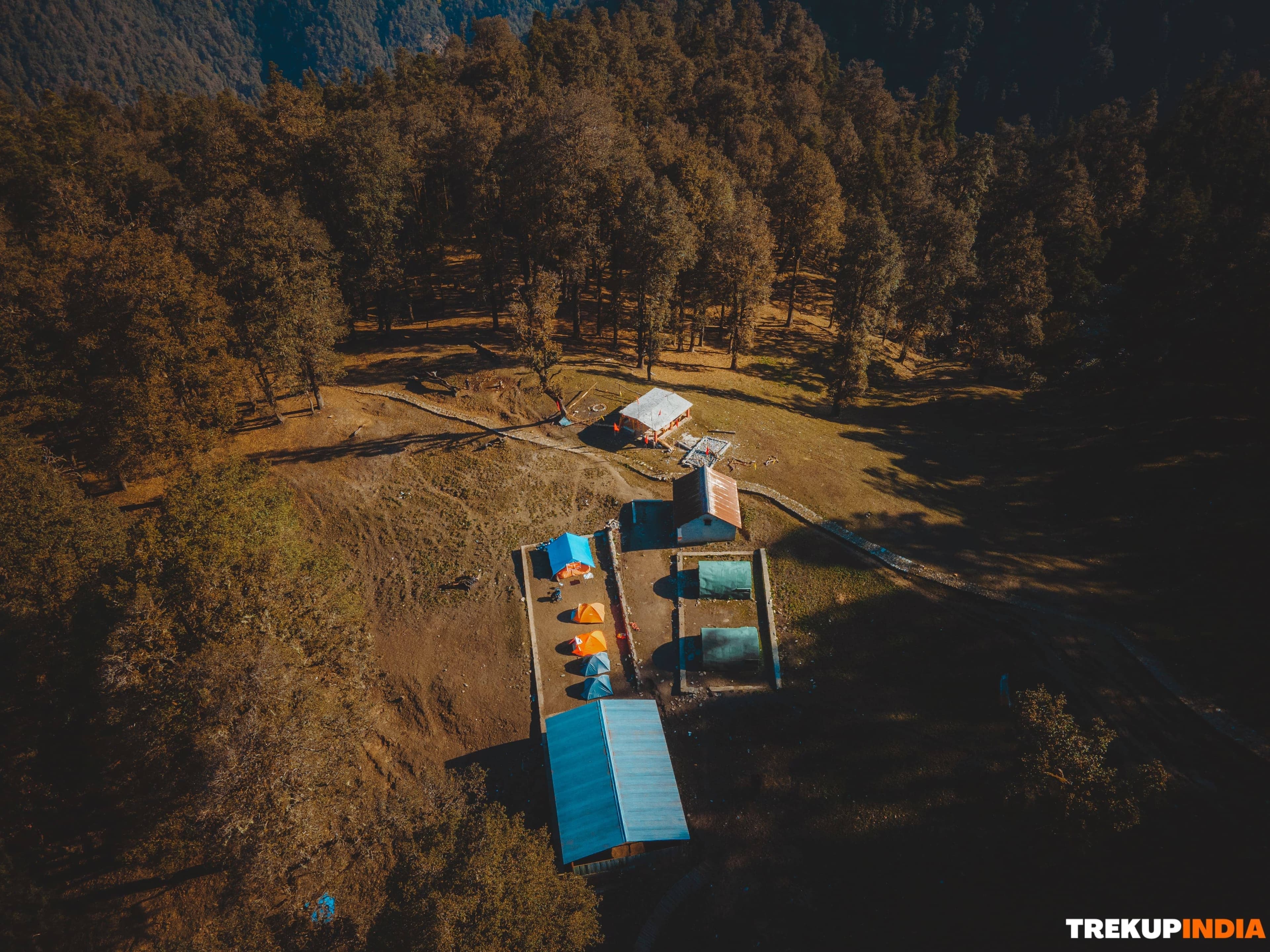
1 Nights accommodation in Lohajung guesthouse will be provided on Quad / multi sharing basis. 4 Nights accommodation in Dome style customised tents of Trekup India on Triple sharing basis.
Meal:
Your meals with Trekup India starts with evening tea & snacks on day 01 in Lohajung and ends with tea/ coffee on Day 06 in Lohajung. All meals provided by Trekup India are pure vegetarian meals and FOUR meals a day when on trek (Breakfast, Lunch, Tea Snacks and Dinners). The meals are freshly cooked and non repeated with delicious sweet dishes each night.
Permit: All camping and Trekking Permits from Forest Department, full assistance in documentation and formalities will be given by the team Trekup India.
Team of Experts & Professionals:
- Trek Leaders: Qualified and Experienced Trek Leaders to lead your group when on Trek. Trekup India Trek Leaders are AMC, BMC certified and trained for immediate First Aid with search & rescue Course.
- Assistant Trek Leaders: They are superwise under the Trek Leader guidance focussing on the safety, logistics and trekkers engagement.
- Local Guides: Experienced local guide familiar with region & routes. They understand the way of conduct better, especially being locals.
- Support Staff: A team of high altitude including mountain chefs and Helpers to prepare and provide you healthy and freshly cooked meals on your trek.
Trek Equipment: Trekup India provided high quality of trekking equipments for your adventure, all equipments provided on the trek is 100% customised by Trekup India, any equipments provided is tested on high altitude by our mountain experts and thereafter qualified for use of our trekkers, each fabric and designed are carefully chosen.
- Dome Style Trekking Tents: The sleeping tent we provide is 6/6 ft. in size giving extra comfort for your sleep in the high altitude.
- Sleeping Bags: To provide you warmth, comfort and cozy sleeping.
- Sleeping Mattresses: Warm Form mattresses are provided inside your dome tents.
- Kitchen tent: A designated area at the campsite where all the cooking staff prepare all the meals.
- Dining tents: A large common area where all the meals are ready to be served. It is the social space for enjoying meals together.
- Toilet tents: These are the private space away from the main campsite area to avoid smell and maintain hygiene. We have two separate toilets for male and female.
- Camp Chair/ Table: Portable stools and tables are provided at your campsite.
- Cooking & Service Utensils: All the necessary cooking and serving utensils.
Safety Gears: Trekup India stands proud itself that all our Treks and adventures operated since 1993 are without any single casualty as we take safety of our trekkers and staff on high priority, following are some of the gears that are included in your trek cost.
- Oxygen Cylinders
- First Aid and Medicine
- Stretchers
- BP Machine to regulate your blood pressure
- Oximeters to regulate your oxygen flow
- Health cards to measure your daily BP and Oxygen reading
- Walkies Talkies for Immediate communication
- Micro Spikes
- Gaiters
- Other Safety Equipment such as Helmets, Rops, Ice Axe, Carabiners much more as per technicality of a Trek.
Porters / Mules Support: Porters / Mules are provided to carry your common trekking gear, rations, trekking equipment and other supplies.
3 - Post-trek Assistance
This section implies with the following -
- Trek Feedback and improvement advice call from your Trek Coordinators.
- How to overcome Trek injuries and settle to normal life.
- Advice and suggestions for Next Adventure Trek.
Completion Certificate:
It is the best way to recognize someone’s adventure journey with a certificate. A well recognized certificate (IMF, ATOAI & Uttarakhand tourism development board) approved is provided to the trekker by two ways:
- Reached at Summit: we are giving certificates of summiteer to those trekkers who have completed their trek at the Summit.
- Incomplete Summit: we also provide our certificate for those who have not reached the final summit due to medical reasons but they are part of the trek.
Brahmatal Trek Difficulty: An Honest & Detailed Guide
The Brahmatal Trek can be described as one of the best treks to experience the beauty of winter while trekking through the snow. This trek is rated as a moderate trek due to the fact that it is not necessarily easy, but it is a beautiful and breathtaking trek. However, the first challenge that you face is the trek of over 2,200 feet from Lohajung to Bekaltal which is also a very tough test on your cardiovascular system. As you gain elevation, the terrain changes from the soft forest floor to exposed ridges that are battered by the wind, and the trail is covered with hard packed snow and slippery ice. On top of all of that, as you gain elevation the oxygen is reduced and the temperature will drop to as low as -10 degrees Celsius at night, making sleeping and recovering from exercise much more difficult. Therefore, the trek is doable for any person that is physically healthy, you must have the strength in your legs to ascend the steep grades, and the mental toughness able to deal with the extreme cold and the long duration (7-8 hours) on summit day.
Brahmatal Trek Difficulty: A Factor-by-Factor Analysis
You need to take a look at what you will experience when you trek the Brahmatal Trail; however, in order to do this, you cannot just review some pretty pictures. You need to understand what it will be like as you trek the trail.
1. Terrain: The earliest hard trek you will do
- The Trail: The trail through ancient rainforests (oak and rhododendron) and high altitude meadows. The floor of the forest is covered with a veil of soft snow during the winter. The meadows become high, rocky areas that you will trek through when the snow melts.
- The Challenge: The most difficult part of the trek will be the summit, where you are traversing a narrow ridgeline that has steep drops on either side of the trail. Throughout your trek to the summit, you will experience a thin layer of ice that sits on top of the rocks and is difficult to see, requiring careful manpower across rock studded slopes. You will also need to negotiate steep slopes of 30-40 degrees.
- Honest Take: Trekking through the dense forest is very easy, while the ridgeline will challenge your confidence. If you have a fear of heights or vertigo, you will experience a lot of anxiety traversing the exposed areas around the Jhandi Top. You can safely complete this experience without micro-spikes, but the trail will be much easier if you wear the correct footwear with spikes.
2. Altitude: Manageable but not negligible
- The Stats: You start at 7,600 ft (Lohajung) and reach a peak of 12,250 ft (Summit). The total vertical trek from Lohajung to the summit of 12,250 is equal to 4,650 ft.
- The Challenge: As the trek approaches and exceeds 10,000 ft (the AMS threshold), energy is depleted and acclimating occurs. The summit of Kilimanjaro has approximately a third of the oxygen levels of base camp, therefore if you are carrying a full bag it will feel twice as heavy and you will use twice as much energy attempting to breathe.
- Honest Take: That 2,200 ft trek on Day 1 is much harder than anticipated by most trekkers because of lack of acclimating to high altitude. Day 1 is often the most challenging moment of the entire trek. By the time you reach Bekaltal, if you have not been drinking plenty of water, you will be suffering from an altitude headache.
3. Weather: The defining challenge
- The Conditions: Daytime temperatures in the winter months of Dec-Feb can range from 8 to 15˚C, however, chill factor at night may drop temperatures to -10˚C.
- The Shoulder: From March-April, many days will experience pleasant sun during the day and snow melting, however, be ready for occasional hailstorms.
- The Challenges of Winter: The towers or ridges have extremely high wind-chill factors. Therefore, at the elevation of 5,000 ft, 10 km/hr wind could decrease 5 Cosmic surface temperatures to temperatures like Earth at 15 Cos. Also, snowstorms can cause trail blockage and, without local knowledge, will require guide support.
- Honest Take: Trekking in a tent with temperatures as low as 10 degrees Celsius (50F) is a skill set. Cold has a negative impact on your overall strength level. If your sleeping bag and layers are not of the best possible quality, you will not get any sleep, and if you cannot sleep you will not make it to the Summit.
4. Duration and Remoteness: The Isolation
- The Stats: Six Days – approximately 28 km of total distance & with limited exit points.
- The Challenges: Once you exit Lohajung, there is no permanent settlement. There is no electricity in the mountains, and to contact family/friends for emergencies you must go to an area with signal spots, only available on the mountain ridges. If you are hurt at Brahmatal Lake, the only way back to Lohajung would be through an emergency stretcher, which can take hours.
- Honest Take: While six days may not seem long to some, the mental and physical isolation will take its toll and will be noticeable to some on that third day of isolation at Brahmatal Lake. You are so remote that it is possible it would not be a simple task to simply sprain your ankle and manage to walk back to civilization.
So, is the Brahmatal Trek Difficult? The Honest Verdict
The unvarnished truth is that Brahmatal is a moderate trek; it is often underestimated due to its accessibility for beginners. However, in reality, it is a physically challenging trek that requires the trekkers to trek 2,300 feet on day one and summit at 12,250 feet after an arduous eight-hour trek. The obstacles during this trek are caused by lack of oxygen, extreme cold ( -10 C), and navigating along a narrow, windy ridge—which requires calmness and the use of mini spikes. The greater challenge of Brahmatal over Kedarkantha makes it an ideal for those seeking an authentic Himalayan experience, rather than simply a leisurely trek in the mountains.
1. Beginner Friendly- The Myth and the Reality
One of the biggest myths that trekkers are told is that Brahmatal is just an easy winter wonderland trek suitable for anyone capable of trekking. The truth is the elevation gain over the course of the trek will be almost as much as what most beginners will experience during their first attempt at reaching mountain summits. The first day’s ascent will require you to trek nearly 2,300 up through dense woods. For those coming from the sea level, this initial ascent can lead to extreme exhaustion and altitude sickness. Because of the technicalities of the trekking process, Brahmatal is still classified as a beginner trek; however, it requires much higher endurance levels than one would expect from most beginner trails, which should be trained by performing cardio exercises for approximately one month in advance.
2. The Summit Push: The Ultimate Challenge
Reaching the Brahmatal summit at 12,250 feet is a final challenge of your physical strength and willpower. The major difficulty with no doubt is not only the steep ascent but also the narrow ridge at the very top where strong winds could easily make you lose your balance. You will require extreme concentration and very good legs to trek safely over the slick frozen snow. With the oxygen in the air being 40% less than at sea level, every single step will be unbelievably heavy, like if you were pulling a giant weight along with you. It is such a tough experience that it will take virtually all of your energy and attention to complete it.
Verdict
If you are physically prepared and mentally tough enough to endure -10 Celsius nights without heating or showering, the Brahmatal Trek will provide an amazing challenge. On the other hand, if you consider it to be a casual vacation, then the combination of trekking inclines and thin air will lead to a very hard experience.
Who is this Trek Really for?
Brahmatal is an advanced trek during the wintertime, yet is repeatedly labelled as beginner-friendly; in fact, many first-time trekkers may underestimate how much physical effort is needed for this trek. Starting at an elevation of 12,250 ft, the trail changes from a dense growth of oak woodlands to a ridge exposed to wind and cold; while the primary challenge is fairly moderate due to steep vertical treks and thin air, the true difficulty lies in the constant upward trek on the first day of the trek and the eight-hour ascent at temperatures below 10°C. This trek would be considered a serious challenge for someone with the desire to take on a challenging trek and have completed other easy/moderate treks without any issues. Brahamtal will be the next step up for that type of person.
1. The First-Time Summit:
A trek for those who don't want a touristy trek. Standing on a summit in the Himalayas is an amazing accomplishment when you've achieved it by more than just trekking on a path; you're navigating glacial lakes, ridge walking, & ascents. If you're a first-time summit with the mindset & mental preparation, Brahmatal is the perfect trek for you. When you reach 7,000 m peaks on the summit, you'll know you've worked hard for your reward.
2. The Fitness Enthusiast:
If you love to really push your body to its limits, then Brahmatal is like a giant playground. With a 2,300-ft. ascent on day 1 and a summit that requires endurance, it is the best way for anyone to gauge how fit they are for the mountains - before attempting difficult treks. If you love feeling the burn of going up a steep incline & want to test how your lungs feel at an altitude of 12,250 ft., this trek is a great test of your mountain fitness.
3. The Minimalist Adventurer:
The Brahmatal Trek is an ideal trek for someone wanting to experience nature in a place that is away from the major commercial trail systems, such as Kedarkantha. Rather than offering modern conveniences, like cell phone signals and lights, the Brahmatal Trek offers one chance to enjoy the feel of one’s boots crunching in the snow, while gazing up at the Milky Way in a clear quiet sky at high elevation. It is the perfect place for someone who feels at home in solitude and who finds joy in being surrounded by the stunning natural scenery of the Himalayas. It gives you an amazing opportunity to get away from society and to get back to what you love most.
Final Verdict:
The Brahmatal Trek is an ideal crossing point for the ambitious novice who boasts the desire to take the challenge without the need for professional mountaineering skills. It presents a sweet spot of adventure—sufficiently tough to develop high-altitude endurance and mental toughness, yet safe enough for those undergoing the learning process. This trek is for the one who considers the extraordinary and the heart-stirring views of peaks like Mt. Trishul over the comforts of a warm bed, thus being the best option for anyone willing to swap luxury for the spectacular beauty of India's most breathtaking landscapes.
Honest Comparison with other treks
Here is an honest view of how the Brahmatal Trek compares to the three most popular beginner-level winter treks: All the mentioned treks are categorized as beginner-to-moderate difficulty. However, the level of exertion for each of these treks is considerably different.
1. Brahmatal verses Sandakphu
When comparing Brahmatal with Sandakphu, it would be fair to say that Sandakphu is more about traversing long (but flat) distances, while Brahmatal is more about ascending. In case you prefer to stay in a bed or have a roof over your head at night, you should choose Sandakphu. Conversely, if you would prefer to experience the true mountaineering feel of sleeping in a tent and experiencing steep slopes, then you should choose Brahmatal.
2. Brahmatal verses Dayara Bugyal
When you compare Brahmatal with Dayara Bugyal, you will see that Dayara is more like a soft introduction to the Himalayas and would be ideal for families/children. You will ascend to a high altitude at a much faster rate than Dayara, which makes it a more demanding trek for both your cardiovascular and pulmonic systems.
3. Brahmatal verses Kedarkantha
Brahmatal is also commonly compared to Kedarkantha. The reason Kedarkantha is the most well-known of these treks is that it is so popular that it feels like a well-paved highway. Because of this, Kedarkantha's trail is more straight forward, while Brahmatal's is much more rugged, and the ridge walk is typically a lot more exposed to high winds. There is also a significant difference in distance, with most trekkers that have completed both saying that Brahmatal was one level up in terms of endurance.
Final Advice: Prepare to succeed
Your physical and equipment preparation is the most important factor in achieving your summit success. The following two sections outline your success planning that will yield successful results when preparing for your Brahmatal trek.
1. Physical Preparation: Engine Building
As you trek high (12,250 feet+), your body will be working much harder to obtain adequate oxygen levels. Building an engine capable of ascending steep inclines while carrying a heavy pack will prepare your body for these elevations.
- The Cardio Base: You can't just go out and walk to create your cardiovascular base; you must have adequate lung capacity. You should train for a target of completing a 5 km run in less than 32-35 minutes. If you aren't a runner, you may want to practice trekking stairs (20-30 flights) while carrying a 5 kg pack to stimulate the Day 1 ascent to Bekaltal.
- Leg Strength: The descent is just as difficult as the ascent. You will want to increase your leg strength by adding exercises such as squats, lunges, and planks to your workout. Building strong quads and a stable core will help protect your knees while descending snowy or slippery surfaces.
- Interval Training: Add in HIIT (high-intensity interval training) 1x per week to push your heart level to the max on flat ground. Pushing your heart rate near to its max on flat ground helps train your heart to handle the burst of exertion required when reaching the summit ridge.
2. Gear Preparation: Your Lifeline
In extreme environments (below freezing), having the correct clothing is essential for survival.
- 3-Layer System: Avoid wearing one large bulk jacket. Instead, use three layers of clothing: a base layer (moisture-wicking), an insulating middle layer (e.g., fleece, down, etc.), and an outer shell (e.g., windproof/waterproof). These three layers will allow you to manage body temperature while trekking.
- Footwear and traction: Boots are the most important piece of gear when trekking. Make sure you have a good pair of trekking boots with a lot of lugs (deep grooves) on the sole for good traction. You also need to have microspikes and gaiters. Microspikes will give you four wheel drive traction for trekking on icy peaks, and gaiters will help to keep snow from getting into your boots, which causes frostbite.
- Some essentials: The cold weather will suppress your feeling of thirst, which also makes it very easy to become dehydrated. Dehydration is the most common cause of Altitude Sickness (AMS). Always take a thermos with warm water on the trek, and keep high-muscle burning snack items (nuts or chocolate) in your pants pocket.
Verdict:
To summarize, Brahmatal is a moderate difficulty trek. You must prepare at an advanced level. Your chance of having a transformative experience at the summit of Mt. Trishul, if you have trained your body and have learned to use your gear well, is extremely high.
Fitness Required & Preparation Guide For The Brahmatal Trek
The Brahmatal Trek is classified as an easy to moderate level trek and requires good fitness levels and conditioning in preparation for the trek. As a trekker, you will need to achieve a good level of physical and mental strength in order to perform well on the trek. If you are getting ready to do the Brahmatal Trek, one of the most important aspects in preparation is to build your own fitness level, for your future safety and being healthy. Trekking is a physically challenging adventure for your body, as it takes a good degree of cardiovascular endurance, muscular strength, and overall fitness. Trekup India suggests that you should engage yourself with the basic exercise, running and walking as part of your fitness. It is important to follow a specialized fitness routine that develops strength, stability, and endurance. By our experienced trek guides and trek leader, every recommendation and advice is practically field tested and aligned with the real demands of mountain trekking. We have divided each guideline into the following sections.
- Training Plan (8- 12 Weeks)
- Cardiovascular Training
- Strength Training
- Breathing Exercises
- Meditation
- Weekly based workout activity
- Gear Preparation for the trek
- Physiological adjustments on the trek
1. Training Plan: 8 - 12 Weeks
A structured 8–12 week training plan designed to build stamina, strength, and endurance for a safe and successful trek.
A structured 8–12 week training plan designed to build stamina, strength, and endurance for a safe and successful trek.
To make your trekking experience memorable and a good one, be ready to prepare with proper planning of cardiovascular, strength, breathing based training and meditation. Your 8-12 week training program includes developing your stamina and strength through 4-5 workout sessions per week. This plan is designed for the following -
- To build your cardiovascular stamina
- To strengthen your muscle group
- To prevent from the injury
- To cope up with the breathing problems
- To keep you focus with calm during the trek
2. Cardiovascular Training
Exercises focused on improving stamina, heart health, and endurance to prepare your body for long trekking days.
Exercises focused on improving stamina, heart health, and endurance to prepare your body for long trekking days.
It is the most vital physical component for trekking that enhances your body's capacity to tolerate different environmental conditions at high altitude.These workout exercises build stamina, endurance, and agility, relative to the intensity of trekking. Here are some cardio exercises that help you to fit for your trekking journey.
1. Walking
- Goal: Walk regularly at least 2-3 km per day, gradually increase your distance day by day.
- Specification: There are many things that you can do to prepare for trekking, and walking with a backpack on the trail represents the most direct stimulation of the different types of actions (movement) that will occur on a trek.
- Focus Shift: While the primary focus of the walking must be the distance (km), the focus should actually shift to Time on Feet (walking). Once you reach a point of comfortably walking continuously for 2-3 km you must move into a mode of challenge and attempt to walk continuously for 60-90 minutes.
- Benefits: Consistent walking allows your ligaments, tendons and joints to withstand the cumulative stresses of walking for 5-8 hours at a time, thereby reducing your chances of developing overuse injuries when trekking.
2. Jogging / Running
- Goal: Jogging and running are another form of endurance exercise, so start slowly building up your tolerance by gradually increasing the number of steps you take each time you jog/run, as well as building up a morning routine.
- Trek Elaboration: Running/jogging is an effective way to quickly increase your body's ability to take in oxygen; the Higher Rate of Oxygen Consumption (VO2 Max).
- Specificity: Include increments of grades on your routes, as running/hiking up a hill assists in developing your climbing muscles and running down a hill develops the eccentric strength of the knee and quad muscles to minimise the impact when descending.
3. Cycling
- Goal: Cycling is an excellent low-impact method that develops strength and builds leg endurance, while producing minimal impact on the joints.
- Specification: Cycling is a great way to develop strength as you can pedal in high-resistance (high tension) for short segments of time that will replicate the power you will require in your legs when trekking up steep hills.
- Trek Focus: Cycling can also serve as a form of active recovery (increased circulation through light pedalling to reduce lactic acid build-up) after heavy strength training and / or hiking days.
4. Weighted Bag Walking
- Goal: Walking with a weighted backpack (made of heavy material such as sand, rocks or concrete blocks) is critical to simulate a proper load and endurance preparation.
- Trek Specification: You should begin this method of training with a light bag (5-10% of your bodyweight) for 1-2 months before adding additional weight until you reach a maximum of 15% of your bodyweight by the end of your training period.
- Integration: Integrate these walking workouts into hilly or uneven terrain with your hiking boots and hiking poles. Training your core and stabilizer muscles (agility) about the changes in your centre of gravity allows your heart to adapt to the increased demands placed on it from an elevated level of circulatory demand. It allows your body to maintain balance.
5. Burpee: Full Body Power & Cardio
The Burpee is a multi-joint, total-body exercise that utilizes power and aerobic conditioning through a sequence of exercises done at high speed. The exercise consists of moving the body from a standing position to the squat position, then to a plank position, usually including a push-up, and finally jumping back to the standing position.
- Main Benefit: The Burpee significantly increases your heart rate in a short period of time, which is an important component of building anaerobic capacity, as well as developing explosive power in the lower legs for steep, difficult hills during long-distance trekking.
- Muscles Used: The Burpee exercises nearly all of the major muscle groups, including: quads, hamstrings, glutes, chest, shoulders, triceps, and core.
- Key Tip: To avoid hip sagging and to help with protecting your lower back, maintain a flat back and engage your core when kicking back into the plank position.
3. Strength Training
Exercises aimed at building leg, core, and upper-body strength to handle steep climbs, descents, and carrying a backpack during the trek.
Exercises aimed at building leg, core, and upper-body strength to handle steep climbs, descents, and carrying a backpack during the trek.
The downhill portions of this trek are very taxing on your knees, and injuries occur frequently on the descent. You will need to build strong legs, in conjunction with a stable core, to prevent injuries from over-straining and over-fatiguing. Below mentioned are some strength based training that helps you when you are going to the trek.
1. Squats
Primary Muscles: Quadriceps, Hamstrings, Glutes, and Calves
Trekking Advantages: Squats promote more strength and endurance in the lower body muscles that power a trek uphill. Strong glutes and quadriceps make climbing easy, while hamstrings control stability and strength while descending.
How to do squats:
- Begin standing with feet shoulder-width apart, with toes pointed slightly outward.
- Lower down with your body by bending your knees and bending at the hips by pushing your hips back, all while keeping your back as straight as you can.
- Lower down as far as you can, ideally until your thighs are even with the ground, then to a height that is comfortable for you.
- Push through your heels, and back to the standing position.
2. Lunges
Primary Muscles: Quadriceps, Hamstrings, Glutes, and Calves
Trek advantage: Lunges promote better balance, flexibility, and stability and help to keep your balance while moving over uneven and rocky trails. Lunges specifically develop the lower body muscles needed to move uphill, as well as descend downhill.
How to do lunges:
- Begin standing upright, with feet hip-width apart, and hands at your sides or on your hips.
- Step forward with one foot, lowering your body until there is a 90-degree angle between your front thigh and your lower leg, and a 90-degree angle between your back leg and lower back thigh.
- Push through the heel of your front foot to elevate your body back to standing position while lowering your back knee closer to the forms as much as possible.
3. Planks
Areas: Abdominals, Obliques, and Low Back
Advantages for Hiking: Planks strengthen your entire core and improve balance & posture which reduces lower back fatigue over long hikes
How to do It:
- Start on your elbows and toes, making a straight line from head to heels
- Tighten your core and hold
- Continue to breathe, while not sagging/arching your back.
4. Russian Twists
Areas: Obliques, Abdominals, and Low Back
Advantages for Hiking: Russian Twists improve rotational stability and core endurance which is important to maintain balance while walking over uneven surfaces or carrying a pack.
How to do It:
- Sit on the ground with your knees bent, and feet flat.
- Lean back just a little so your core is engaged.
- With hands together, twist your torso to one arm's side, and then to the opposite side.
- Repeat to the desired rep scheme.
4. Breathing Exercises
Techniques to improve lung capacity, oxygen intake, and breath control for better performance at high altitudes.
Techniques to improve lung capacity, oxygen intake, and breath control for better performance at high altitudes.
It is a technique used to control the rate, depth and rhythm of respiration to promote physical health and emotional calmmess. The purpose is to control how much breath is taken in and how much is breathed out, therefore training the lungs and the mind to be relaxed when they are fatigued, during steep ascents/descents, etc.
Types of the Breathing Exercises
1. Diaphragmatic Breathing
Diaphragmatic Breathing allows the user to maximally utilize the diaphragm muscle, which raises the tummy area with each inhalation and does not raise the lungs. Thereby using all of the lung to its maximum capacity and bringing in maximum amounts of oxygen.
Benefit: Diaphragmatic Breathing can be thought of as the building block of good quality breathing habits.
2. Pursed Lip Breathing
The goal of Pursed Lip Breathing is to perform a longer than average exhalation time period (at least 2 times longer than you inhaled), or to provide a back pressure during the expiratory phase by creating a tight seal between the lips to prevent air from escaping.
Benefit: This technique provides you with the ability to maintain an open airway for a longer period of time.
3. Nose Breathing (Nadi Shodhana):
This exercise is performed by gently holding each nostril closed with the fingers in an alternating manner, and breathing in and out of the left or right nostrils, respectively.
Benefit: Alternate Nose Breathing is extremely calming and reduces anxiety and stress in a challenging situation; it also creates a balance in the body’s nervous system, which helps improve mental concentration.
4. Box Breathing (Four-Square Breathing):
This method provides an equal count for all four parts of the breath, using a methodical rhythm for inhalation (4), holding (4), exhalation (4), holding (4). Using counting to become mindful of where you are during the process of Box Breathing.
Benefit: Provide an immediate sense of calm and control good for dealing with the acute panic or fear on the trek.
5. Meditation
Practices to enhance mental focus, calmness, and resilience, helping you stay relaxed and positive throughout the trek.
Practices to enhance mental focus, calmness, and resilience, helping you stay relaxed and positive throughout the trek.
Meditation is a practice to mentally train the mind by redirecting your focus from thoughts and feelings to a chosen medium such as breathing or physical sensations. The purpose of meditation is not to stop all thoughts, but to build the ability to observe your thoughts without judgment, leading to mental clarity and emotional regulation while decreasing reactivity and stress response.
Methods:
- Focusing: The practice of focusing your attention on one specific object (e.g. a mantra, a candle, the breath) For example, when the mind wanders, you gently guide it back to the focus.
- Open Monitor Meditation (Mindfulness): The act of being non-judgmental toward whatever comes into your awareness, whether it is internal (thoughts, emotions, sensations) or external (images, sounds).
Benefits of Meditation
- Lower Stress Levels: Meditation helps reduce cortisol, the stress hormone, and can help alleviate anxiety symptoms.
- Stronger Focus Ability: By practicing meditation, we strengthen the neural pathways that allow us to remain focused and flexible cognitively.
- Greater Emotional Regulation: Through practicing meditation, people develop the ability to become aware of and recognize their emotions before acting on them, providing greater emotional stability.
- Better Physical Health: Practicing meditation helps decrease or increase blood pressure, heart rate, and improve quality of sleep.
6. Week Based Workout Activity
A structured, week-by-week workout routine designed to gradually improve fitness, strength, and endurance in preparation for the trek.
A structured, week-by-week workout routine designed to gradually improve fitness, strength, and endurance in preparation for the trek.
For Week 1 to Week 4
For Week 5 to Week 8
For Week 9 to Week 12
For more information and practical approach, you can see our fitness related videos -
| Day | Workout Focus | Week 1 Target | Week 2 Target | Week 3 Target | Week 4 Target |
|---|---|---|---|---|---|
| Long Endurance | Sustained hiking or walking with a good grip of boots. | 90 minutes | |||
| Moderate Cardio | Walking, light jogging and cycling by maintaining steady pace where walking is possible | 30 minutes | |||
| Intensity | Stairs, treadmill on incline or hill repeat | 20 minutes |
7. Gear Preparation for the trek
Planning and organizing all essential gear in advance to ensure comfort, safety, and readiness throughout the trek.
Planning and organizing all essential gear in advance to ensure comfort, safety, and readiness throughout the trek.
1. Footwear (Socks and Boots)
Choosing proper footwear is very important. The number of people who stop trekking early due to foot issues has increased. Wearing suitable footwear is one of the main reasons there is a higher percentage of early trek abandonments.
- Trekking Boots: Good-quality trekking boots (mid- or high-cut) not only protect the feet from the environment but also provide stability to the ankle and prevent rolling when walking on uneven terrain. Good-quality trekking boots are made with waterproof membranes (Gore-Tex, for example) to keep feet dry if they come into contact with moisture from the environment.
- Trekking Socks: Trekking socks serve a dual purpose as insulation and the intermediary between your foot and the boot. Synthetics and Merino wool are the preferred materials because they wick moisture away from the skin and keep your feet dry.
2. Backpack (Fit & Packing)
Good fit and packing of the backpack will reduce risk of injury, optimise energy expenditure and allow for rapid access to items needed.
- Fit: A frequent mistake is loading the weight on the shoulders. Correctly fitted backpacks are designed so that most (70-80%) of the weight is carried on the hips with a hip belt and this helps to distribute the load and stress to the larger, stronger muscles of the legs and hips. You will need to learn how to adjust the sternum strap (for shoulder stabilization) and load lifters (straps on top of the shoulder straps) as you train to achieve the most efficient balance while walking.
- Packing: Heavier items should be placed as close to the back as possible, centred between the two shoulder blades to maintain your natural centre of gravity while carrying the backpack. Bulky, lighter weight items that will not be used during the day should be stored in the bottom storage (sleeping bag compartment). Strategic packing increases stability when walking, reducing the chance of muscle strain and unstable gait, especially on steep terrain.
3. Layering: The 3-Layer System
A dynamic three-layering system assists with temperature stability and temperature management. Using a three-layer system limits the risk of overheating and also limits the risk of hypothermia.
- Base Layer: A base layer is used primarily to transport moisture. When you sweat, a base layer moves sweat away from your body and into the air for evaporation. If you wear cotton, your cotton base will absorb moisture, which rapidly decreases your core temperature when you stop exercising because it traps the moisture against your body and creates a "chill factor."
- Mid Layer: The mid-layer forms an insulating air gap around your core. This layer can be made of lightweight and quick-drying fleece, or synthetic or down-filled puffy jackets. When you stop for a short break, you can easily add or remove this layer to help maintain core temperature without stopping for an extended time.
- Outer Layer: The protective outer layer is essential. It should be made of a high-quality, breathable waterproof and windproof shell. The key feature of the outer layer is the ability to let internal vapour (sweat) out of the shell while preventing external moisture (rain or wind) from entering.
4. Trekking Poles (Highly Recommended)
The use of trekking poles increases the use of other muscles in your body when trekking, thus helping to reduce the amount of time you spend getting tired or injured. Trekking poles enhance the walking motion, allowing total body utilization when walking, thus diminishing fatigue and reducing the possibility of injury.
- Height Adjustment: When using trekking poles and adjusting them for height, the elbows should be up at a right angle (90 degrees) when the tip of the pole is on the ground next to the foot. When climbing uphill, the trekking poles should be slightly shorter to provide a better uphill climbing position. When going downhill, the trekking poles should be slightly longer to give you more reach and to provide additional braking ability. Mastering the skill of getting the height adjustment correct is essential for any activity.
5. Warm Accessories
Small, warm accessories are an often-neglected part of preparing for a mountain trek, however, these items are essential for surviving quickly changing mountain weather conditions.
- Head and Neck: Approximately 30% of body heat is expelled through the head; thus, the best (and quickest) way to warm the entire body is with a beanie or hat. A neck gaiter or Buff (which can be pulled over the nose and mouth, thereby warming cold air before being inhaled and provides a compact storage size) has a better fit than a traditional scarf.
- Gloves and Hand Warmers: It is often observed that your hands and feet are the first to be affected by exposure to cold temperatures; therefore, wearing waterproof gloves on the outside will help protect your hands from the cold.
6. Health and medical preparation
- Medical Check: Consult your doctor especially when you are going on a trek at high altitudes. Discuss medication like Diamox for altitude sickness prevention.
- Dental Check-up: Get any necessary dental work done, a toothache on the trail is miserable.
- Vaccination: Ensure all the standard vaccinations are up to date.
- First Aid Kit: Prepare a medical kit on your personal behalf which includes all the important medication that is required in the trek.
- Blister Treatment: Compeer, moleskin and medical tape.
- Pain Relief: Anti-inflammatory or paracetamol.
- Stomach/Bowel: Anti-diarrhoea medication and broad spectrum antibiotic (prescribed by doctor).
For more protection from the external climatic conditions such as rain, heavy snow and cold wind. You can buy the rental gear seven days prior to the trek starts because last minute renting is not confirmed due to size availability. Rental gear involves- double layer waterproof jackets, hand gloves, head torch, poncho, thermos flask water bottles, trek pants, trek pole and trekking shoes at an affordable price. You can rent these gears from our company’s website https://rent.trekupindia.com/ .
8. Physiological Adjustment on the trek
The body’s gradual adaptation to altitude, terrain, and physical exertion to maintain health and performance during the trek.
The body’s gradual adaptation to altitude, terrain, and physical exertion to maintain health and performance during the trek.
Physiological Adjustment refers to an lifesaving adjustment your body goes through as it encounters environmental stresses on your trek. This adaptation is due to the body internally adapting its systems for delivery of Oxygen to tissues, i.e., the body will increase the heart and respiration rates; as you continue at higher elevations in a gradual manner, the body will eventually stimulate the production of more red blood cells. Unlike general physical fitness, Physiological Adjustment is not something that you can develop through training; this adjustment occurs on the trail at the same time you are managing your pace, hydration, safety practices, and so forth. By understanding where the limits of your body are and being able to recognize when they are reached, you will achieve effective physiological adjustment, otherwise altitude sickness can be life-threatening.
1. Alert to your body:
This adjustment is critical, especially for the prevention of AMS (Acute Mountain Sickness). Your body will give you immediate feedback if you listen!
- Actionable Insight: Be aware of any early warning signs/symptoms that you may be experiencing, such as a constant headache, nausea, general fatigue, or appetite suppression. These are the first indicators of AMS.
- Rule for Descent: If symptoms are worsening while resting, then you must descend immediately! Do not ascend when your symptoms decline.
2. Hydration:
High-altitude environments result in rapid fluid loss because of the cold/dry air (respiratory loss) and from increased urine output. When there is less fluid in the blood, it is thicker, making it more difficult for it to carry oxygen to the tissues (muscles) and brain.
- Actionable Insight: Aim to drink 3 to 5 litres of fluids/day (i.e., water, soup, tea). Keeping well-hydrated in keeping the blood fluid, which facilitates efficient circulation for transporting of the limited amount of oxygen available for use during times of extreme exertion/motion (i.e., physical activity).
- Hydration Reminder: Check the colour of your urine. If it is very dark yellow; or orange, then you know you are dehydrated! If the colour of your urine is light yellow or clear, then you are well-hydrated.
3. Maintain your pace
A fundamental principle of climbing is to maintain a consistent speed on the mountain as opposed to trying to climb as fast as possible.
- The Reason It Works: If you start off trekking too hard your body will enter into an anaerobic state or doesn't have enough oxygen to perform aerobic work. As a result, limited amounts of energy glycogen stores quickly, and fatigue sets very quickly. Trekking at a slow and steady rhythm allows your body to conserve oxygen and continue to burn fat for fuel, therefore giving you eight hours of walking ease rather than collapsing after two hours.
4. Focus On Your Journey
Mental fatigue is a bigger contributor to failure than physical exhaustion. Try not to focus on how far you still have to go or how tired your legs feel. Instead, look around and notice all the amazing things -- the scenery, the trees, the sky, the people.
- The Reason It Works: By focusing on the external rewards of beautiful views along with the unique culture of your surroundings, you redirect your brain away from focusing on the discomfort of physical exertion. The physical challenge is just one small part of your whole experience; the real reward is the memory that you are creating and taking with you.
Local Culture & Attractions on the Brahmatal Trek
The Brahmatal Trek starts with the spiritual centre of Pindar Valley where Garhwali culture flourishes with its profound spiritual appreciation of the mountains. This area's landscape reflects mythical geography, the Lohajung area represents the mythical battlefield of Goddess Durga, and the God Brahma's meditative area is Brahmatal. This area is considered to be the heart of Nanda Devi Raj Jat pilgrimage, which takes place every twelve years, and holds the mountains as a living home for the Goddess. For the trekker, this means that the trail is not merely a path but also a sacred corridor that reveals ancient stone shrines, traditional dance (Pandav Nritya), and the resilience of local stone-and-wood villages. In order to truly explore this beautiful region, cultural consciousness must be present; having respect for the stillness of the lakes, the holiness of the high meadows is as essential as the climbing aspect of the trek.
Nearby Villages and Communities
The trek starts and finishes in the scenic villages that are used as the base camps for the trek which allow trekkers to experience the authentic local life and architecture.
1. Lohajung: The hub of high altitude Hospitality
It is a cultural hub with spiritual significance to both the Thakur caste as well as the Brahmin caste. In addition to being a significant cultural site for the Garhwal Valley, it serves as the primary economic engine of the Lohajung base.
- Seva as Community: The primary form of community organization for this area is through seva or to serve. As a result, many of the families in this area have moved from farming to the professional mountain guides of the Garhwal region.
- Agro-Culture: Agriculture provides most families in this area with a means of livelihood. Although agriculture provides basic food, the deep cultural significance associated with the Amaranth (Ramdana) and Kidney Bean (Rajma) harvests illustrates people's ability to survive through the winter.
2. Wan - The Guardians of the Sacred Gate:
Wan lies at the edge of the wilderness and is the most historically traditional community in the Pindar Valley.
- Architectural Heritage: The Koti Banal architectural style is one of the few examples of a traditional building technique that is not only ancient and earthquake-resistant but also continues to be widely used today. As a result, the architectural heritage of the Wan community embodies the resistance created by a culture that has learned to coexist with earthquakes.
- The Latu Devta Legend: The temple of Latu Devta, brother of Goddess Nanda Devi, is at the heart of the Wan community. The community follows a unique tradition of blindfolding the priest when he enters the temple. The purpose of this practice is to illustrate how the culture of the Wan community has evolved around the natural landscape.
3. The Mundoli Community
The Mundoli community is a tranquil hamlet that is referred to as the natural pharmacists of the mountains due to their extensive knowledge of the Himalayan herbal species of plants.
- Ethnobatany: Culture of the Mundoli community is built on the ethnobatanical knowledge that they possess with respect to the Himalayan herbal species of Atees (Aconitum) and Katukki (Plantago) which are shared by members of the community's older generations as oral traditions on how best to gather these medicinal plants without causing harm to the ecosystem in which they grow.
- Self Sufficiency: The Mundoli community takes pride in their self-sufficiency, unlike more urbanized and commercialized communities. All of the food that the members of this community consume is produced by them. The Mundoli community's diet is based on their cultural heritage with traditional grains (Mandua - Millet), and they consider the surrounding forests as sacred places and a means to connect to their spirituality.
4. The Anwals Community
They are high-altitude nomads and represent a distinct cultural group in the Bugyals (High Altitude Pastures). The Anwals do not belong to a specific village; instead, they are found wherever their sheep are, and they spend several months of the year living in isolation with their flocks.
- Nomadic Wisdom: The Anwals possess an unprecedented amount of nomadic wisdom about the mountains, which makes them the living GPS of the mountains. Their culture is centred on a fundamental understanding of the weather patterns, wildlife, and survival in a high-altitude environment.
Temple, Monasteries & Sacred Sites
In addition to their spiritual significance, both the LohaJung Temple and the lakes of Bekaltal and Brahmatal are important cultural features of the region.
1. Loha Jung Temple: The Victory Shrine
- The Legend: A worship site located at the base of the mountains (rebuilt many times) is dedicated to Goddess Durga. It also indicates where she defeated Lohasur (where the battle took place).
- Significance: The site has great cultural importance to all trekkers and local guides because it has long been used as an invocation of permission and protection for those ascending into the high altitude areas.
2. Brahmatal and Bekaltal Lake: The Meditative Water
- Brahmatal Lake: It is based on the belief that this lake is where Brahma performed his “Tapsya” (extended period of meditation). Brahmatal is located at a summit of 12,250 feet and considered a holy place. The lake is treated as a sacred site, therefore there are strict prohibitions on loud sounds, trash, and other pollution. Loudness disrupts the divine energy and would interfere with the meditative state.
- Bekaltal Lake: It symbolizes the meditative aspect of this valley (serpents). Bekaltal is dedicated to Bhekala Nag (the god of snakes) and has been used for ages as a site of religious offerings by the local populace of Bekaltal to ensure the continued prosperity of the valley.
3. Bedni Kund: The Pilgrimage Anchor
- The High-Altitude Source of Pilgrimage: This lake is located a distance from the traditional path, but its importance towers over the whole area as it is a prominent site for the Nanda Devi Raj Jat Yatra.
- The Holy Reflection: the green lake located at the base of Mt. Trishul is said to be where Goddess Nanda bathed. Because of the holiness of this lake, the influence extends to the entire Pindar Valley as it becomes a secondary destination during the pilgrimage to Brahmatal.
Festivals and Traditions
Festivals in the Brahmatal area are not only times for celebrations but also are very important to society and how people can spiritualize the social aspect of their life and where they live (Pindar Valley) and the connection they have with the mountains (high-altitude area).
1. Nanda Devi Raj Jat, the Greatest Yatra
- The Legend: It is known as 'Himalayan Kumbh', and every 12th year it is celebrated as an expression of the pilgrimage Mother's journey of Goddess Nanda Devi from her Place of Birth (Lohajung / Wan) to her Home Place with her Husband (mt. Kailash).
- The Connecting Path: The Brahmatal Trekway uses the same trails as the Royal Procession. Chasinga Khapra (The four-horned sheep). Even in 'Non Yatra' years, the Nanda Lok Jat (the smaller annual Yatra) brings the whole valley together through songs. and Traditional Drums (Dhol-Damau) and Colorful Palanquins (Dolis).
2. Pandav Nritya, the Living Mahabharata
- The Ritual: Performs usually in the winter months (November–February), the dance-dramatic rituals of the villagers act out the events of the Mahabharata.
- The Spiritual Belief: It is felt that the spirits of the five Pandavas inhabit the bodies of the dancers during the performances. This belief has been based on traditions from the time of the Pandavas who were known to have come to these mountains in the search of heaven.
3. Harela (Greenery Festival)
- Nature’s New Year: When Nature's Calendar Begins, Nature Implements It Three Times Per Year. The Most Important/Primary Harela marks the beginning of Monsoon.
- Tradition: Family and Friends fill Small Containers with 5 to 7 varieties of seeds sown in them. After 10 Days Harela or Young Buds of Grass are harvested by Family and Friends, then presented to the Gods and stored in a person's hair behind their ears, indicating that they are a blessing of fertility and sustainability of the Mountain.
4. Bagwal (Stone Festival)
- Context: Bagwal is also celebrated during Raksha Bandhan in the surrounding Areas.
- Tradition: In earlier times, Bagwal was when villagers from Two Villages would gather to throw stones at each other and present the Stones to Godess Barahi. Today, however, Bagwal is a more liberal Expression of Community; Villagers gather together with Flowers and Music. It also reinforces our Strong Protective Relationship with our Clan and Land.
5. Ghughuti (Traditional Bird):
During the annual winter festival of Ghughuti Tyar, local residents create an assortment of fried sweet treats shaped like crows. It is often referred to as a "heartwarming" tradition, where communities express their gratitude to the birds of the mountains (and therefore) for being present during the difficult winter months.
Local Folklore and Stories
Long before the present era, the legends regarding the mountain's name and places to visit provided a mystique to one's trek.
1. The Creator's Solitude (Brahmatal)
According to local folklore, following the creation of the universe, Lord Brahma searched for a location that offered complete tranquility and silence in order to reflect upon his creative work. As a result, he named this secluded alpine lake located at a height of 12,250 feet as Brahmatal. The people from this area believe that the water within the lake contains remnants of Lord Brahma's wisdom, while the exceptional peace found within that area is referred to as being an echo of his meditative thoughts.
2. The Iron Battle (Lohajung)
The location where trekkers arrive at the base camp for their treks is known as Lohajung, which translates into the "War of Iron." According to local beliefs, it was here that the goddess Durga confronted a most brutal and ferocious battle with Lohasur, a demon so powerful that Goddess Durga needed to carry and utilize her iron weapons within the battle before she was able to defeat him. The community surrounding Lohajung holds this area sacred due to the perceived victory that took place there.
3. The Blindfolded God (Latu Devta)
In Wan, there is a temple dedicated to the god Latu Devta (the brother of Nanda Devi/Brahma) which is embraced by an air of secrecy and mystery. It is said in local legends that disaster would occur if one were to look directly at Latu Devta, thus his power is considered too much for the human eye to behold. Therefore, the priest of this temple covers his eyes with a blindfold prior to entering the inner sanctum to perform the rituals in honor of Latu Devta.
4. Acheris, the Legend of the Hill Fairies
Tilandi and Jhandi Top's high meadows are widely held by shepherds to be the playground for the Acheris, also known as heavenly spirits or hill fairies. According to local legends, Acheris favour bright red. For this reason, many traditional outfits are brown or earth-toned. Visitors trekking through the area are often told not to shout or whistle too loudly, as this may draw the attention of the Acheris or cause them to take the trekker away from their group.
5. The Serpent of Bekaltal (Bhekal Nag)
Bekaltal is believed to be Bhekal Nag's home. The lake's dark green colour comes from the Nag's inhabiting and guarding of nearby water sources in the valley. It is said by villagers that if the Nag is unhappy or angry, then the water springs located in the lower villages will dry up.
Cultural Awareness and Travel Responsibility
When you trek in the Indian Himalayas, you have a responsibility to take care of the environment as well as the culture of the people who live there.
- Treat Sacred Places with Respect: You should treat all temples, shrines, and sacred sites with respect. If you wish to take photographs of the local people, please ask first. Also, don't take photographs in a place of worship unless you have been granted permission.
- Follow the Leave No Trace (LNT) Principles: You must adhere strictly to the LNT principles. Carry all non-bio-degradable waste (i.e., plastic, wrappers) with you when you leave. You should camp in designated areas, and you should not disturb natural (freshwater) sources of water.
- Support the Local Economy: When trekking in the Himalayas, it's important to stay in local homestays in Lohajung, hire local guides and porters, and purchase local crafts and food, to help support the local mountain communities and to encourage the continuation of their traditional lifestyle.
- Dress Appropriately: When visiting a village or place of worship, it's a good idea to dress modestly in order to show respect for their culture.
- Interaction with the Local People: You should engage with the local people respectfully, try to learn a few phrases in their language (Hindi or Garhwali), and don't impose on them any customs or ideas from urban life.
The Brahmatal trek should be viewed as not just a snowy adventure, but also a cultural and spiritual journey that leads to the core of Garhwal region. If one wishes to have a better trekking experience and be a part of preserving the natural and cultural heritage of the Brahmatal trek, one must approach their trek with open-mindedness and an awareness of the needs of the local population.
Meet the Expert Behind the Above Insights

Nanda Rawat
Operations Manager
Nanda Rawat holds a Master’s degree in Tourism & Hospitality and brings over 16 years of experience in adventure and leisure travel. He has led multiple Himalayan expeditions, contributed to ATOAI, and is trained in first aid by the Indian Mountaineering Foundation. A strong supporter of sustainable and ethical tourism, he plays a key role at Trekup India.
Write to him at: nanda@trekupindia.com
How We Created This Guide?
- First-hand knowledge: Our guides and trek leaders, many of whom have lived and worked in these regions, contribute detailed insights.
- Local expertise: Information is cross-verified with villagers, porters, and ground teams who know the trails better than anyone.
- Continuous updates: Each season, we refine our trek details based on weather conditions, trekker feedback, and safety improvements.
- Responsible practices: The content aligns with Leave No Trace principles and Trekup India's strict safety protocols.
Why This Content Exists?
At Trekup India, our mission is simple: to empower trekkers to explore the Himalayas with confidence and respect.
- We want to cut through the clutter of generic trek info online by offering authentic, ground-tested guidance.
- Our goal is to ensure that every trekker, whether a beginner or a seasoned mountaineer, feels prepared, safe, and inspired.
- Most importantly, this content exists to build trust, because we believe every successful trek starts with honest information.